六大经济走廊坡度数据
收藏地球大数据科学工程2024-03-04 收录
下载链接:
https://data.casearth.cn/sdo/detail/5feae825819aec33049b7c03
下载链接
链接失效反馈官方服务:
资源简介:
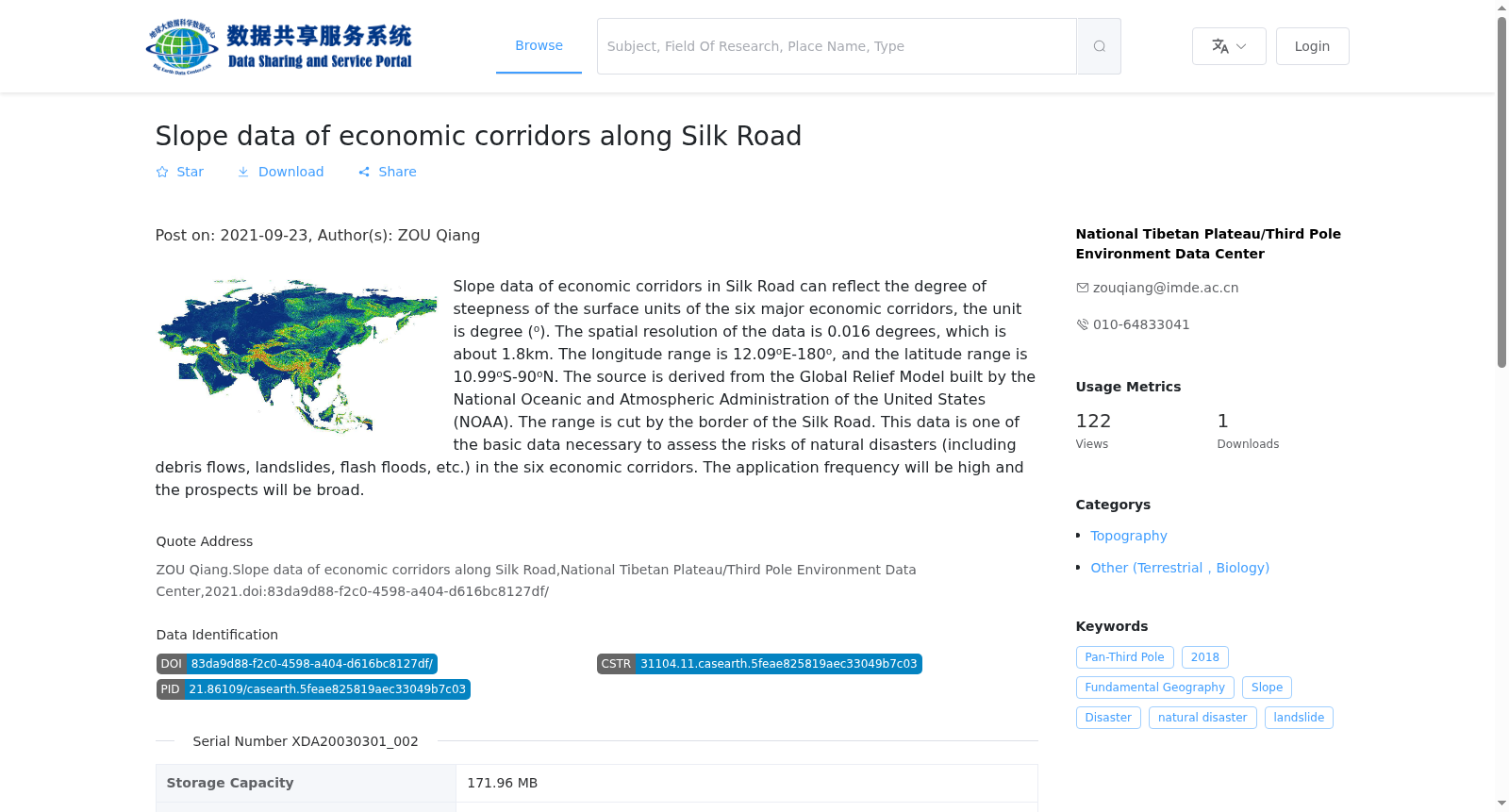
该数据为涵盖六大经济走廊的坡度数据,能够反映出六大经济走廊地表单元陡缓的程度,单位°。该数据空间分辨率为0.016度,约为1.8km,经度范围12.09°E-180°,维度范围10.99°S-90°N,来源自美国国家海洋和大气管理局构建的Global Relief Model,基于“一带一路”国家边界裁剪得到。该数据是评估六大经济走廊中的自然灾害(包括泥石流、滑坡、山洪等灾害)风险所必需的基础数据之一,应用频率高与前景广泛。
This is a slope dataset covering the Six Economic Corridors, which characterizes the steepness of surface units across these corridors, with the unit of degrees (°). The dataset has a spatial resolution of 0.016 degrees, approximately equal to 1.8 km, with a spatial coverage of longitude ranging from 12.09°E to 180° and latitude ranging from 10.99°S to 90°N. It is sourced from the Global Relief Model developed by the U.S. National Oceanic and Atmospheric Administration (NOAA), and was cropped based on the national boundaries of countries along the Belt and Road Initiative. This dataset is one of the essential foundational datasets for assessing natural disaster risks including debris flows, landslides, flash floods, and other disasters in the Six Economic Corridors, featuring high application frequency and broad application prospects.
提供机构:
国家青藏高原科学数据中心
搜集汇总
数据集介绍
背景与挑战
背景概述
该数据集提供丝绸之路沿线六大经济走廊的坡度信息,覆盖范围从东经12.09度至180度、南纬10.99度至北纬90度,空间分辨率约为1.8公里,数据源自美国国家海洋和大气管理局(NOAA)的全球地形模型。它主要用于评估泥石流、滑坡、山洪等自然灾害风险,具有高应用频率和广泛前景,是基础地理和灾害研究的重要资源。
以上内容由遇见数据集搜集并总结生成


