California Coast: Big Creek, Vincente, Arroyo Seco, Scotts Creek, UCSC
收藏portal.opentopography.org2013-09-24 更新2025-03-25 收录
下载链接:
https://portal.opentopography.org/lidarDataset?opentopoID=OTLAS.082013.26910.1
下载链接
链接失效反馈官方服务:
资源简介:
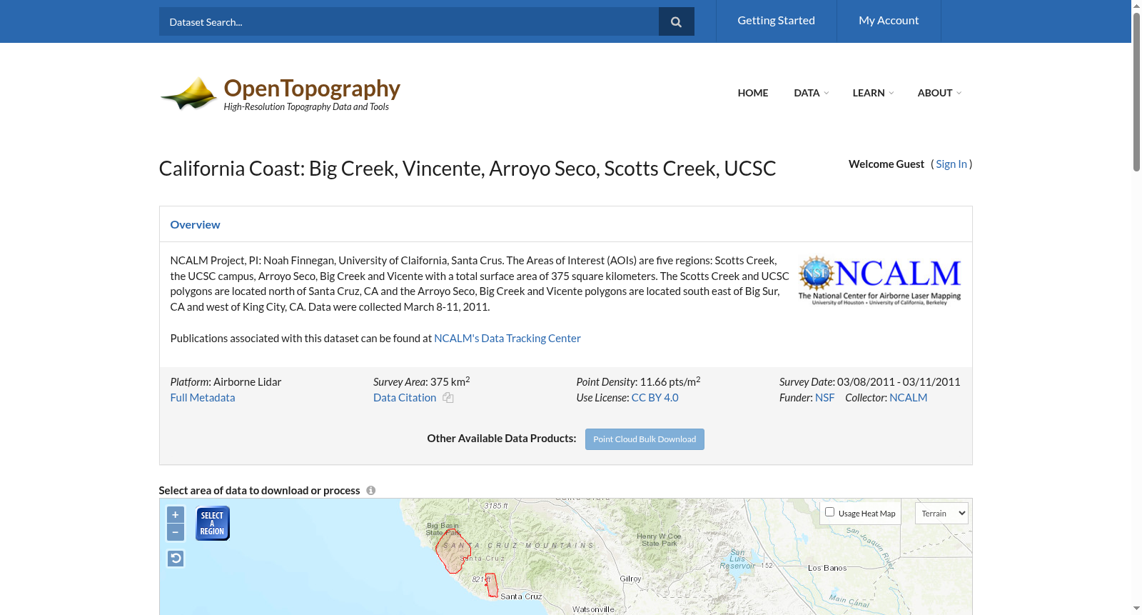
NCALM Project, PI: Noah Finnegan, University of Claifornia, Santa Crus. The Areas of Interest (AOIs) are five regions: Scotts Creek, the UCSC campus, Arroyo Seco, Big Creek and Vicente with a total surface area of 375 square kilometers. The Scotts Creek and UCSC polygons are located north of Santa Cruz, CA and the Arroyo Seco, Big Creek and Vicente polygons are located south east of Big Sur, CA and west of King City, CA. Data were collected March 8-11, 2011.<p><br>Publications associated with this dataset can be found at <a href="http://calm.geo.berkeley.edu/ncalm/dtc.html" target="_blank">NCALM's Data Tracking Center</a></p>
NCALM项目,负责人:诺亚·芬egan,加州大学圣克鲁兹分校。研究兴趣区域(AOIs)涵盖五个区域:斯科茨溪、加州大学圣克鲁兹分校校园、阿罗约塞科、大溪和维克托,总面积达375平方公里。斯科茨溪和加州大学圣克鲁兹分校的多边形位于加利福尼亚州圣克鲁兹北部,而阿罗约塞科、大溪和维克托的多边形则位于加利福尼亚州大苏尔东南部、金城西部。数据采集时间为2011年3月8日至11日。<p><br>与该数据集相关的出版物可在<a href="http://calm.geo.berkeley.edu/ncalm/dtc.html" target="_blank">NCALM数据追踪中心</a>找到。
提供机构:
portal.opentopography.org
搜集汇总
数据集介绍
背景与挑战
背景概述
该数据集是加利福尼亚海岸五个区域的机载激光雷达点云数据,覆盖总面积375平方公里,包括Big Creek、Vincente、Arroyo Seco、Scotts Creek和UCSC校园。数据于2011年3月收集,点密度为11.66点/平方米,提供高分辨率地形信息,适用于地形分析和研究。数据集采用CC BY 4.0许可,由NSF资助,NCALM收集,并支持多种数据下载和处理服务。
以上内容由遇见数据集搜集并总结生成


