象山县无人机飞行综合质量评估数据
收藏资源简介:
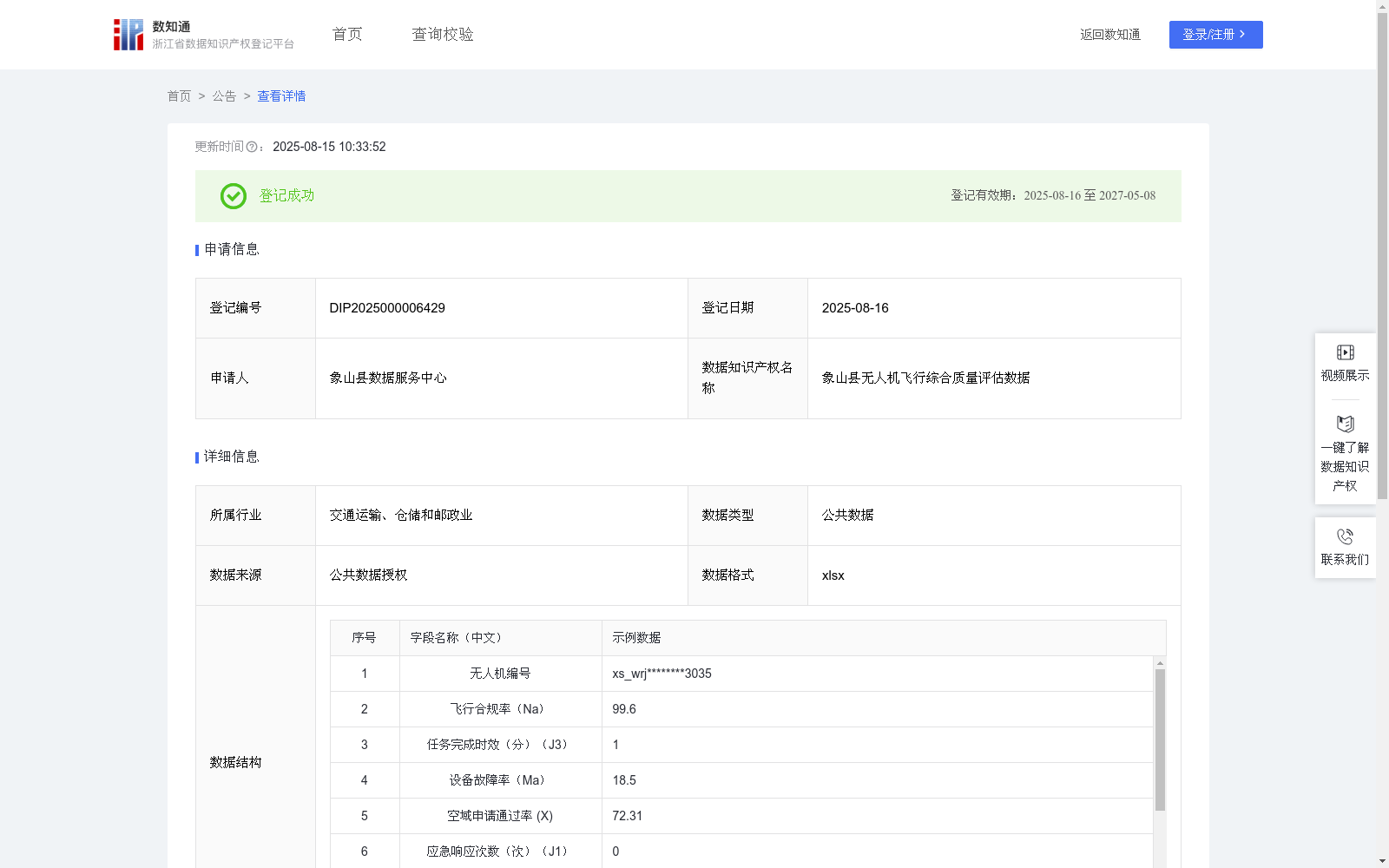
象山县无人机飞行综合质量评分数据的应用场景主要体现在提升空中交通监管效能与智能化水平。该模型通过整合无人机飞行轨迹、设备状态、环境数据等多维信息,构建动态评估体系,可实时识别违规飞行、设备异常等风险,辅助执法人员精准定位问题目标。同时,通过对历史飞行数据的趋势分析,能够优化空域资源配置,预警潜在冲突点,为制定无人机飞行规则提供数据支撑。模型的应用将显著加强低空空域安全管控能力,减少人工巡检盲区,促进无人机物流、应急救援等新型交通业态的规范化发展,最终实现传统地面交通管理与新兴空中交通体系的协同治理。根据无人机厂家唯一编号加县特殊标记获得无人机编号;根据无人机日常飞行情况获得飞行合规率(%)Na;根据无人机任务完成情况获得任务完成时效(分)J3;根据无人机各设备故障次数获得设备故障率(%)Ma;根据空域管理平台获得空域申请通过率(%)X;根据交通应急指挥中心报告数据获得应急响应次数(次)J1;根据图形识别质检系统获得数据采集合格率(%)S;根据民航局认证证书获得培训认证等级J2;根据飞行任务报表获得夜间作业占比Ac;所有采集汇总数据通过线性加权法进行计算:Y=Na*0.2+J3*3.6-Ma*0.5+X*0.12+J1*0.2+S*0.12+J2*1.6-Ac*0.125,最终获得象山县无人机飞行综合质量评分值,当评分>=80分,为A级,优先获得空域审批;当评分在60-79分,为B级,常规监管;当评分<60分,为C级,重点督查,查看是无人机设备问题还是个人驾驶员的飞行技术问题。
The application scenarios of the comprehensive flight quality scoring dataset for unmanned aerial vehicles (UAVs) in Xiangshan County primarily focus on improving the efficiency and intelligent level of air traffic supervision. This model constructs a dynamic evaluation system by integrating multi-dimensional information such as UAV flight trajectories, equipment status and environmental data, which can identify risks including unauthorized flights and equipment abnormalities in real time, and assist law enforcement personnel in accurately pinpointing problematic targets. Meanwhile, through trend analysis of historical flight data, it can optimize airspace resource allocation, issue early warnings for potential conflict points, and provide data support for formulating UAV flight regulations. The deployment of this model will significantly enhance the safety management and control capabilities of low-altitude airspace, reduce blind spots in manual inspections, promote the standardized development of emerging transportation business formats such as UAV logistics and emergency rescue, and ultimately achieve collaborative governance between traditional ground traffic management and emerging air traffic systems. The UAV number is generated based on the unique serial number of the UAV manufacturer plus the county-specific marker. The flight compliance rate (%), denoted as Na, is obtained according to the daily flight status of the UAV; the task completion timeliness (in minutes), denoted as J3, is derived from the UAV's task completion performance; the equipment failure rate (%), denoted as Ma, is calculated based on the number of equipment failures of all UAV subsystems; the airspace application approval rate (%), denoted as X, is sourced from the airspace management platform; the number of emergency responses (times), denoted as J1, is collected from the report data of the traffic emergency command center; the data collection qualification rate (%), denoted as S, is obtained via the image recognition quality inspection system; the training certification level, denoted as J2, is determined based on the Civil Aviation Administration certification certificate; the nighttime operation proportion, denoted as Ac, is extracted from the flight task report. All collected and aggregated data are computed using the linear weighting method: Y = Na*0.2 + J3*3.6 - Ma*0.5 + X*0.12 + J1*0.2 + S*0.12 + J2*1.6 - Ac*0.125, and the final comprehensive flight quality scoring value for UAVs in Xiangshan County is obtained. When the score is ≥ 80, it is rated as Grade A and will be granted priority in airspace approval; when the score ranges from 60 to 79, it is rated as Grade B and subject to regular supervision; when the score is < 60, it is rated as Grade C and requires key inspections to verify whether the issues stem from UAV equipment problems or the pilot's flight technical proficiency.