三江源地区1:25万湖泊面积变化数据集(1975-2005年)
收藏国家地球系统科学数据中心2016-10-27 更新2024-03-04 收录
下载链接:
https://www.geodata.cn/data/datadetails.html?dataguid=78366898718560&docId=31294
下载链接
链接失效反馈官方服务:
资源简介:
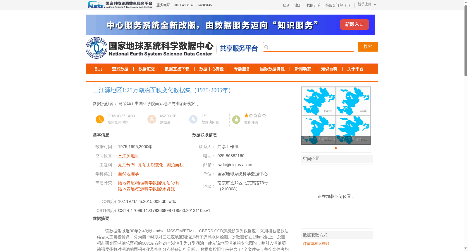
该数据集以近30年的40景Landsat MSS/TM/ETM+、CBERS CCD遥感影像为数据源,采用植被指数法结合人工目视解译,分为四个时期对三江源地区湖泊进行了遥感水体检测。选取面积在15km2以上、总面积占研究区湖泊总面积的90%左右的24个湖泊作为典型湖泊,建立该地区湖泊的变化图谱,并引入湖泊萎缩强度指数对湖泊的面积变化及空间分布特征进行分析。
数据集按照年份包含了4个文件夹,每个文件夹均包含1个shp矢量数据,“1975_pologon.shp”,“ 1995_pologon.shp”, “2000_pologon.shp”,“2005_pologon.shp”,分别为各年的湖泊面图层的数据。
This dataset utilizes 40 remote sensing images of Landsat MSS/TM/ETM+ and CBERS CCD acquired over the past 30 years as its data source. Adopting the vegetation index method combined with manual visual interpretation, remote sensing water body detection was performed for lakes in the Sanjiangyuan Area across four distinct periods. Twenty-four lakes with an area of more than 15 km² and accounting for approximately 90% of the total area of all lakes in the study area were selected as typical lakes. The lake change atlas of this region was established, and the lake shrinkage intensity index was introduced to analyze the area changes and spatial distribution characteristics of the lakes. The dataset contains 4 folders sorted by year, each holding one shapefile vector dataset: "1975_polygon.shp", "1995_polygon.shp", "2000_polygon.shp", and "2005_polygon.shp", which correspond to the lake polygon layer data for each respective year.
提供机构:
中国科学院南京地理与湖泊研究所
创建时间:
2013-11-05
搜集汇总
数据集介绍
背景与挑战
背景概述
该数据集涵盖1975-2005年三江源地区1:25万比例的湖泊面积变化数据,基于Landsat MSS/TM/ETM+和CBERS CCD遥感影像,采用植被指数法结合人工目视解译方法生成,包含24个典型湖泊的矢量数据,用于分析湖泊面积变化及空间分布特征。
以上内容由遇见数据集搜集并总结生成


