1:50万青藏高原土壤类型图(亚类)
收藏国家青藏高原科学数据中心2025-04-09 更新2025-04-19 收录
下载链接:
https://data.tpdc.ac.cn/zh-hans/data/946aaa55-193d-43b1-aead-c892ece8de0c
下载链接
链接失效反馈官方服务:
资源简介:
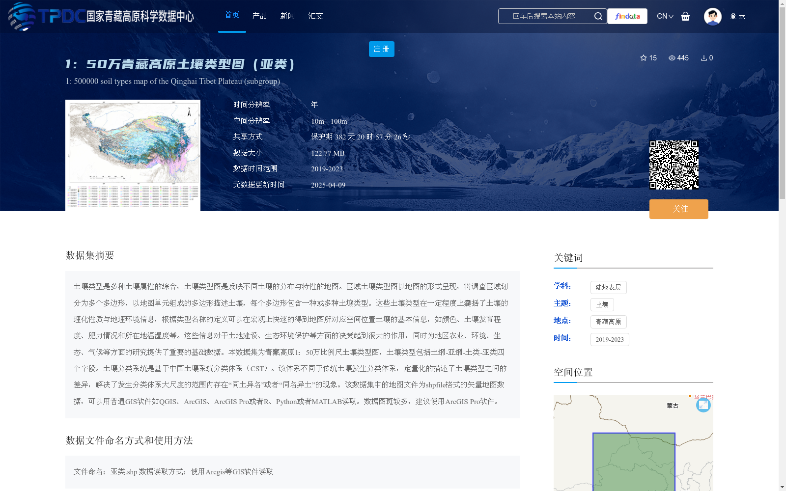
土壤类型是多种土壤属性的综合,土壤类型图是反映不同土壤的分布与特性的地图。区域土壤类型图以地图的形式呈现,将调查区域划分为多个多边形,以地图单元组成的多边形描述土壤,每个多边形包含一种或多种土壤类型。这些土壤类型在一定程度上囊括了土壤的理化性质与地理环境信息,根据类型名称的定义可以在宏观上快速的得到地图所对应空间位置土壤的基本信息,如颜色、土壤发育程度、肥力情况和所在地温湿度等。这些信息对于土地建设、生态环境保护等方面的决策起到很大的作用,同时为地区农业、环境、生态、气候等方面的研究提供了重要的基础数据。本数据集为青藏高原1:50万比例尺土壤类型图,土壤类型包括土纲-亚纲-土类-亚类四个字段。土壤分类系统是基于中国土壤系统分类体系(CST)。该体系不同于传统土壤发生分类体系,定量化的描述了土壤类型之间的差异,解决了发生分类体系大尺度的范围内存在“同土异名”或者“同名异土”的现象。该数据集中的地图文件为shpfile格式的矢量地图数据,可以用普通GIS软件如QGIS、ArcGIS、ArcGIS Pro或者R、Python或者MATLAB读取。数据图斑较多,建议使用ArcGIS Pro软件。
Soil type is a composite of multiple soil attributes, while soil type maps are cartographic products that depict the distribution and properties of various soils. Regional soil type maps divide the surveyed area into multiple polygons, where soils are represented by map unit polygons, and each polygon encompasses one or more soil types. These soil types, to a certain extent, incorporate the physicochemical properties of soils and relevant geographical environment information. By referring to the definitions of the soil type names, one can rapidly acquire basic information about the soil at the corresponding spatial position of the map at a macro scale, including color, soil development stage, fertility status, local temperature and humidity, and so on. Such information plays a crucial role in decision-making for land development, ecological environmental protection and other related fields, and also provides essential basic data for regional research in agriculture, environment, ecology, climatology and other disciplines. This dataset is a 1:500,000 scale soil type map of the Qinghai-Tibet Plateau, with the soil types categorized into four hierarchical levels: order, suborder, great group, and subgroup. The soil classification system is based on the Chinese Soil Taxonomy (CST). Unlike the traditional genetic soil classification system, CST quantitatively describes the differences between soil types, and resolves the issues of "different names for the same soil" and "same name for different soils" that occurred within large-scale scopes of the genetic classification system. The map files in this dataset are vector map data in shapefile format, which can be read by common GIS software such as QGIS, ArcGIS, ArcGIS Pro, as well as programming environments including R, Python, and MATLAB. Given the large number of map patches in this dataset, it is recommended to use ArcGIS Pro for data processing.
提供机构:
宋效东
创建时间:
2025-02-25
搜集汇总
数据集介绍
背景与挑战
背景概述
该数据集是1:50万比例尺的青藏高原土壤类型图,基于中国土壤系统分类体系(CST),包含土纲、亚纲、土类和亚类四个字段,为矢量地图数据(shpfile格式),适用于GIS软件读取。数据覆盖2019-2023年,主要用于土地建设、生态环境保护及多领域研究。
以上内容由遇见数据集搜集并总结生成


