青藏高原区域基于多源遥感数据协同反演的耦合地形效应的日地表反照率数据集(2016)
收藏国家青藏高原科学数据中心2021-04-19 更新2024-03-07 收录
下载链接:
https://data.tpdc.ac.cn/zh-hans/data/6e1052c5-47f4-466f-9dda-88171a6a4fe5
下载链接
链接失效反馈官方服务:
资源简介:
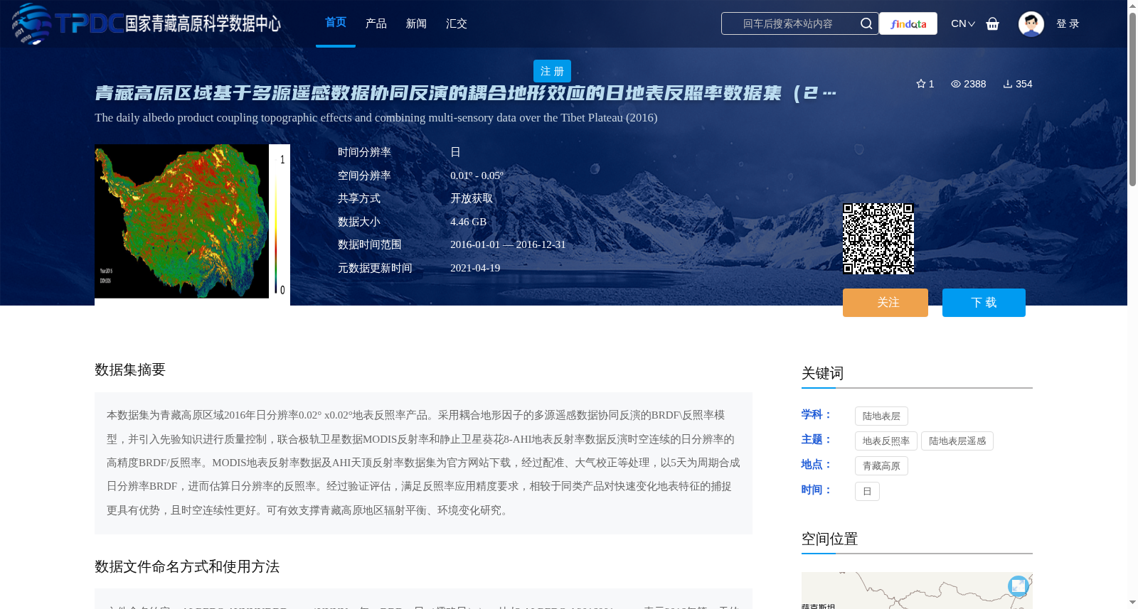
本数据集为青藏高原区域2016年日分辨率0.02° x0.02°地表反照率产品。采用耦合地形因子的多源遥感数据协同反演的BRDF\反照率模型,并引入先验知识进行质量控制,联合极轨卫星数据MODIS反射率和静止卫星葵花8-AHI地表反射率数据反演时空连续的日分辨率的高精度BRDF/反照率。MODIS地表反射率数据及AHI天顶反射率数据集为官方网站下载,经过配准、大气校正等处理,以5天为周期合成日分辨率BRDF,进而估算日分辨率的反照率。经过验证评估,满足反照率应用精度要求,相较于同类产品对快速变化地表特征的捕捉更具有优势,且时空连续性更好。可有效支撑青藏高原地区辐射平衡、环境变化研究。
This dataset is a 0.02°×0.02° daily-resolution surface albedo product for the Qinghai-Tibet Plateau region in 2016. It adopts a BRDF/albedo inversion model coupled with topographic factors and multi-source remote sensing data for collaborative inversion, and introduces prior knowledge for quality control. By combining polar-orbiting satellite MODIS reflectance data and geostationary satellite Himawari-8 AHI surface reflectance data, it retrieves high-precision, spatiotemporally continuous daily-resolution BRDF/albedo products. The MODIS surface reflectance data and AHI zenith reflectance dataset were downloaded from official websites, and processed via registration, atmospheric correction and other procedures. The daily-resolution BRDF is synthesized with a 5-day cycle, based on which the daily-resolution albedo is estimated. Through validation and evaluation, it meets the accuracy requirements for albedo applications. Compared with similar products, it exhibits superior performance in capturing rapidly changing surface features and has better spatiotemporal continuity. It can effectively support research on radiation balance and environmental change in the Qinghai-Tibet Plateau region.
提供机构:
闻建光,唐勇,游冬琴
创建时间:
2021-02-26
搜集汇总
数据集介绍
背景与挑战
背景概述
该数据集是2016年青藏高原区域的日分辨率地表反照率产品,采用耦合地形效应的多源遥感数据协同反演模型,结合MODIS和AHI数据,空间分辨率为0.02°。它具有高精度和良好的时空连续性,能有效捕捉快速变化的地表特征,适用于辐射平衡和环境变化研究。
以上内容由遇见数据集搜集并总结生成


