高原典型下垫面能量、水分循环观测数据集(草地、湿地、湖泊、冻土)有质量控制
收藏地球大数据科学工程2024-04-21 收录
下载链接:
https://data.casearth.cn/sdo/detail/6538968f819aec0f260ec8c8
下载链接
链接失效反馈官方服务:
资源简介:
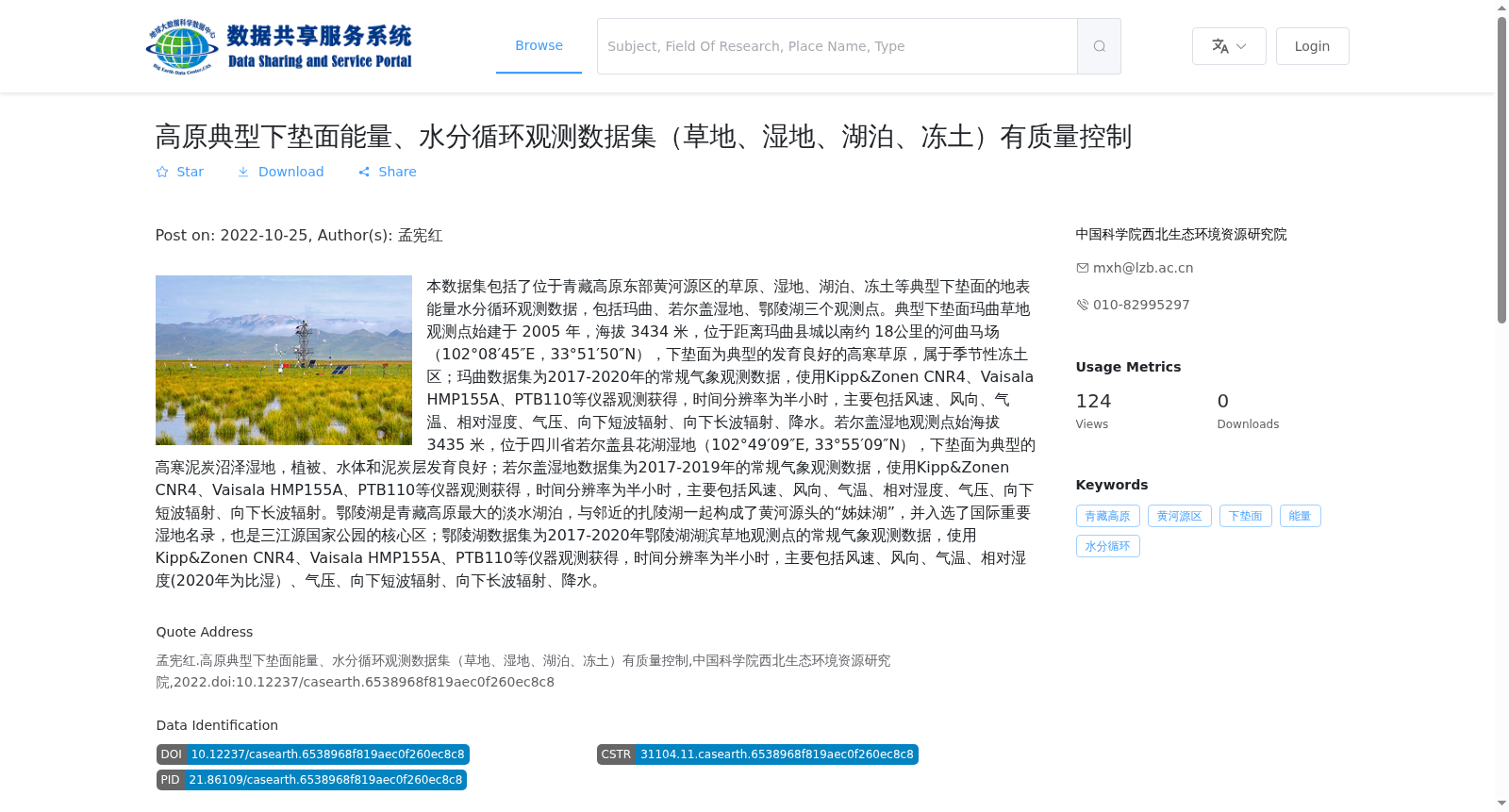
本数据集包括了位于青藏高原东部黄河源区的草原、湿地、湖泊、冻土等典型下垫面的地表能量水分循环观测数据,包括玛曲、若尔盖湿地、鄂陵湖三个观测点。典型下垫面玛曲草地观测点始建于 2005 年,海拔 3434 米,位于距离玛曲县城以南约 18公里的河曲马场(102°08′45″E,33°51′50″N),下垫面为典型的发育良好的高寒草原,属于季节性冻土区;玛曲数据集为2017-2020年的常规气象观测数据,使用Kipp&Zonen CNR4、Vaisala HMP155A、PTB110等仪器观测获得,时间分辨率为半小时,主要包括风速、风向、气温、相对湿度、气压、向下短波辐射、向下长波辐射、降水。若尔盖湿地观测点始海拔 3435 米,位于四川省若尔盖县花湖湿地(102°49′09″E, 33°55′09″N),下垫面为典型的高寒泥炭沼泽湿地,植被、水体和泥炭层发育良好;若尔盖湿地数据集为2017-2019年的常规气象观测数据,使用Kipp&Zonen CNR4、Vaisala HMP155A、PTB110等仪器观测获得,时间分辨率为半小时,主要包括风速、风向、气温、相对湿度、气压、向下短波辐射、向下长波辐射。鄂陵湖是青藏高原最大的淡水湖泊,与邻近的扎陵湖一起构成了黄河源头的“姊妹湖”,并入选了国际重要湿地名录,也是三江源国家公园的核心区;鄂陵湖数据集为2017-2020年鄂陵湖湖滨草地观测点的常规气象观测数据,使用Kipp&Zonen CNR4、Vaisala HMP155A、PTB110等仪器观测获得,时间分辨率为半小时,主要包括风速、风向、气温、相对湿度(2020年为比湿)、气压、向下短波辐射、向下长波辐射、降水。
This dataset contains surface energy and water cycle observation data for typical underlying surfaces including grasslands, wetlands, lakes and frozen soils in the source region of the Yellow River in the eastern Qinghai-Tibet Plateau, with three observation sites: Maqu, Zoige Wetland and Ngoring Lake.
The Maqu grassland observation site, a typical well-developed alpine grassland located in a seasonally frozen ground region, was established in 2005. It sits at an altitude of 3434 m in the Hequ Horse Farm (102°08′45″E, 33°51′50″N), approximately 18 km south of Maqu County. The Maqu dataset includes routine meteorological observation data from 2017 to 2020, collected using instruments such as Kipp&Zonen CNR4, Vaisala HMP155A and PTB110, with a temporal resolution of 30 minutes. The main measured variables are wind speed, wind direction, air temperature, relative humidity, atmospheric pressure, downward shortwave radiation, downward longwave radiation and precipitation.
The Zoige Wetland observation site is located at an altitude of 3435 m in the Huahu Wetland of Zoige County, Sichuan Province (102°49′09″E, 33°55′09″N), with a typical alpine peat swamp wetland underlying surface that has well-developed vegetation, water bodies and peat layers. The Zoige Wetland dataset contains routine meteorological observation data from 2017 to 2019, collected using the same type of instruments including Kipp&Zonen CNR4, Vaisala HMP155A and PTB110, with a 30-minute temporal resolution. The main measured variables are wind speed, wind direction, air temperature, relative humidity, atmospheric pressure, downward shortwave radiation and downward longwave radiation.
Ngoring Lake is the largest freshwater lake on the Qinghai-Tibet Plateau. Together with the adjacent Zhaling Lake, it forms the "sister lakes" of the Yellow River source region, and has been included in the List of Wetlands of International Importance, as well as being a core area of the Sanjiangyuan National Park. The Ngoring Lake dataset consists of routine meteorological observation data from the Ngoring Lake lakeside grassland observation site from 2017 to 2020, collected using instruments including Kipp&Zonen CNR4, Vaisala HMP155A and PTB110, with a 30-minute temporal resolution. The main measured variables are wind speed, wind direction, air temperature, relative humidity (specific humidity for the year 2020), atmospheric pressure, downward shortwave radiation, downward longwave radiation and precipitation.
提供机构:
中国科学院西北生态环境资源研究院
搜集汇总
数据集介绍
背景与挑战
背景概述
该数据集包含青藏高原东部黄河源区三个观测点(玛曲草地、若尔盖湿地、鄂陵湖湖滨草地)2017-2020年的地表能量水分循环观测数据,时间分辨率为半小时,主要观测要素包括风速、风向、气温、相对湿度、气压、向下短波辐射、向下长波辐射和降水。数据集由中国科学院西北生态环境资源研究院发布,具有质量控制。
以上内容由遇见数据集搜集并总结生成


