巴生港LandSat5悬浮泥沙浓度30米遥感产品图集(1988-2008)
收藏南海海洋数据中心2024-03-01 收录
下载链接:
https://data.scsio.ac.cn/metaData-detail/1255028613149237249
下载链接
链接失效反馈官方服务:
资源简介:
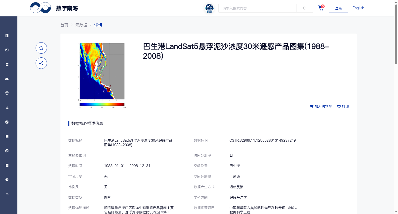
印度洋重点港口区海洋生态遥感产品资料主要包括叶绿素、悬浮泥沙数据的30米分辨率产品,共处理3颗卫星13年以上遥感数据产品,突破了中等分辨率数据近岸水体大气校正难题。
The marine ecological remote sensing product dataset for key port areas in the Indian Ocean primarily includes 30-meter resolution products of chlorophyll and suspended sediment data. It has processed remote sensing data products from 3 satellites with a total time span of over 13 years, and broken through the technical bottleneck of atmospheric correction for coastal waters using medium-resolution remote sensing data.
提供机构:
中国科学院南海海洋研究所
搜集汇总
数据集介绍
背景与挑战
背景概述
该数据集是巴生港区域1988年至2008年的悬浮泥沙浓度30米分辨率遥感产品图集,基于LandSat5卫星数据通过SWIRE大气校正方法反演生成,属于遥感海洋学领域,用于长期监测近岸水体环境。
以上内容由遇见数据集搜集并总结生成


