有没有相关的论文或文献参考?
这个数据集是基于什么背景创建的?
数据集的作者是谁?
能帮我联系到这个数据集的作者吗?
这个数据集如何下载?
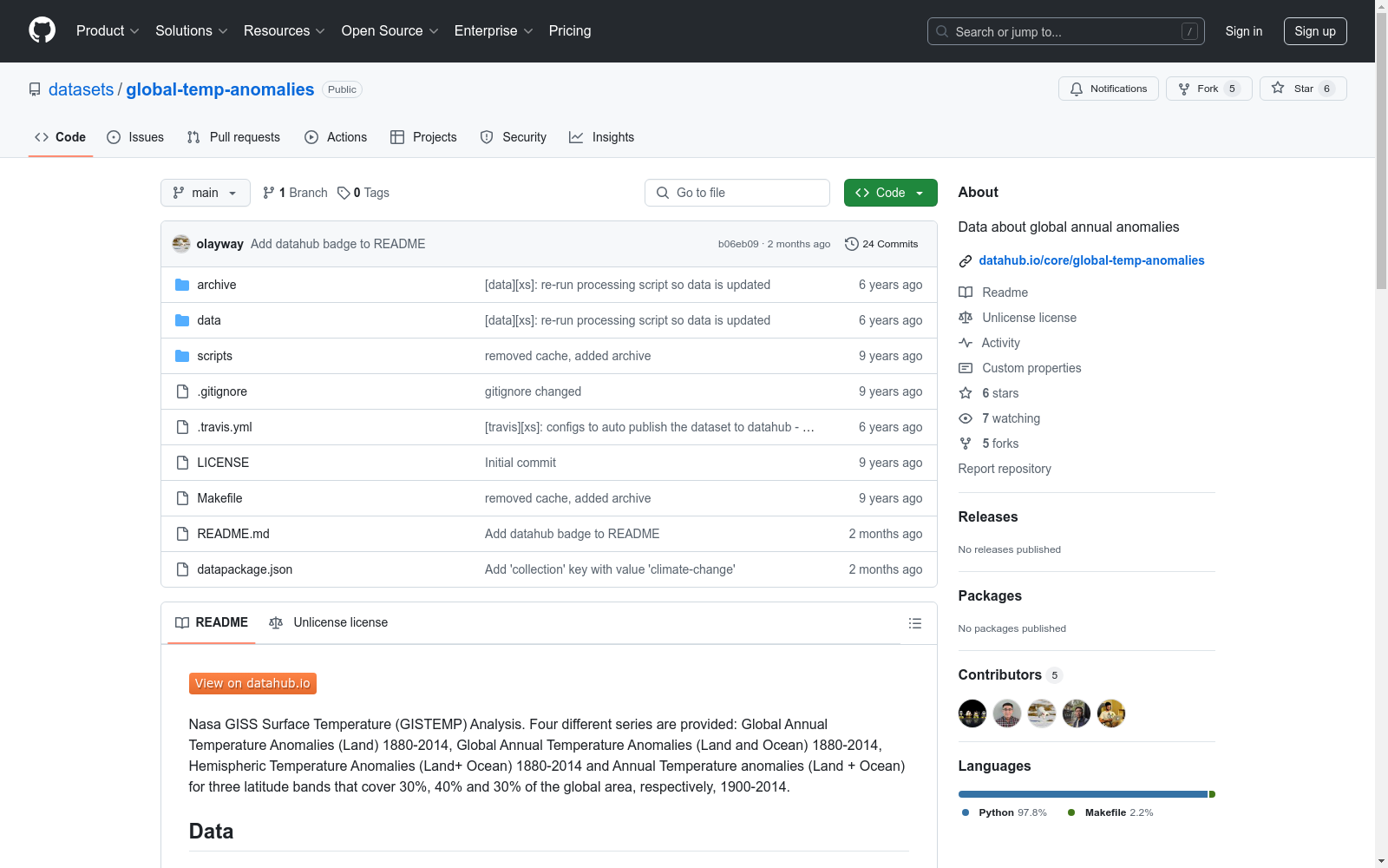
NASA GISS Surface Temperature (GISTEMP) Analysis
Asteroids by the Minor Planet Center
包含所有已知小行星的轨道数据和观测数据。数据来源于Minor Planet Center,格式包括Fortran (.DAT)和JSON,数据集大小为81MB(压缩)和450MB(未压缩),记录数约750,000条,每日更新。
github 收录
OpenPose
OpenPose数据集包含人体姿态估计的相关数据,主要用于训练和评估人体姿态检测算法。数据集包括多视角的图像和视频,标注了人体关键点位置,适用于研究人体姿态识别和动作分析。
github.com 收录
Differential introgression in a mosaic hybrid zone reveals candidate barrier genes
Hybrid zones act as genomic sieves; although globally advantageous alleles will spread throughout the zone and neutral alleles can be freely exchanged between species, introgression will be restricted for genes that contribute to reproductive barriers or local adaptation. Seminal fluid proteins (SFPs) are known to contribute to reproductive barriers in insects and have been proposed as candidate barrier genes in the hybridizing field crickets G. pennsylvanicus and G. firmus. Here, we have used 125 SNPs to characterize patterns of differential introgression and to identify genes that may contribute to prezygotic barriers between these species. Using a transcriptome scan of the male cricket accessory gland (the site of SFP synthesis), we identified genes with major allele frequency differences between the species. We then compared patterns of introgression for genes encoding seminal fluid proteins with patterns for genes expressed in the same tissue that do not encode SFPs. We find no evi...
DataONE 收录
全国 1∶200 000 数字地质图(公开版)空间数据库
As the only one of its kind, China National Digital Geological Map (Public Version at 1∶200 000 scale) Spatial Database (CNDGM-PVSD) is based on China' s former nationwide measured results of regional geological survey at 1∶200 000 scale, and is also one of the nationwide basic geosciences spatial databases jointly accomplished by multiple organizations of China. Spatially, it embraces 1 163 geological map-sheets (at scale 1: 200 000) in both formats of MapGIS and ArcGIS, covering 72% of China's whole territory with a total data volume of 90 GB. Its main sources is from 1∶200 000 regional geological survey reports, geological maps, and mineral resources maps with an original time span from mid-1950s to early 1990s. Approved by the State's related agencies, it meets all the related technical qualification requirements and standards issued by China Geological Survey in data integrity, logic consistency, location acc racy, attribution fineness, and collation precision, and is hence of excellent and reliable quality. The CNDGM-PVSD is an important component of China' s national spatial database categories, serving as a spatial digital platform for the information construction of the State's national economy, and providing informationbackbones to the national and provincial economic planning, geohazard monitoring, geological survey, mineral resources exploration as well as macro decision-making.
DataCite Commons 收录
iAWE
iAWE是一个专为非侵入式负载监测(NILM)算法设计的优秀数据集。数据集包含多个家用电器的能耗数据,如冰箱、空调、洗衣机等,每个CSV文件包含时间戳和能耗相关参数。数据集的原始格式存在一些问题,如时间戳处理和数据不一致性,需要进行预处理以适应NILM算法。
github 收录