咸海流域土壤湿度数据集(2019)
收藏国家青藏高原科学数据中心2021-12-24 更新2024-03-01 收录
下载链接:
https://data.tpdc.ac.cn/zh-hans/data/2da1fc2c-56d4-4976-9b19-1db4529b722a
下载链接
链接失效反馈官方服务:
资源简介:
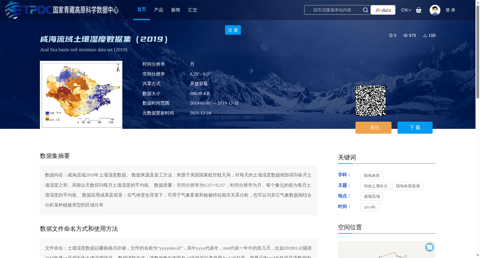
数据内容:咸海流域2019年土壤湿度数据。
数据来源及加工方法:来源于美国国家航空航天局,对每天的土壤湿度数据相加得到各月土壤湿度之和,再除以天数得到每月土壤湿度的平均值。
数据质量:空间分辨率为0.25°×0.25°,时间分辨率为月,每个像元的值为每月土壤湿度的平均值。
数据应用成果及前景:在气候变化背景下,可用于气象要素和植被特征相关关系分析,也可以与其它气象数据相结合分析某种植被类型的区域分布
Data Content: Soil moisture data of the Aral Sea Basin in 2019.
Data Source and Processing Method: Derived from the National Aeronautics and Space Administration (NASA). For each month, sum the daily soil moisture data within the month to obtain the total monthly soil moisture, then divide by the number of days in that month to calculate the monthly average soil moisture.
Data Quality: The spatial resolution is 0.25°×0.25°, the temporal resolution is monthly, and the value of each pixel is the monthly average soil moisture.
Data Application Achievements and Prospects: Under the context of climate change, it can be employed to analyze the correlation between meteorological factors and vegetation characteristics. It can also be combined with other meteorological data to examine the regional distribution of a specific vegetation type.
提供机构:
刘铁
创建时间:
2021-12-24
搜集汇总
数据集介绍
背景与挑战
背景概述
该数据集提供了2019年咸海流域的月均土壤湿度数据,空间分辨率为0.25°×0.25°,时间分辨率为月。数据来源于美国国家航空航天局,适用于气象和植被相关研究。
以上内容由遇见数据集搜集并总结生成


