青藏高原草地退化分级-文档、图、数据-修改(2010-2019)
收藏国家青藏高原科学数据中心2022-06-09 更新2024-03-01 收录
下载链接:
https://data.tpdc.ac.cn/zh-hans/data/88237e4e-f55c-4a94-9425-1e74b8bac031
下载链接
链接失效反馈官方服务:
资源简介:
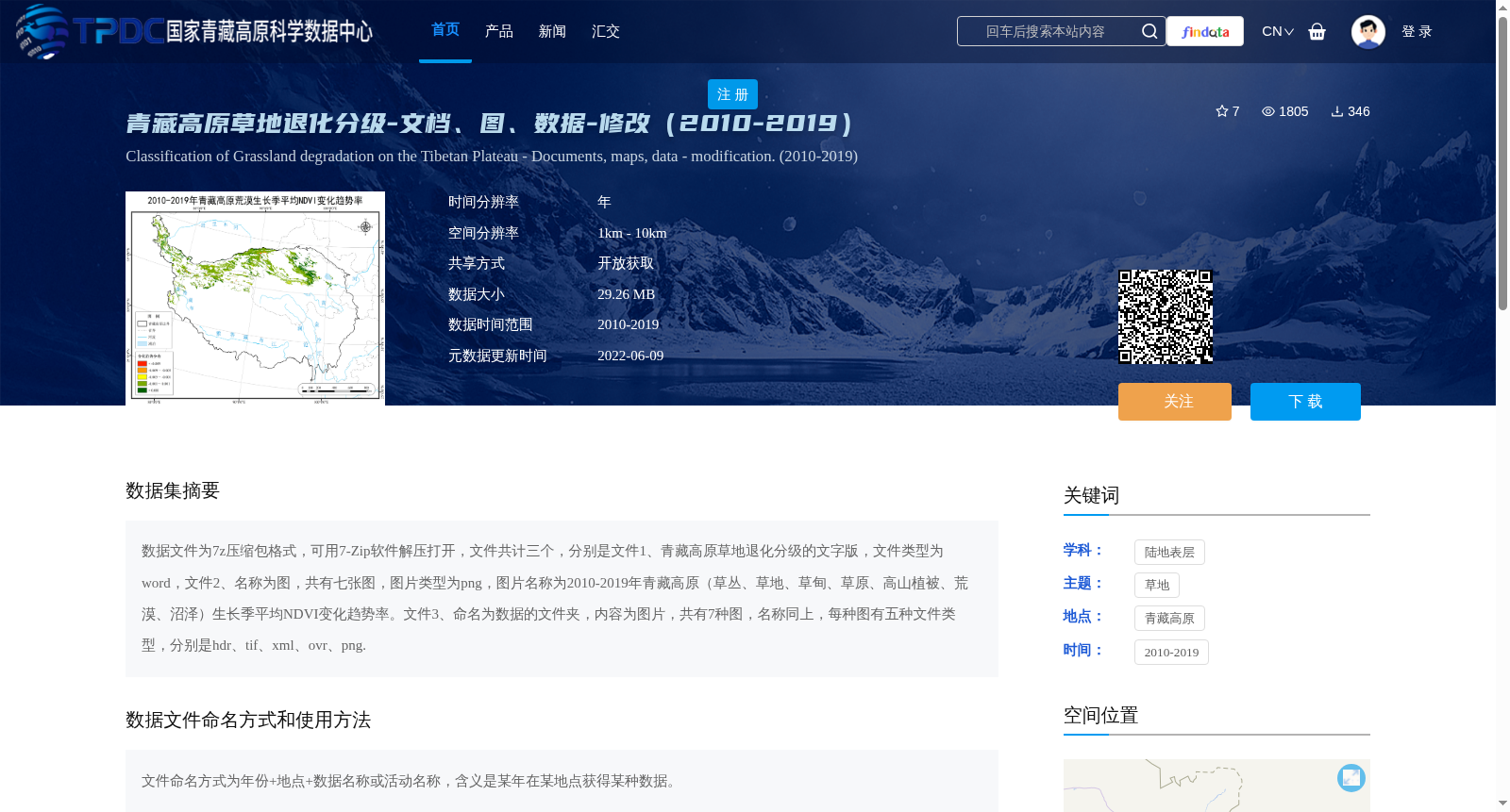
数据文件为7z压缩包格式,可用7-Zip软件解压打开,文件共计三个,分别是文件1、青藏高原草地退化分级的文字版,文件类型为word,文件2、名称为图,共有七张图,图片类型为png,图片名称为2010-2019年青藏高原(草丛、草地、草甸、草原、高山植被、荒漠、沼泽)生长季平均NDVI变化趋势率。文件3、命名为数据的文件夹,内容为图片,共有7种图,名称同上,每种图有五种文件类型,分别是hdr、tif、xml、ovr、png.
The dataset is packaged as a single 7z compressed archive, which can be extracted and accessed using 7-Zip software. The archive contains three components:
1. File 1: The textual document for grassland degradation classification on the Qinghai-Tibet Plateau, saved in Microsoft Word format.
2. File 2: Seven PNG-format images titled 'Trend Rate of Average Growing-Season NDVI Changes of the Qinghai-Tibet Plateau (grass clusters, grassland, meadow, steppe, alpine vegetation, desert, marsh) from 2010 to 2019'.
3. File 3: A folder named "Data" that holds the corresponding images. There are 7 categories of images with the same names as those in File 2, and each category includes 5 file types: .hdr, .tif, .xml, .ovr, and .png.
提供机构:
周华坤
创建时间:
2022-06-04
搜集汇总
数据集介绍
背景与挑战
背景概述
该数据集提供了2010-2019年青藏高原草地退化分级的文档、图片和数据,包含七种草地类型的生长季平均NDVI变化趋势率图,空间分辨率为1km至10km。数据集要求在使用时引用指定文献和数据来源,适用于草地退化研究和生态监测。
以上内容由遇见数据集搜集并总结生成


