2020年非洲稀树草地30m-100m草地类型和利用方式数据
收藏地球大数据科学工程2024-04-26 收录
下载链接:
https://data.casearth.cn/sdo/detail/6538960f819aec0f260e0404
下载链接
链接失效反馈官方服务:
资源简介:
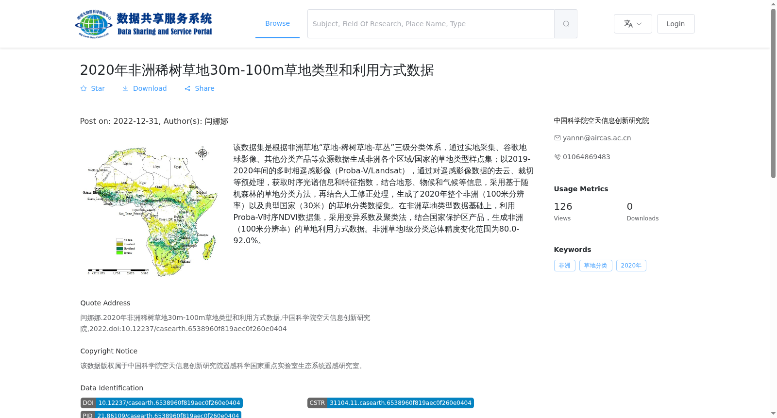
该数据集是根据非洲草地“草地-稀树草地-草丛”三级分类体系,通过实地采集、谷歌地球影像、其他分类产品等众源数据生成非洲各个区域/国家的草地类型样点集;以2019-2020年间的多时相遥感影像(Proba-V/Landsat),通过对遥感影像数据的去云、裁切等预处理,获取时序光谱信息和特征指数,结合地形、物候和气候等信息,采用基于随机森林的草地分类方法,再结合人工修正处理,生成了2020年整个非洲(100米分辨率)以及典型国家(30米)的草地分类数据集。在非洲草地类型数据基础上,利用Proba-V时序NDVI数据集,采用变异系数及聚类法,结合国家保护区产品,生成非洲(100米分辨率)的草地利用方式数据。非洲草地I级分类总体精度变化范围为80.0-92.0%。
This dataset was constructed based on the three-level classification system for African grasslands: Grassland, Savanna, and Scrub. Sample points of grassland types across various regions and countries in Africa were generated via crowdsourced data sources including field surveys, Google Earth imagery, and existing classification products. Using multi-temporal remote sensing imagery (Proba-V/Landsat) collected during 2019–2020, preprocessing steps such as cloud masking and cropping were performed on the remote sensing data to derive temporal spectral information and feature indices. Combined with auxiliary geospatial data including terrain, phenology, and climate variables, a random forest-based grassland classification approach was adopted, followed by manual correction. Consequently, grassland classification datasets for the entire African continent (100 m resolution) and typical African countries (30 m resolution) were produced in 2020. Based on the aforementioned African grassland type dataset, the African grassland use pattern dataset (100 m resolution) was generated using the Proba-V time-series NDVI dataset, integrating the coefficient of variation method, clustering algorithm, and national protected area products. The overall accuracy of the Level I classification for African grasslands ranges from 80.0% to 92.0%.
提供机构:
中国科学院空天信息创新研究院
搜集汇总
数据集介绍
背景与挑战
背景概述
该数据集提供了2020年非洲稀树草地的类型和利用方式信息,包括30米和100米两种分辨率,基于多时相遥感影像和众源数据生成,分类精度在80.0-92.0%之间。
以上内容由遇见数据集搜集并总结生成


