青藏高原流域边界数据集(2016)
收藏国家地球系统科学数据中心2022-02-15 更新2024-03-04 收录
下载链接:
https://www.geodata.cn/data/datadetails.html?dataguid=197357977647668&docId=10361
下载链接
链接失效反馈官方服务:
资源简介:
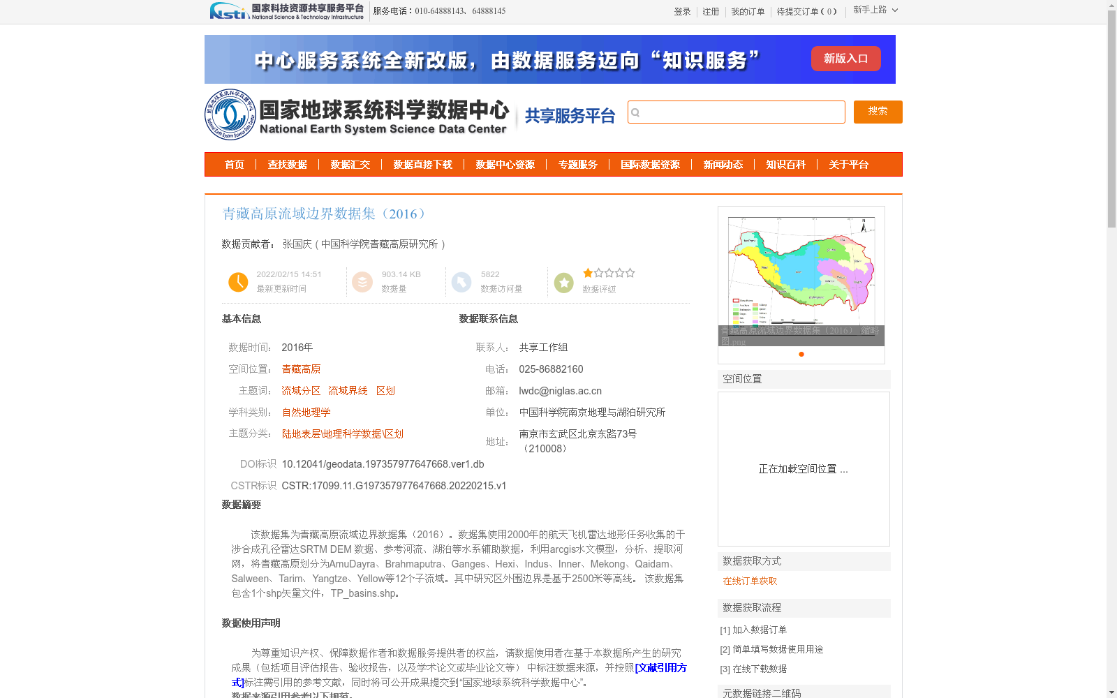
该数据集为青藏高原流域边界数据集(2016)。数据集使用2000年的航天飞机雷达地形任务收集的干涉合成孔径雷达SRTM DEM 数据、参考河流、湖泊等水系辅助数据,利用arcgis水文模型,分析、提取河网,将青藏高原划分为AmuDayra、Brahmaputra、Ganges、Hexi、Indus、Inner、Mekong、Qaidam、Salween、Tarim、Yangtze、Yellow等12个子流域。其中研究区外围边界是基于2500米等高线。
该数据集包含1个shp矢量文件,TP_basins.shp。
This is the Tibetan Plateau Basin Boundary Dataset (2016). This dataset utilizes Interferometric Synthetic Aperture Radar (InSAR) SRTM DEM data collected during the 2000 Shuttle Radar Topography Mission (SRTM), along with auxiliary hydrological datasets such as reference rivers and lakes. The ArcGIS Hydrological Model was employed to analyze and extract the fluvial network, which was used to divide the Tibetan Plateau into 12 sub-basins: AmuDayra, Brahmaputra, Ganges, Hexi, Indus, Inner, Mekong, Qaidam, Salween, Tarim, Yangtze, and Yellow. The outer boundary of the study area is delineated based on the 2500-meter contour line. This dataset includes a single shapefile vector file, TP_basins.shp.
提供机构:
中国科学院青藏高原研究所
创建时间:
2022-02-15
搜集汇总
数据集介绍
背景与挑战
背景概述
该数据集是2016年发布的青藏高原流域边界地理空间数据,基于2000年的SRTM DEM和水系辅助数据,利用ArcGIS水文模型将青藏高原划分为12个子流域,包括AmuDayra、Brahmaputra等主要河流区域。数据集以shp矢量文件形式提供,采用WGS_1984坐标系,数据质量可靠,适用于自然地理学和流域区划研究。
以上内容由遇见数据集搜集并总结生成


