贵州省退耕还林工程分县坡耕地情况表
收藏国家林业和草原科学数据中心2006-06-22 更新2024-03-06 收录
下载链接:
https://www.forestdata.cn/dataDetail.html?id=CSTR:17575.11.0120190809070.000009.V1
下载链接
链接失效反馈官方服务:
资源简介:
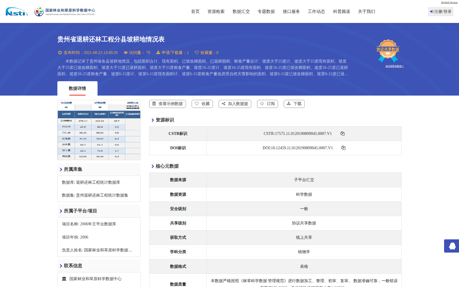
本数据记录了贵州省各县坡耕地情况,包括面积合计、现有面积、已坡改梯面积、已退耕面积、粮食产量合计、坡度大于25度计、坡度大于25度现有面积、坡度大于25度已坡改梯面积、坡度大于25度已退耕面积、坡度大于25度粮食产量、坡度16-25度计、坡度16-25度现有面积、坡度16-25度已坡改梯面积、坡度16-25度已退耕面积、坡度16-25度粮食产量、坡度6-15度计、坡度6-15度现有面积计、坡度6-15度粮食产量低易受自然灾害影响的面积、坡度6-15度已坡改梯面积、坡度6-15度已退耕面积、坡度6-15度粮食产量等记录。
This dataset records the sloping farmland conditions for each county in Guizhou Province. The covered records include total area, existing area, area converted to terraced fields, area returned to cropland for forest/pasture, and total grain yield at the overall level; as well as classified indicators for slope gradient >25°: total area, existing area, area converted to terraced fields, area returned to cropland for forest/pasture, and grain yield; classified indicators for slope gradient 16-25°: total area, existing area, area converted to terraced fields, area returned to cropland for forest/pasture, and grain yield; classified indicators for slope gradient 6-15°: total area, existing area, area with low grain yield and high susceptibility to natural disasters, area converted to terraced fields, area returned to cropland for forest/pasture, and grain yield.
提供机构:
国家林业和草原科学数据中心
创建时间:
2006-06-22
搜集汇总
数据集介绍
背景与挑战
背景概述
该数据集记录了2002年贵州省退耕还林工程中各县坡耕地的详细情况,包括面积、已坡改梯面积、已退耕面积和粮食产量等指标,并按不同坡度等级进行统计。数据以表格形式呈现,覆盖贵州省范围,属于退耕还林工程统计数据库的一部分。
以上内容由遇见数据集搜集并总结生成


