雅鲁藏布江中游古洪水-堰塞湖溃决洪水分布
收藏国家青藏高原科学数据中心2024-01-18 更新2024-03-06 收录
下载链接:
https://data.tpdc.ac.cn/zh-hans/data/5fa57396-82a3-4510-adce-173ba4bbbefc
下载链接
链接失效反馈官方服务:
资源简介:
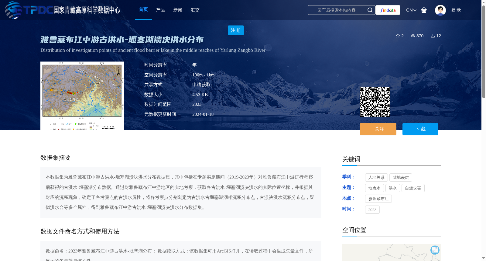
本数据集为雅鲁藏布江中游古洪水-堰塞湖溃决洪水分布数据集,其中包括在专题实施期间(2019-2023年)对雅鲁藏布江中游进行考察后获得的古洪水-堰塞湖分布数据。通过对雅鲁藏布江中游地区的实地考察,获取各古洪水-堰塞湖溃决洪水的实际位置坐标,并根据其对应的沉积现象,确定了各考察点的古洪水属性,将各考察点分别划定为古洪水古堰塞湖湖相沉积分布点,古溃决洪水沉积分布点,疑似洪水台等多个属性,得到雅鲁藏布江中游古洪水-堰塞湖溃决洪水分布数据集。
This dataset is a distribution dataset of paleoflood and ancient barrier lake outburst floods in the middle reaches of the Yarlung Tsangpo River. It includes distribution data of paleofloods and barrier lakes obtained via field surveys conducted in the middle reaches of the Yarlung Tsangpo River during the project implementation period (2019–2023). Through field investigations in this region, the exact geographic coordinates of each paleoflood and barrier lake outburst flood site were collected. Based on corresponding sedimentary features, the paleoflood-related attributes of each survey site were identified, and each site was categorized into multiple types, including paleoflood and ancient barrier lake lacustrine sediment distribution points, ancient outburst flood sediment distribution points, and suspected flood terraces. Ultimately, this distribution dataset of paleoflood and ancient barrier lake outburst floods in the middle reaches of the Yarlung Tsangpo River was developed.
提供机构:
王中根
创建时间:
2024-01-17
搜集汇总
数据集介绍
背景与挑战
背景概述
该数据集包含2019-2023年雅鲁藏布江中游古洪水-堰塞湖溃决洪水的分布数据,通过实地考察获取各考察点的坐标和沉积现象,分类为古洪水古堰塞湖湖相沉积分布点、古溃决洪水沉积分布点等。数据可用ArcGIS打开,适用于地表水、洪水及自然灾害研究。
以上内容由遇见数据集搜集并总结生成


