2001-2018中亚天山垂直自然带谱监测数据产品
收藏地球大数据科学工程2024-03-04 收录
下载链接:
https://data.casearth.cn/sdo/detail/653cb53f819aec42f01b3f62
下载链接
链接失效反馈官方服务:
资源简介:
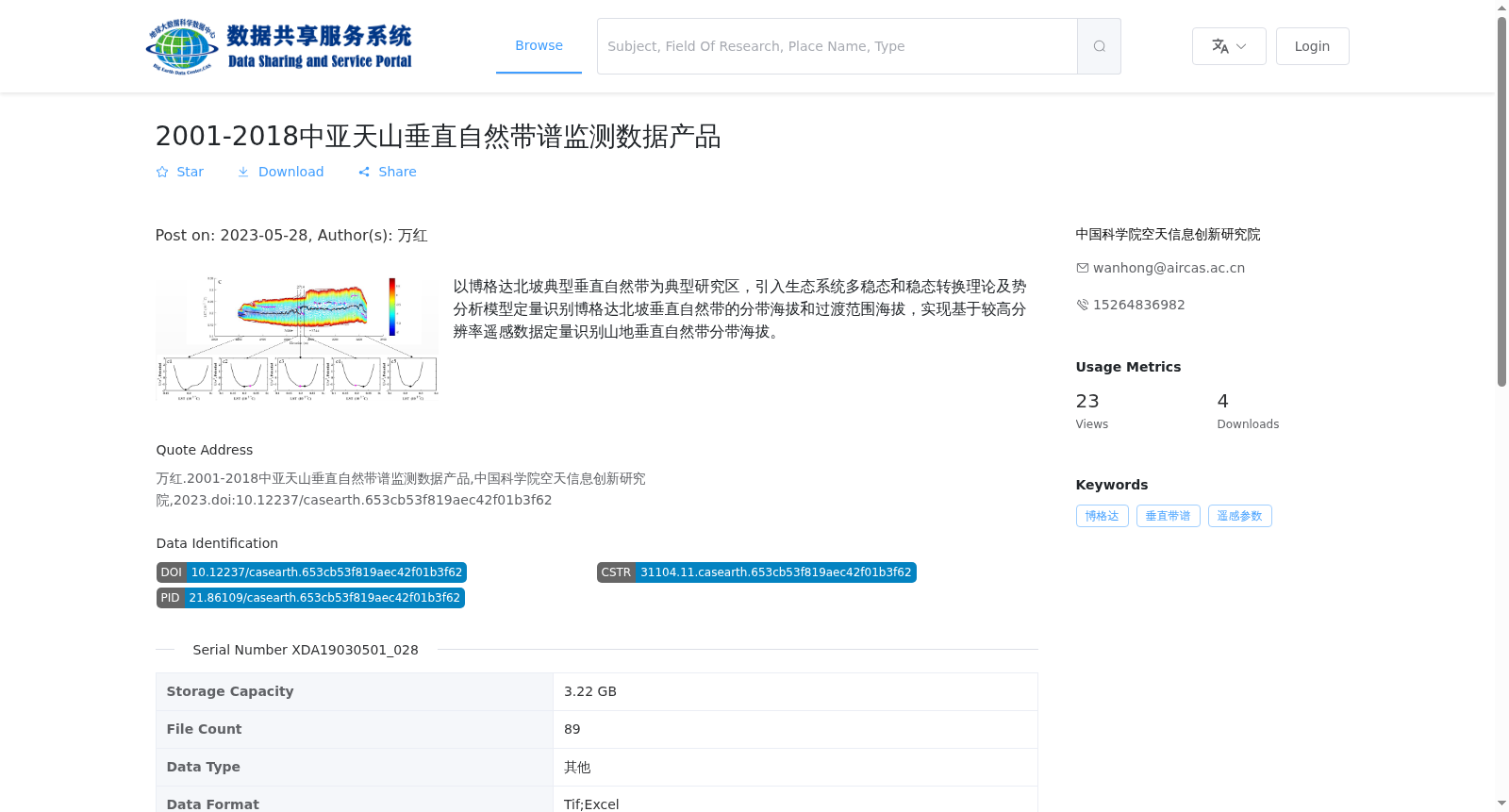
以博格达北坡典型垂直自然带为典型研究区,引入生态系统多稳态和稳态转换理论及势分析模型定量识别博格达北坡垂直自然带的分带海拔和过渡范围海拔,实现基于较高分辨率遥感数据定量识别山地垂直自然带分带海拔。
Taking the typical vertical natural zones on the northern slope of the Bogda Mountains as the study area, this study adopts the theories of ecosystem multistability and regime shift, together with the potential analysis model, to quantitatively identify the elevation of each vertical zone and the elevation range of their transitional zones, thereby achieving the quantitative identification of mountain vertical natural zone elevations using high-resolution remote sensing data.
提供机构:
中国科学院空天信息创新研究院
搜集汇总
数据集介绍
背景与挑战
背景概述
该数据集是2001-2018年期间针对中亚天山博格达北坡垂直自然带谱的监测产品,基于生态系统多稳态理论和势分析模型,利用30米空间分辨率的遥感数据定量识别自然带的分带海拔和过渡范围海拔。数据以Tif和Excel格式提供,年时间分辨率,适用于山地生态系统的研究和监测。
以上内容由遇见数据集搜集并总结生成


