青藏高原生态资产评估遥感反演净初级生产力数据集
收藏地球大数据科学工程2024-03-04 收录
下载链接:
https://data.casearth.cn/sdo/detail/5feae825819aec33049b7bf5
下载链接
链接失效反馈官方服务:
资源简介:
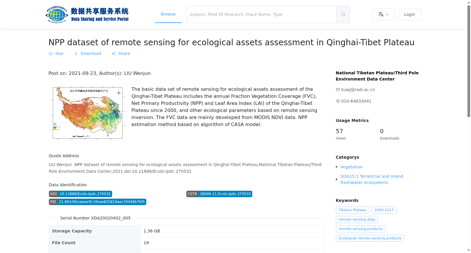
青藏高原生态资产评估遥感反演基础数据集包括了青藏高原自2000年起年度的植被覆盖度(FVC),净初级生产力(NPP)和叶面积指数(LAI)等基于遥感反演的生态参数,以供区域尺度生态资产评估研究使用。其中净初级生产力数据基于CASA模型的NPP估算方法完成。在某些极端或环境因子迅速变化的情况下,如果完全适应不可能,或者植物还来不及适应新的环境,NPP则受到最紧缺资源的限制,它们可以通过一个转换因子连接起来,这一转换因子可以是一个复杂的模型,也可以是一个简单的比率常数。
Basic Remote Sensing Retrieval Dataset for Ecological Asset Assessment of the Qinghai-Tibet Plateau contains annual remote sensing-retrieved ecological parameters of the Qinghai-Tibet Plateau since 2000, including Fraction of Vegetation Cover (FVC), Net Primary Productivity (NPP), and Leaf Area Index (LAI). It is designed to support regional-scale ecological asset assessment research. The Net Primary Productivity (NPP) data was estimated using the CASA model-based NPP estimation approach. Under certain extreme conditions or scenarios where environmental factors change rapidly, if full acclimation is impossible or plants have not had sufficient time to adapt to the new environment, NPP will be constrained by the most scarce resources. The relationship between these limiting factors and NPP can be linked via a conversion factor, which may be either a complex model or a simple proportional constant.
提供机构:
国家青藏高原科学数据中心
搜集汇总
数据集介绍
背景与挑战
背景概述
该数据集是青藏高原生态资产评估的遥感反演产品,核心包含自2000年以来的年度净初级生产力(NPP)、植被覆盖度(FVC)和叶面积指数(LAI)等关键生态参数,基于MODIS NDVI数据和CASA模型算法生成。数据以GeoTiff格式提供,时间分辨率为年,空间分辨率以米为单位,覆盖青藏高原广阔地理区域(东经104.38度至73.44度,南纬25.99度至40.02度),适用于生态监测和可持续发展目标研究。
以上内容由遇见数据集搜集并总结生成


