A dataset of cultivated land ridge coefficient in 1km grid in China(2020)
收藏DataCite Commons2025-05-20 更新2025-04-16 收录
下载链接:
https://www.scidb.cn/detail?dataSetId=6379a0f4163240319fda80bfa3e22d33
下载链接
链接失效反馈官方服务:
资源简介:
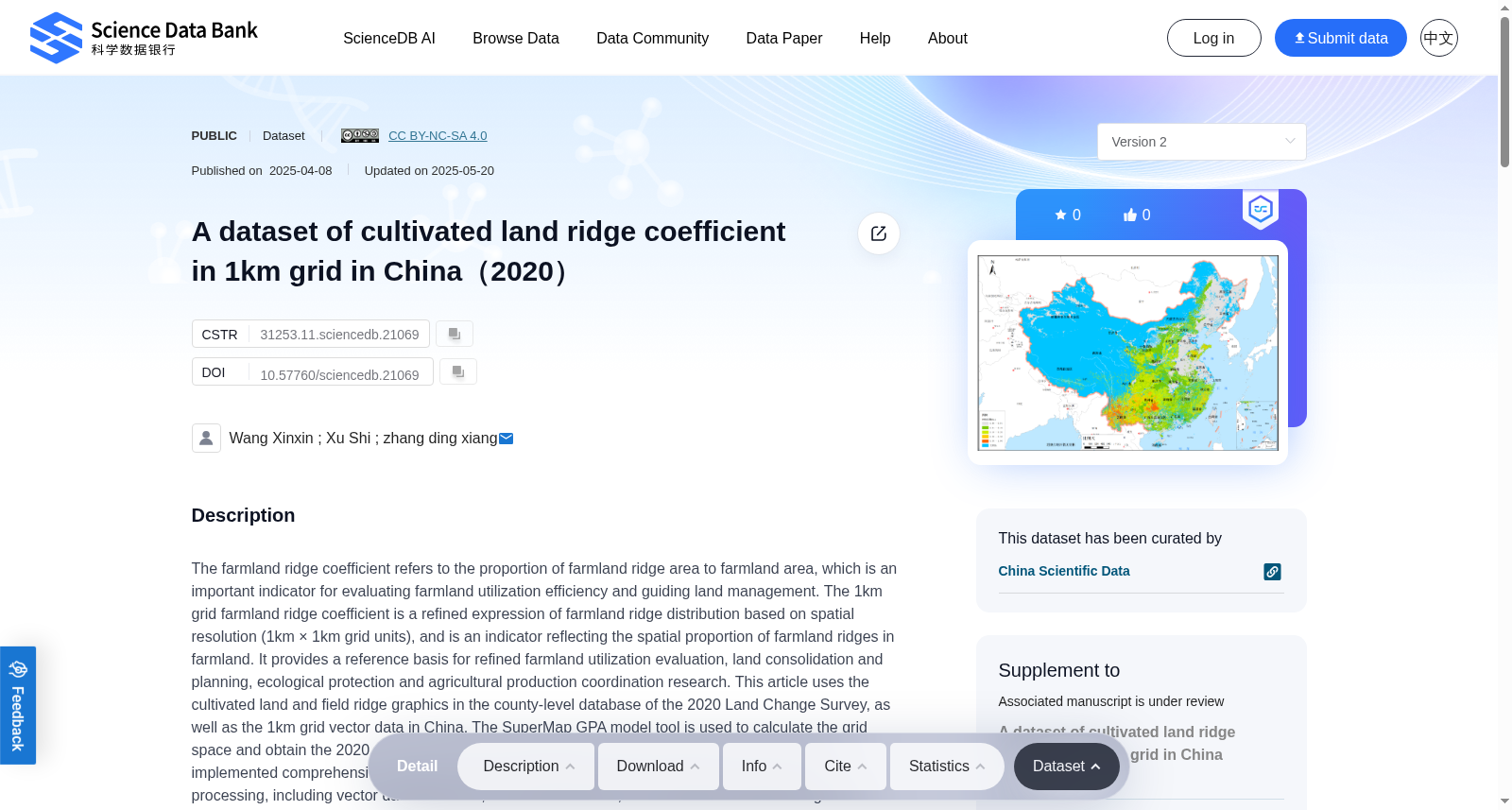
The farmland ridge coefficient refers to the proportion of farmland ridge area to farmland area, which is an important indicator for evaluating farmland utilization efficiency and guiding land management. The 1km grid farmland ridge coefficient is a refined expression of farmland ridge distribution based on spatial resolution (1km × 1km grid units), and is an indicator reflecting the spatial proportion of farmland ridges in farmland. It provides a reference basis for refined farmland utilization evaluation, land consolidation and planning, ecological protection and agricultural production coordination research. This article uses the cultivated land and field ridge graphics in the county-level database of the 2020 Land Change Survey, as well as the 1km grid vector data in China. The SuperMap GPA model tool is used to calculate the grid space and obtain the 2020 1km grid cultivated land field ridge coefficient dataset in China. We have implemented comprehensive quality control and inspection measures at various stages of data processing, including vector data extraction, data concatenation, and calculation of kilometer grid field slope coefficients, to ensure the correctness, completeness, and consistency of the data. This dataset can be used for research on farmland production capacity assessment, land consolidation and planning, agricultural landscape design and optimization, and other related fields.
农田田埂系数(farmland ridge coefficient)指田埂面积占农田总面积的比例,是评估农田利用效率、指导土地管理的重要指标。1km格网农田田埂系数是以1km×1km格网单元为空间分辨率的农田田埂分布精细化表达,是反映农田内部田埂空间占比的指标,可为精细化农田利用评价、土地整治与规划、生态保护与农业生产协同研究提供参考依据。本研究采用2020年全国土地变更调查县级数据库中的耕地与田埂矢量图形,以及全国1km格网矢量数据,依托SuperMap GPA模型工具计算格网空间占比,得到2020年全国1km格网耕地田埂系数数据集。本研究在数据处理的各环节(包括矢量数据提取、数据拼接、公里格网田埂系数计算等)均实施了全面的质量管控与检验措施,以保障数据的正确性、完整性与一致性。该数据集可应用于农田生产能力评估、土地整治与规划、农业景观设计与优化等相关领域的研究。
提供机构:
Science Data Bank
创建时间:
2025-04-08
搜集汇总
数据集介绍
背景与挑战
背景概述
该数据集基于2020年中国土地变更调查数据,通过SuperMap GPA模型工具计算得出全国1km网格单元的耕地田埂系数,该系数反映了田埂面积在耕地中的空间比例,用于评估耕地利用效率和指导土地管理。数据集经过严格质量控制,适用于耕地生产力评估、土地整理规划和农业景观优化等相关研究。
以上内容由遇见数据集搜集并总结生成


