高亚洲地区融雪开始时间数据集(1979-2018)
收藏国家青藏高原科学数据中心2023-08-05 更新2024-03-01 收录
下载链接:
https://data.tpdc.ac.cn/zh-hans/data/01be1b50-d9b6-4189-8aa0-9e005514b6d1
下载链接
链接失效反馈官方服务:
资源简介:
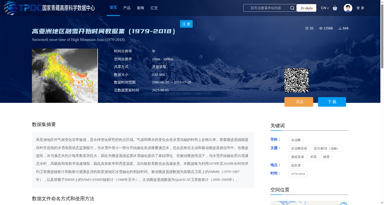
高亚洲地区对气候变化非常敏感,是全球变化研究的热点区域。气温和降水的变化会在冰雪冻融的时间上反映出来。星载微波遥感能提供时空连续的冰雪表面状态监测能力,当冰雪中很小一部分开始融化造成微量液态水,也会反映在主动和被动微波遥感信号中。在微波波段,冰与液态水的介电常数差异巨大,因此为微波遥感监测冰雪融化提供了基础理论。在被动微波情况下,当冰雪开始融化而出现液态水时,其吸收和发射率迅速增加,因此其发射率和亮度温度、后向散射系数也会迅速改变。本数据集为利用1979年至2018年长时间序列卫星微波辐射计和散射计观测反演的高亚洲地区冰雪融化的初始时间。被动微波遥感数据为搭载在卫星上的SMMR(1979~1987年),以及搭载于DMSP上的SSM/I-SSMIS辐射计(1988年至今)。主动微波遥感数据为QuikSCAT卫星散射计(2000~2009年)。
The High Asia region is highly sensitive to climate change and a hotspot for global change research. Changes in air temperature and precipitation are reflected in the timing of snow and ice freeze-thaw cycles. Satellite-borne microwave remote sensing enables spatio-temporally continuous monitoring of snow and ice surface conditions. Even the onset of minor melting of snow and ice that produces trace amounts of liquid water can be detected in both active and passive microwave remote sensing signals. The dielectric constants of ice and liquid water differ drastically in the microwave band, providing the fundamental theoretical basis for microwave remote sensing monitoring of snow and ice melting. For passive microwave remote sensing, when snow and ice start to melt and liquid water emerges, their absorption and emissivity increase rapidly, leading to sharp changes in emissivity, brightness temperature, and backscatter coefficient. This dataset provides the initial timing of snow and ice melting in the High Asia region, retrieved from long-time-series satellite microwave radiometer and scatterometer observations spanning from 1979 to 2018. The passive microwave remote sensing data are sourced from the SMMR (1979–1987) onboard satellites, and the SSM/I-SSMIS radiometers onboard DMSP (1988–present). The active microwave remote sensing data are from the QuikSCAT satellite scatterometer (2000–2009).
提供机构:
熊川,施建成,姚汝桢,雷永荟,潘金梅
创建时间:
2020-07-07
搜集汇总
数据集介绍
背景与挑战
背景概述
该数据集提供了高亚洲地区1979年至2018年的融雪开始时间数据,基于长时间序列卫星微波辐射计和散射计观测反演,包括被动微波(SMMR、SSM/I-SSMIS)和主动微波(QuikSCAT)遥感数据。数据以Geotiff格式存储,时间分辨率为年,空间分辨率为10km至100km,适用于气候变化和冰冻圈研究,支持开放获取。
以上内容由遇见数据集搜集并总结生成


