2021年中国京津冀地区GF1-2m土地利用分类数据集
收藏地球大数据科学工程2024-04-26 收录
下载链接:
https://data.casearth.cn/sdo/detail/653890f7819aec0f26027c3f
下载链接
链接失效反馈官方服务:
资源简介:
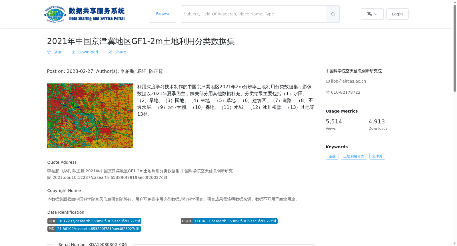
利用深度学习技术制作的中国京津冀地区2021年2m分辨率土地利用分类数据集,影像数据以2021年夏季为主,缺失部分用其他数据补充。分类结果主要包括(1)水田、(2)旱地、(3)园地、(4)林地、(5)草地、(6)建筑区、(7)道路、(8)不透水层、(9)农业大棚、(10)裸地、(11)水域、(12)冰川积雪、(13)其他等13类。
This is a 2-meter resolution land use classification dataset for the Beijing-Tianjin-Hebei region of China, developed using deep learning technologies. The image data is mainly sourced from summer 2021, with missing segments supplemented by other datasets. The classification results cover 13 categories: (1) paddy field, (2) rain-fed cropland, (3) orchard land, (4) forest land, (5) grassland, (6) built-up area, (7) road, (8) impervious surface, (9) agricultural greenhouse, (10) bare land, (11) water area, (12) glacier and snow cover, (13) others.
提供机构:
中国科学院空天信息创新研究院
搜集汇总
数据集介绍
背景与挑战
背景概述
该数据集是中国科学院空天信息创新研究院制作的2021年京津冀地区2米分辨率土地利用分类数据,包含13个土地类型分类,采用.tif栅格格式,总容量37.21GB。数据适用于科研用途,覆盖京津冀地区,时间分辨率为2021年。
以上内容由遇见数据集搜集并总结生成


