中国青藏高原东南缘大雪山南段石冰川编目数据集(2019-2022)
收藏国家青藏高原科学数据中心2023-03-29 更新2024-03-01 收录
下载链接:
https://data.tpdc.ac.cn/zh-hans/data/0087ad7a-2b48-4fa9-8288-323caae9e09a
下载链接
链接失效反馈官方服务:
资源简介:
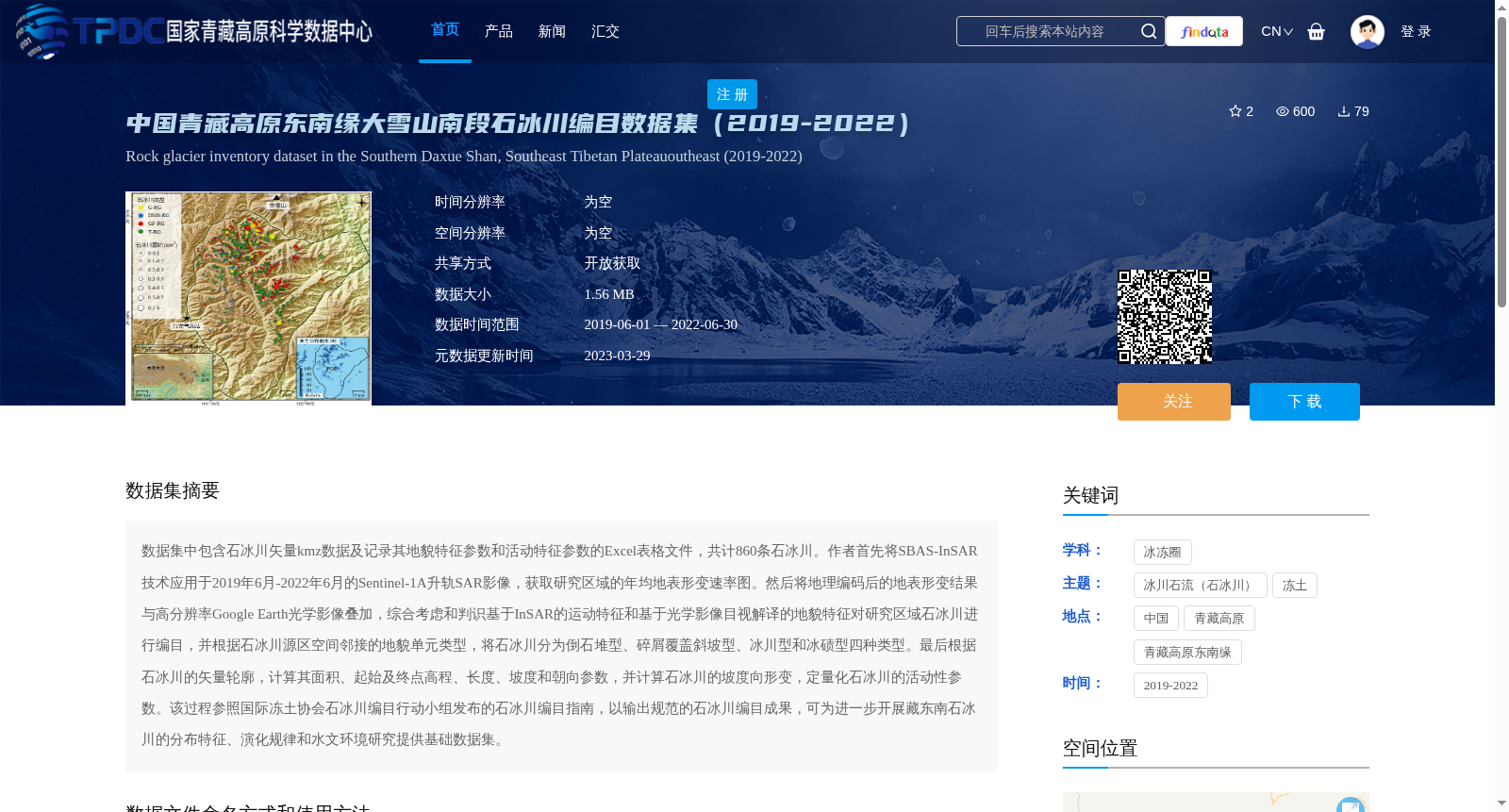
数据集中包含石冰川矢量kmz数据及记录其地貌特征参数和活动特征参数的Excel表格文件,共计860条石冰川。作者首先将SBAS-InSAR技术应用于2019年6月-2022年6月的Sentinel-1A升轨SAR影像,获取研究区域的年均地表形变速率图。然后将地理编码后的地表形变结果与高分辨率Google Earth光学影像叠加,综合考虑和判识基于InSAR的运动特征和基于光学影像目视解译的地貌特征对研究区域石冰川进行编目,并根据石冰川源区空间邻接的地貌单元类型,将石冰川分为倒石堆型、碎屑覆盖斜坡型、冰川型和冰碛型四种类型。最后根据石冰川的矢量轮廓,计算其面积、起始及终点高程、长度、坡度和朝向参数,并计算石冰川的坡度向形变,定量化石冰川的活动性参数。该过程参照国际冻土协会石冰川编目行动小组发布的石冰川编目指南,以输出规范的石冰川编目成果,可为进一步开展藏东南石冰川的分布特征、演化规律和水文环境研究提供基础数据集。
This dataset contains vector KMZ data of rock glaciers and Excel spreadsheet files recording their geomorphic and activity characteristic parameters, involving a total of 860 rock glaciers. First, the authors applied the SBAS-InSAR technique to ascending-track Sentinel-1A SAR images acquired between June 2019 and June 2022 to generate the annual average surface deformation rate map of the study area. Then, the geocoded surface deformation results were overlaid with high-resolution optical images from Google Earth, and rock glaciers in the study area were cataloged by comprehensively considering and identifying the motion characteristics derived from InSAR and the geomorphic features obtained via visual interpretation of optical images. Additionally, based on the types of geomorphic units spatially adjacent to the source areas of rock glaciers, the rock glaciers were classified into four categories: talus type, debris-covered slope type, glacier type, and moraine type. Finally, based on the vector outlines of rock glaciers, parameters including area, start and end elevations, length, slope, and aspect were calculated, alongside the slope-direction deformation of rock glaciers, to quantify their activity parameters. This process follows the Rock Glacier Inventory Guidelines released by the Rock Glacier Inventory Task Group of the International Permafrost Association to produce standardized rock glacier inventory results, which can provide a fundamental dataset for further research on the distribution characteristics, evolutionary laws, and hydrological environment of rock glaciers in southeastern Tibet.
提供机构:
蔡佳欣,何昱君,王晓文,刘国祥
创建时间:
2023-03-28
搜集汇总
数据集介绍
背景与挑战
背景概述
该数据集包含2019-2022年中国青藏高原东南缘大雪山南段的860条石冰川编目数据,涵盖矢量轮廓和地貌特征参数,采用SBAS-InSAR技术分析地表形变,为研究石冰川分布和演化提供基础数据。
以上内容由遇见数据集搜集并总结生成


