“一带一路”关键节点区域高时空分辨率多光谱遥感影像(2000-2016)
收藏国家青藏高原科学数据中心2021-04-18 更新2024-03-01 收录
下载链接:
https://data.tpdc.ac.cn/zh-hans/data/52f9d459-b2ec-4497-8601-9e6ab24b67e4
下载链接
链接失效反馈官方服务:
资源简介:
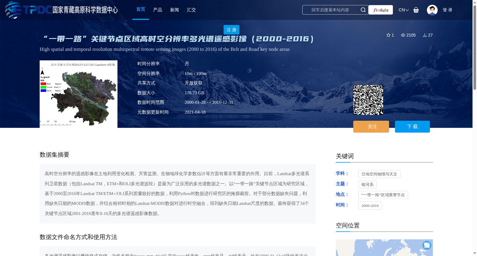
高时空分辨率的遥感影像在土地利用变化检测、灾害监测、生物地球化学参数估计等方面有着非常重要的作用。目前,Landsat多光谱系列卫星数据(包括Landsat TM,ETM+和OLI多光谱波段)是最为广泛应用的多光谱数据之一。以“一带一路”关键节点区域为研究区域,基于2000至2016年Landsat TM/ETM+/OLI系列质量较好的数据,利用Python对数据进行研究区的掩膜裁剪。对于部分数据缺失问题,利用缺失日期的MODIS数据,并结合相邻时相的Landsat-MODIS数据对进行时空融合,得到缺失日期Landsat尺度的数据。最终获得了34个关键节点区域2001-2016逐年8-16天的多光谱遥感影像数据。
High-spatial and temporal resolution remote sensing images play a critical role in land use change detection, disaster monitoring, biogeochemical parameter estimation, and other relevant research fields. Currently, the Landsat multi-spectral satellite dataset series (including Landsat TM, ETM+ and OLI multi-spectral bands) is one of the most widely used multi-spectral datasets. Taking the key node regions of the Belt and Road Initiative as the study area, based on high-quality Landsat TM/ETM+/OLI series data from 2000 to 2016, Python was utilized to conduct mask cropping of the data within the study area. For the issue of partial data gaps, MODIS images of the missing dates and Landsat-MODIS image pairs with adjacent temporal phases were employed to perform spatiotemporal fusion, so as to acquire data at the Landsat scale for the missing dates. Finally, multi-spectral remote sensing image data with a temporal resolution of 8-16 days per year from 2001 to 2016 for 34 key node regions were obtained.
提供机构:
殷志祥,凌峰
创建时间:
2020-12-21
搜集汇总
数据集介绍
背景与挑战
背景概述
该数据集为'一带一路'关键节点区域的高时空分辨率多光谱遥感影像,覆盖2000年至2016年,基于Landsat TM/ETM+/OLI卫星数据,通过时空融合技术处理缺失部分,生成34个区域逐年8-16天的影像,空间分辨率10-100米,时间分辨率月,数据量176.73 GB,适用于土地利用变化检测和灾害监测等研究。
以上内容由遇见数据集搜集并总结生成


