中国青藏高原东南部冰川数据集(2009)
收藏国家青藏高原科学数据中心2024-05-25 更新2024-06-06 收录
下载链接:
https://data.tpdc.ac.cn/zh-hans/data/d36c3c2b-6128-4180-9c89-fae9820f3b05
下载链接
链接失效反馈官方服务:
资源简介:
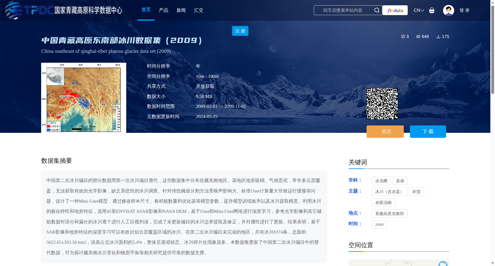
中国第二次冰川编目的部分数据用第一次冰川编目替代,这些数据集中分布在藏东南地区。该地区地形陡峭、气候恶劣,常年多云层覆盖,无法获取有效的光学影像,缺乏系统性的冰川调查。针对传统阈值分割方法受噪声影响大、标准Unet计算量大导致运行缓慢等问题,设计了一种Mini-Unet模型,通过修改样本尺寸、卷积核数量和优化器等模型参数,提升模型训练效率以及冰川提取精度。利用冰川的极化特性和地形特征,选用45景ENVISAT ASAR影像和NASA DEM,基于Unet和Mini-Unet网络进行深度学习,参考光学影像和其它辅助数据对误分和漏分的冰川逐个进行人工目视判读,完成了未更新编目的冰川边界提取及修正,并对属性进行了更新。结果表明,基于SAR影像和地形特征的深度学习可以有效识别云层覆盖区域的冰川。在第二次冰川编目未完成的地区,共有冰川8374条,总面积5622.65±303.58 km2,误差占总冰川面积的5.4%,整体呈退缩状态,冰川碎片化现象居多。本数据集更新了中国第二次冰川编目中的替代数据,可为探讨藏东南冰川变化和物质平衡等相关研究提供可靠的数据支撑。
Some data from the Second Chinese Glacier Inventory were replaced with data from the First Chinese Glacier Inventory, and these replaced data are concentrated in the southeastern Tibetan Plateau. This region features steep terrain, harsh climate, and persistent cloud cover, making it impossible to acquire valid optical imagery and lacking systematic glacier surveys. Aiming at the problems that traditional threshold segmentation methods are highly susceptible to noise and the standard U-Net has a large computational load leading to slow operation, a Mini-Unet model was designed. By adjusting model parameters such as sample size, number of convolution kernels, and optimizer, the training efficiency and glacier extraction accuracy of the model were improved. Leveraging the polarization and topographic characteristics of glaciers, 45 scenes of ENVISAT ASAR images and NASA DEM were selected. Deep learning was conducted based on U-Net and Mini-Unet networks. Misclassified and missed glaciers were manually visually interpreted one by one with reference to optical images and other auxiliary data, so as to complete the extraction and correction of glacier boundaries that had not been updated in the inventory, and update their attributes. The results show that deep learning based on SAR images and topographic features can effectively identify glaciers in cloud-covered areas. In the areas where the Second Chinese Glacier Inventory was not completed, there are a total of 8374 glaciers, with a total area of 5622.65±303.58 km². The error accounts for 5.4% of the total glacier area. Glaciers in this region are generally in a state of retreat, and most of them exhibit fragmentation. This dataset updates the replaced data in the Second Chinese Glacier Inventory, and can provide reliable data support for related studies such as exploring glacier changes and mass balance in the southeastern Tibetan Plateau.
提供机构:
柯长青
创建时间:
2023-03-24
搜集汇总
数据集介绍
背景与挑战
背景概述
该数据集包含2009年中国青藏高原东南部冰川的详细信息,采用深度学习技术更新了第二次冰川编目中的替代数据,覆盖8374条冰川,总面积约5622.65 km²,误差率为5.4%。数据集以矢量文件存储,适用于冰川变化和物质平衡研究。
以上内容由遇见数据集搜集并总结生成


