黄河流域生态数据库-黄河流域水域数据(1985-2020)
收藏国家地球系统科学数据中心2022-04-14 更新2024-03-04 收录
下载链接:
https://www.geodata.cn/data/datadetails.html?dataguid=261134665521747&docId=9389
下载链接
链接失效反馈官方服务:
资源简介:
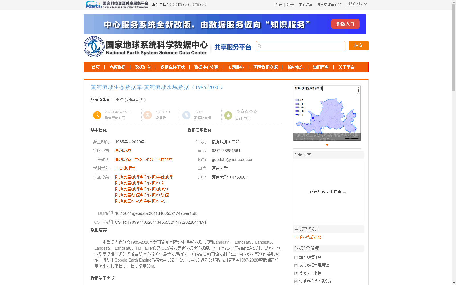
本数据内容包含1985-2020年黄河流域年际水体频率数据。采用Landsat4 、Landsat5、Landsat6、Landsat7、Landsat8、TM、ETM以及OLS遥感影像数据为数据源,对样本点进行光谱信息统计,从各类水体及易混淆地类的光谱曲线上分析,确定最优专题指数,并结合自动阈值分割算法,构建多专题水体提取模型,借助于Google Earth Engine遥感大数据云平台进行数据提取及处理,最终获得1987-2020年黄河流域年际水体频率数据,数据精度30m。
This dataset contains inter-annual water body frequency data of the Yellow River Basin spanning 1985 to 2020. Remote sensing image data from Landsat 4, Landsat 5, Landsat 6, Landsat 7, Landsat 8, TM, ETM, and OLS were used as data sources. We conducted spectral information statistics on sample points, analyzed the spectral curves of various water bodies and easily confused land types to determine the optimal thematic indices, and constructed a multi-thematic water body extraction model combined with automatic threshold segmentation algorithms. Leveraging the Google Earth Engine remote sensing big data cloud platform for data extraction and processing, we finally obtained inter-annual water body frequency data of the Yellow River Basin from 1987 to 2020, with a spatial resolution of 30 meters.
提供机构:
河南大学
创建时间:
2022-04-14
搜集汇总
数据集介绍
背景与挑战
背景概述
该数据集提供了1985年至2020年黄河流域的年际水体频率数据,基于Landsat系列、TM、ETM和OLS遥感影像,通过光谱分析和自动阈值分割算法在Google Earth Engine云平台上处理生成,空间精度为30米。数据聚焦于水域动态监测,适用于生态、水文和地理科学研究,并遵循严格的质量控制流程。
以上内容由遇见数据集搜集并总结生成


