中国主要城市水源区边界及重要性
收藏国家青藏高原科学数据中心2025-04-28 更新2025-10-04 收录
下载链接:
https://data.tpdc.ac.cn/zh-hans/data/61533881-a243-4efb-b15c-a725c2d7f157
下载链接
链接失效反馈官方服务:
资源简介:
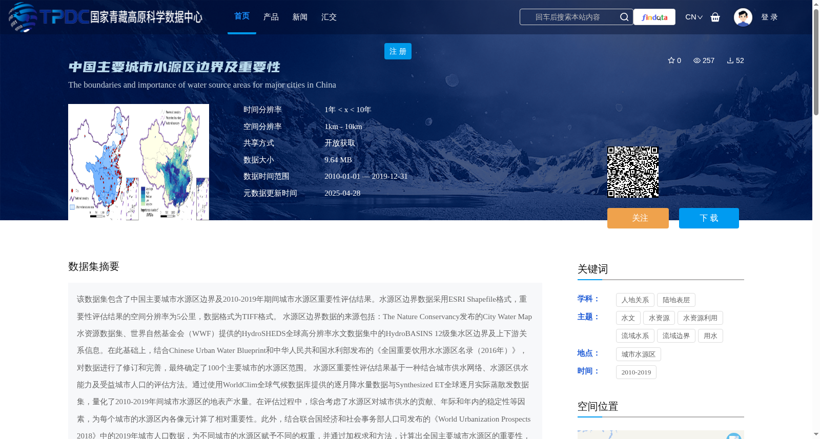
该数据集包含了中国主要城市水源区边界及2010-2019年期间城市水源区重要性评估结果。水源区边界数据采用ESRI Shapefile格式,重要性评估结果的空间分辨率为5公里,数据格式为TIFF格式。
水源区边界数据的来源包括:The Nature Conservancy发布的City Water Map水资源数据集、世界自然基金会(WWF)提供的HydroSHEDS全球高分辨率水文数据集中的HydroBASINS 12级集水区边界及上下游关系信息。在此基础上,结合Chinese Urban Water Blueprint和中华人民共和国水利部发布的《全国重要饮用水水源区名录(2016年)》,对数据进行了修订和完善,最终确定了100个主要城市的水源区范围。
水源区重要性评估结果基于一种结合城市供水网络、水源区供水能力及受益城市人口的评估方法。通过使用WorldClim全球气候数据库提供的逐月降水量数据与Synthesized ET全球逐月实际蒸散发数据集,量化了2010-2019年间城市水源区的地表产水量。在评估过程中,综合考虑了水源区对城市供水的贡献、年际和年内的稳定性等因素,为每个城市的水源区内各像元计算了相对重要性。此外,结合联合国经济和社会事务部人口司发布的《World Urbanization Prospects 2018》中的2019年城市人口数据,为不同城市的水源区赋予不同的权重,并通过加权求和方法,计算出全国主要城市水源区的重要性,最终利用分位数法将全国水源区划分为五个等级。
This dataset contains the boundaries of water source areas for major cities in China, as well as the results of importance assessments of these water source areas during the period 2010–2019. The water source area boundary data is stored in ESRI Shapefile format, while the importance assessment results have a spatial resolution of 5 km and are in TIFF format.
The sources of the water source area boundary data include: the City Water Map water resources dataset released by The Nature Conservancy, and the HydroBASINS Level 12 catchment boundaries and upstream-downstream connectivity information from the HydroSHEDS global high-resolution hydrological dataset provided by the World Wildlife Fund (WWF). On this basis, the dataset was revised and improved by incorporating the Chinese Urban Water Blueprint and the *National List of Important Drinking Water Source Areas (2016)* released by the Ministry of Water Resources of the People's Republic of China, and the water source area ranges for 100 major cities were finally determined.
The importance assessment results of water source areas are based on an evaluation method that integrates urban water supply networks, water supply capacity of water source areas, and the population of benefited cities. By using the monthly precipitation data from the WorldClim global climate database and the Synthesized ET global monthly actual evapotranspiration dataset, the surface water yield of urban water source areas during 2010–2019 was quantified. During the assessment process, factors such as the contribution of water source areas to urban water supply, inter-annual and intra-annual stability were comprehensively considered, and the relative importance was calculated for each pixel within the water source area of each city. In addition, combined with the 2019 urban population data from the *World Urbanization Prospects 2018* released by the Population Division of the Department of Economic and Social Affairs of the United Nations, different weights were assigned to the water source areas of different cities, and the importance of water source areas for major cities across the country was calculated via the weighted summation method. Finally, the national water source areas were divided into five grades using the quantile method.
提供机构:
刘豪富,刘志锋,龚炳华,刘淑慧,毛旭锋,何春阳,官冬杰
创建时间:
2025-04-27
搜集汇总
数据集介绍
背景与挑战
背景概述
该数据集提供了中国100个主要城市的水源区边界及其在2010-2019年间的重要性评估结果。边界数据以ESRI Shapefile格式存储,重要性评估基于城市供水网络、水源区供水能力和受益人口,空间分辨率为5公里,并以TIFF格式呈现。数据集整合了多源权威数据,通过综合方法量化水源区对城市供水的贡献和稳定性,为水资源管理提供科学支持。
以上内容由遇见数据集搜集并总结生成


