长春市30m分辨率建设用地扩张对耕地资源的占用数据集(2019年)
收藏国家地球系统科学数据中心2024-11-27 更新2024-11-16 收录
下载链接:
https://www.geodata.cn/data/datadetails.html?dataguid=10525742658380&docId=2166
下载链接
链接失效反馈官方服务:
资源简介:
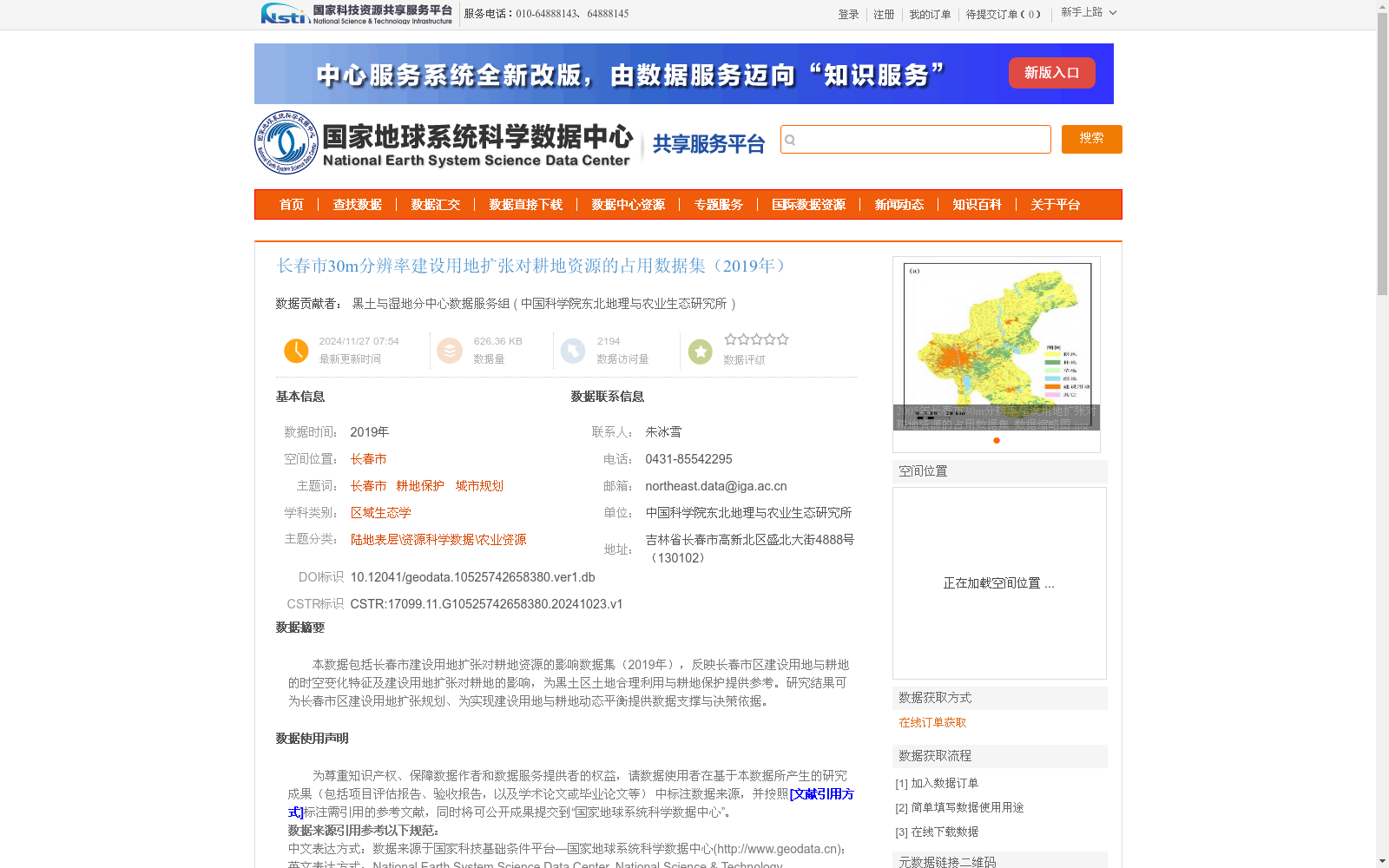
本数据包括长春市建设用地扩张对耕地资源的影响数据集(2019年),反映长春市区建设用地与耕地的时空变化特征及建设用地扩张对耕地的影响,为黑土区土地合理利用与耕地保护提供参考。研究结果可为长春市区建设用地扩张规划、为实现建设用地与耕地动态平衡提供数据支撑与决策依据。
This dataset documents the 2019 impacts of urban construction land expansion on cultivated land resources in Changchun. It reveals the spatiotemporal variation characteristics of urban construction land and cultivated land within the urban area of Changchun, as well as the effects of construction land expansion on local cultivated land, providing a reference for rational land utilization and cultivated land protection in the black soil region. The findings from this dataset can provide data support and decision-making basis for the planning of urban construction land expansion in Changchun, and for achieving the dynamic balance between construction land and cultivated land.
提供机构:
中国科学院东北地理与农业生态研究所
创建时间:
2024-10-23
搜集汇总
数据集介绍
背景与挑战
背景概述
该数据集为2019年长春市30m分辨率建设用地扩张对耕地资源占用的空间分析数据,基于Landsat TM影像通过面向对象-决策树分类方法生成,数据精度高(Kappa系数>0.85),用于研究建设用地与耕地的时空变化关系,为城市规划与耕地保护提供科学依据。
以上内容由遇见数据集搜集并总结生成


