淮河干流蓄滞洪区区域水情遥感监测数据集(2020年)
收藏国家地球系统科学数据中心2022-07-11 更新2024-03-04 收录
下载链接:
https://www.geodata.cn/data/datadetails.html?dataguid=6788638&docId=7378
下载链接
链接失效反馈官方服务:
资源简介:
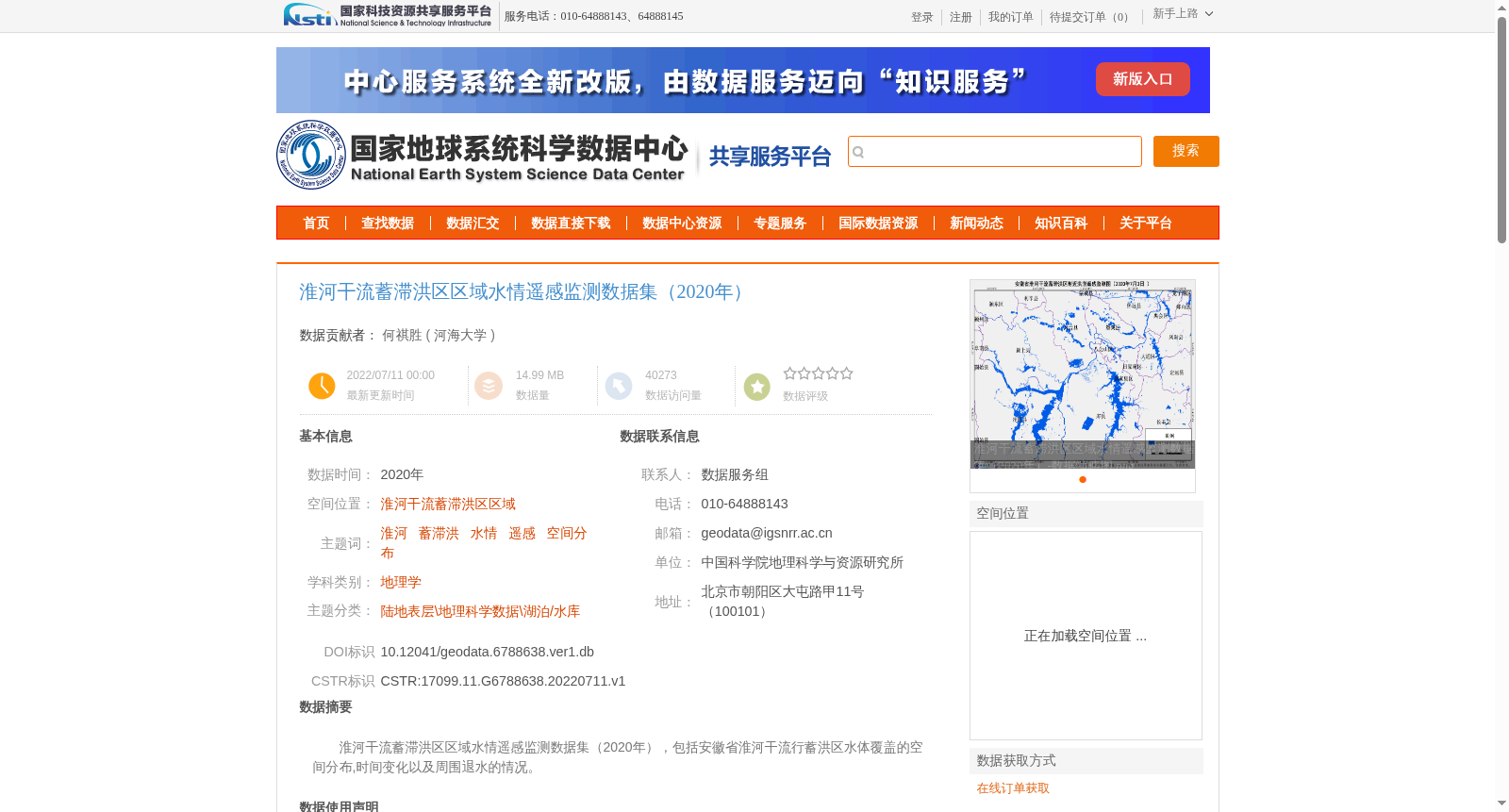
淮河干流蓄滞洪区区域水情遥感监测数据集(2020年),包括安徽省淮河干流行蓄洪区水体覆盖的空间分布,时间变化以及周围退水的情况。
Remote Sensing Monitoring Dataset of Hydrological Conditions in the Flood Storage and Detention Zones Along the Main Stream of the Huaihe River (2020). This dataset covers the spatial distribution and temporal variations of water coverage in the flood storage and detention zones along the main stream of the Huaihe River in Anhui Province, as well as the water recession conditions in the surrounding areas.
提供机构:
河海大学
创建时间:
2022-07-11
搜集汇总
数据集介绍
背景与挑战
背景概述
该数据集提供了2020年淮河干流蓄滞洪区的水体覆盖空间分布和时间变化信息,适用于地理学和水情遥感监测研究。数据来源于哨兵1号和高分系列遥感影像,经过专业处理和质量控制,具有较高的精度和可靠性。
以上内容由遇见数据集搜集并总结生成


