A 30m fused InENVI NDVI dataset from 2001 to 2020 in China
收藏DataCite Commons2025-09-10 更新2025-04-16 收录
下载链接:
https://www.scidb.cn/detail?dataSetId=93f8ef4ea76045f5b9025e6a1f1f99ab
下载链接
链接失效反馈官方服务:
资源简介:
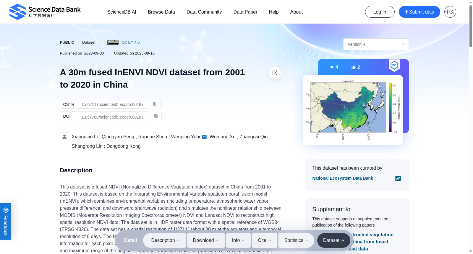
This dataset is a fused NDVI (Normalized Difference Vegetation Index) dataset in China from 2001 to 2020. This dataset is based on the Integrating ENvironmental VarIable spatiotemporal fusion model (InENVI), which combines environmental variables (including temperature, atmospheric water vapor pressure difference, and downward shortwave radiation) and simulates the nonlinear relationship between MODIS (Moderate Resolution Imaging Spectroradiometer) NDVI and Landsat NDVI to reconstruct high spatial resolution NDVI data. The data set is in HDF raster data format with a spatial reference of WGS84 (EPSG:4326). The data set has a spatial resolution of 1/3711° (about 30 m at the equator) and a temporal resolution of 8 days. The HDF file contains NDVI, quality control (QC), longitude, latitude, time, and area information for each pixel. A QC value of 0 indicates that the predicted NDVI value is within the minimum and maximum range of the original sequence, 1 indicates that the predicted NDVI value is outside the range, and 2 indicates that the original Landsat is missing. Besides, the annual maximum NDVI for China derived from the fused dataset is also provided in GeoTIFF format with a spatial reference of WGS84 (EPSG:4326).In order to compress the file volume, the data type used in this dataset is UInt8 (Unsigned Integer 8). The scale is 1.2 / 255, and the offset is -0.2. It needs to be converted to NDVI by the following formula:NDVI = 1.2 / 255 * data - 0.2The missing value of the converted NDVI is -0.2.The dataset is organized in 1°×1° grid cells across the entire region. Each year’s data is stored in a separate folder, with 67 compressed packages per annual folder. Each compressed package covers a 5°×5° geographical area and contains HDF files for all 1°×1° grid cells within that area. For detailed information, please refer to the .docx document.
本数据集为2001年至2020年中国区域融合型归一化差分植被指数(Normalized Difference Vegetation Index, NDVI)数据集。本数据集基于环境变量时空融合模型(Integrating ENvironmental VarIable spatiotemporal fusion model, InENVI)构建,融合气温、大气水汽压差、下行短波辐射等环境变量,拟合中分辨率成像光谱仪(Moderate Resolution Imaging Spectroradiometer, MODIS)NDVI与Landsat NDVI间的非线性关系,以此重构高空间分辨率NDVI数据。本数据集采用HDF栅格数据格式,空间参考为WGS84(EPSG:4326),空间分辨率为1/3711°(赤道处约30米),时间分辨率为8天。HDF文件包含各像元的NDVI、质量控制(Quality Control, QC)、经度、纬度、时间与区域信息:QC值为0时,表示预测NDVI值处于原始序列的最小与最大值域范围内;QC值为1时,表示预测NDVI值超出该值域;QC值为2时,表示原始Landsat数据缺失。此外,本数据集还附带基于融合数据生成的中国年度最大NDVI产品,格式为GeoTIFF,空间参考为WGS84(EPSG:4326)。为压缩文件体积,本数据集采用无符号8位整数(Unsigned Integer 8, UInt8)作为数据存储类型,其缩放系数为1.2/255,偏移量为-0.2,需通过以下公式转换为实际NDVI值:NDVI = 1.2 / 255 × 数据值 - 0.2。转换后的NDVI缺失值为-0.2。本数据集以1°×1°格网对全区域数据进行组织,每年的数据存储于独立文件夹中,每个年度文件夹包含67个压缩包;每个压缩包覆盖5°×5°地理区域,内含该区域内所有1°×1°格网对应的HDF文件。详细信息请参阅配套.docx文档。
提供机构:
Science Data Bank
创建时间:
2023-09-03
搜集汇总
数据集介绍
背景与挑战
背景概述
该数据集是一个2001-2020年中国区域30米分辨率的NDVI融合数据集,基于InENVI模型结合MODIS和Landsat数据生成,包含8天时间分辨率的NDVI值及其质量控制信息,适用于植被动态监测和研究。
以上内容由遇见数据集搜集并总结生成


