横断山区30m数字高程模型(DEM,2006-2011)
收藏国家青藏高原科学数据中心2025-04-07 更新2025-04-12 收录
下载链接:
https://data.tpdc.ac.cn/zh-hans/data/c1393a02-7a74-438e-a35f-293a8c3780f3
下载链接
链接失效反馈官方服务:
资源简介:
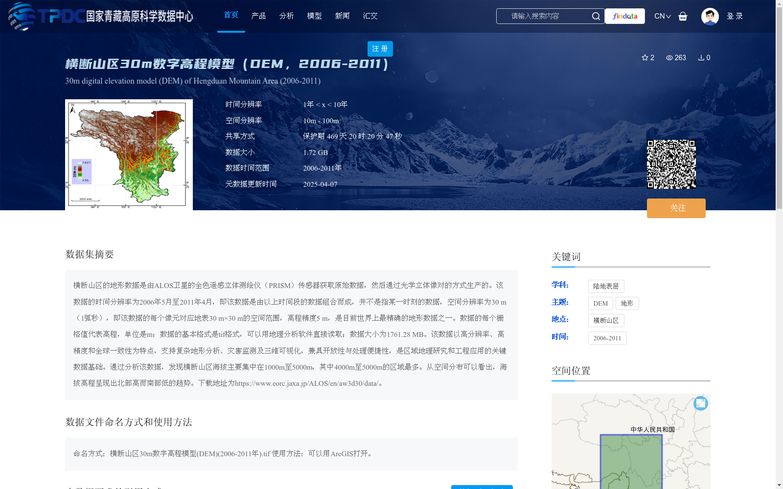
横断山区的地形数据是由ALOS卫星的全色遥感立体测绘仪(PRISM)传感器获取原始数据,然后通过光学立体像对的方式生产的。该数据的时间分辨率为2006年5月至2011年4月,即该数据是由以上时间段的数据组合而成,并不是指某一时刻的数据,空间分辨率为30 m(1弧秒),即该数据的每个像元对应地表30 m×30 m的空间范围,高程精度5 m,是目前世界上最精确的地形数据之一。数据的每个栅格值代表高程,单位是m;数据的基本格式是tif格式,可以用地理分析软件直接读取;数据大小为1761.28 MB。该数据以高分辨率、高精度和全球一致性为特点,支持复杂地形分析、灾害监测及三维可视化,兼具开放性与处理便捷性,是区域地理研究和工程应用的关键数据基础。通过分析该数据,发现横断山区海拔主要集中在1000m至5000m,其中4000m至5000m的区域最多。从空间分布可以看出,海拔高程呈现出北部高而南部低的趋势。下载地址为https://www.eorc.jaxa.jp/ALOS/en/aw3d30/data/。
The topographic data of the Hengduan Mountains was generated from raw data acquired by the Panchromatic Remote-sensing Stereo Instrument (PRISM) sensor on the ALOS satellite via optical stereo pair processing. The temporal coverage of this dataset spans from May 2006 to April 2011, meaning it is a composite dataset compiled from data collected over this period rather than data from a single moment. Its spatial resolution is 30 m (1 arcsecond), where each grid cell corresponds to a 30 m × 30 m surface area on the ground. With an elevation accuracy of 5 m, it is currently one of the most precise topographic datasets worldwide. Each grid cell value represents elevation, with the unit being meter (m). The basic data format is TIFF, which can be directly read by geographic analysis software, and the total size of the dataset is 1761.28 MB. Characterized by high spatial resolution, high elevation accuracy and global consistency, this dataset supports complex topographic analysis, disaster monitoring and 3D visualization. It also features openness and ease of processing, serving as a critical data foundation for regional geographic research and engineering applications. Analysis of this dataset shows that the elevations in the Hengduan Mountains mainly concentrate between 1000 m and 5000 m, with the largest area falling within the 4000 m to 5000 m range. Spatially, the elevation exhibits a trend of being higher in the north and lower in the south. The download link is https://www.eorc.jaxa.jp/ALOS/en/aw3d30/data/.
提供机构:
邱海军
创建时间:
2025-01-07
搜集汇总
数据集介绍
背景与挑战
背景概述
该数据集是横断山区2006年至2011年的30米分辨率数字高程模型(DEM),基于ALOS卫星PRISM传感器数据通过光学立体像对生产,高程精度达5米,具有高分辨率和高精度特点。数据以tif格式提供,大小为1.72 GB,支持复杂地形分析、灾害监测及三维可视化等应用,是区域地理研究和工程的关键基础数据。
以上内容由遇见数据集搜集并总结生成


