青藏高原全区域250m地质灾害危险性基础数据(2020)
收藏国家青藏高原科学数据中心2024-11-27 更新2024-11-30 收录
下载链接:
https://data.tpdc.ac.cn/zh-hans/data/9bf99cda-da68-42e5-979b-5e47fdb2bf0e
下载链接
链接失效反馈官方服务:
资源简介:
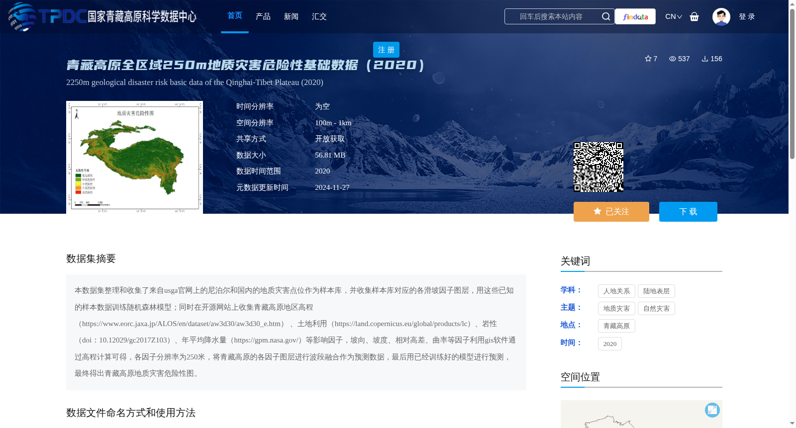
本数据集整理和收集了来自usga官网上的尼泊尔和国内的地质灾害点位作为样本库,并收集样本库对应的各滑坡因子图层,用这些已知的样本数据训练随机森林模型;同时在开源网站上收集青藏高原地区高程(https://www.eorc.jaxa.jp/ALOS/en/dataset/aw3d30/aw3d30_e.htm)
、土地利用(https://land.copernicus.eu/global/products/lc)、岩性(doi:10.12029/gc2017Z103)、年平均降水量(https://gpm.nasa.gov/)等影响因子,坡向、坡度、相对高差、曲率等因子利用gis软件通过高程计算可得,各因子分辨率为250米,将青藏高原的各因子图层进行波段融合作为预测数据,最后用已经训练好的模型进行预测,最终得出青藏高原地质灾害危险性图。
This dataset compiles and collects geological hazard points from Nepal and domestic (China) regions sourced from the official USGA website as a sample library, and additionally collects corresponding landslide factor layers for the sample library. A random forest model is trained using these known sample data. Meanwhile, impact factors including the elevation data of the Qinghai-Tibet Plateau (https://www.eorc.jaxa.jp/ALOS/en/dataset/aw3d30/aw3d30_e.htm), land use products (https://land.copernicus.eu/global/products/lc), lithology (doi: 10.12029/gc2017Z103), and annual average precipitation (https://gpm.nasa.gov/) are gathered from open-source platforms. Factors such as aspect, slope, relative elevation difference, and curvature can be derived from elevation data using GIS software. All factors have a spatial resolution of 250 meters. All factor layers of the Qinghai-Tibet Plateau are merged via band compositing to create the prediction dataset. Finally, the trained random forest model is utilized for prediction, and the geological hazard susceptibility map of the Qinghai-Tibet Plateau is ultimately generated.
提供机构:
杨文涛
创建时间:
2024-11-26
搜集汇总
数据集介绍
背景与挑战
背景概述
该数据集为青藏高原全区域250米分辨率的地质灾害危险性基础数据(2020年),通过随机森林模型训练和多种地理因子(如高程、土地利用、岩性、降水量等)的融合预测得出。数据大小为56.81 MB,共享方式为开放获取,适用于ARCGIS软件使用。
以上内容由遇见数据集搜集并总结生成


