青藏高原多年冻土区热融滑塌分布数据(2018-2020)
收藏国家青藏高原科学数据中心2023-03-17 更新2024-04-26 收录
下载链接:
https://data.tpdc.ac.cn/zh-hans/data/ccfb2902-6e44-4033-b6f6-b76b16e28157
下载链接
链接失效反馈官方服务:
资源简介:
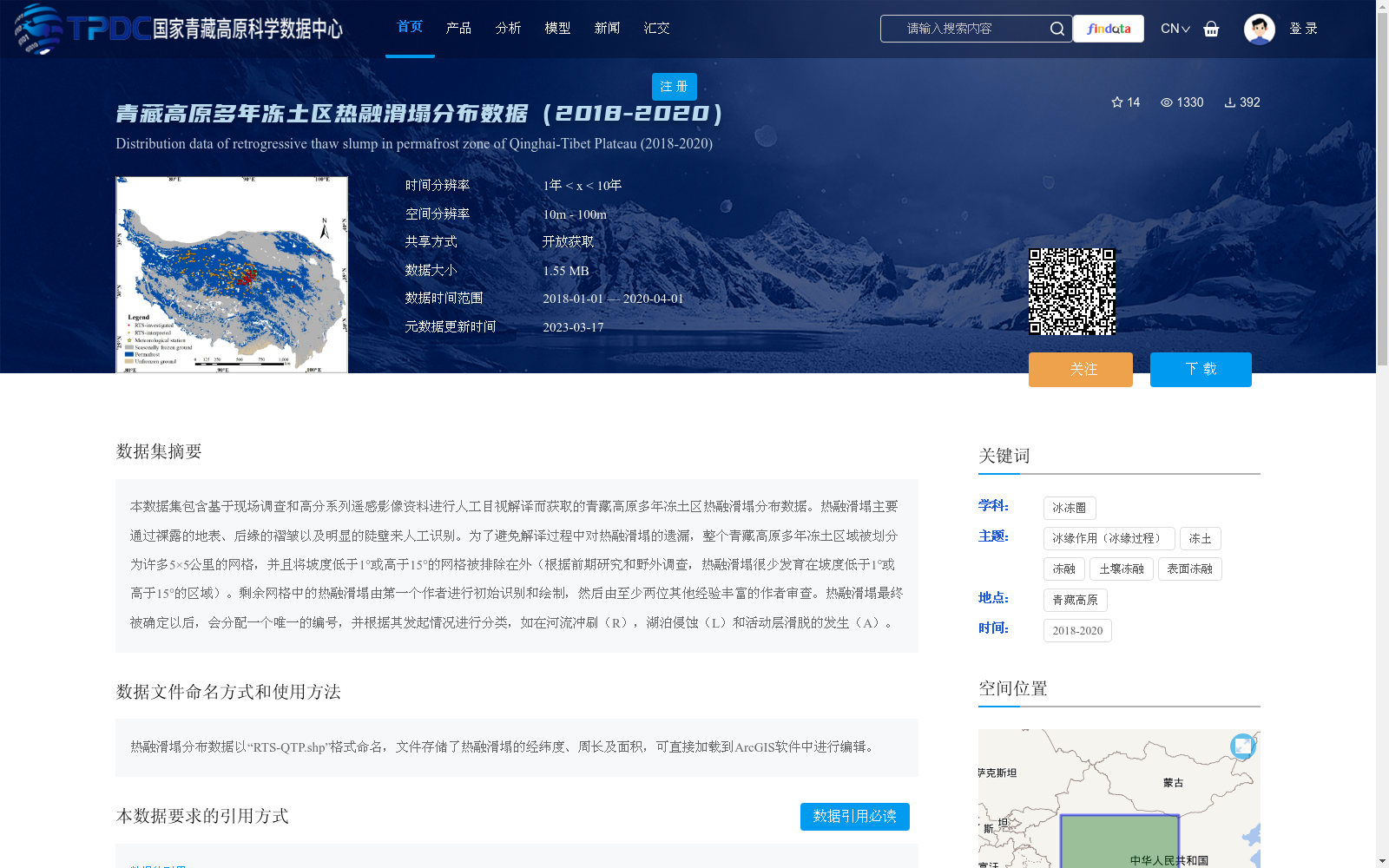
本数据集包含基于现场调查和高分系列遥感影像资料进行人工目视解译而获取的青藏高原多年冻土区热融滑塌分布数据。热融滑塌主要通过裸露的地表、后缘的褶皱以及明显的陡壁来人工识别。为了避免解译过程中对热融滑塌的遗漏,整个青藏高原多年冻土区域被划分为许多5×5公里的网格,并且将坡度低于1°或高于15°的网格被排除在外(根据前期研究和野外调查,热融滑塌很少发育在坡度低于1°或高于15°的区域)。剩余网格中的热融滑塌由第一个作者进行初始识别和绘制,然后由至少两位其他经验丰富的作者审查。热融滑塌最终被确定以后,会分配一个唯一的编号,并根据其发起情况进行分类,如在河流冲刷(R),湖泊侵蚀(L)和活动层滑脱的发生(A)。
This dataset contains distribution data of thermokarst slumps in the permafrost region of the Qinghai-Tibet Plateau, acquired via manual visual interpretation based on field surveys and Gaofen-series remote sensing images. Thermokarst slumps are manually identified primarily by exposed ground surfaces, folds at their trailing edges, and distinct steep cliffs. To avoid overlooking thermokarst slumps during the interpretation process, the entire permafrost region of the Qinghai-Tibet Plateau was divided into multiple 5×5 km grids, and grids with slopes lower than 1° or higher than 15° were excluded (according to prior studies and field investigations, thermokarst slumps rarely develop in areas with slopes below 1° or above 15°). Thermokarst slumps in the remaining grids were initially identified and mapped by the first author, then reviewed by at least two other experienced authors. Once a thermokarst slump is finally confirmed, it will be assigned a unique identification number and classified based on its triggering conditions, including river scouring (R), lake erosion (L), and active layer detachment (A).
提供机构:
罗京
创建时间:
2023-03-17
搜集汇总
数据集介绍
背景与挑战
背景概述
该数据集提供了2018年至2020年青藏高原多年冻土区热融滑塌的分布数据,基于现场调查和高分遥感影像通过人工目视解译获取,采用网格划分和坡度筛选方法确保识别准确性。数据以shapefile格式存储,包含热融滑塌的经纬度、周长和面积,适用于地理信息系统分析,支持冰冻圈和冻土相关研究。
以上内容由遇见数据集搜集并总结生成


