Rainstorm waterlogging vulnerability assessment of subway stations in the central area of Tianjin
收藏DataCite Commons2024-02-09 更新2024-08-18 收录
下载链接:
https://tandf.figshare.com/articles/dataset/Rainstorm_waterlogging_vulnerability_assessment_of_subway_stations_in_the_central_area_of_Tianjin/24220363/1
下载链接
链接失效反馈官方服务:
资源简介:
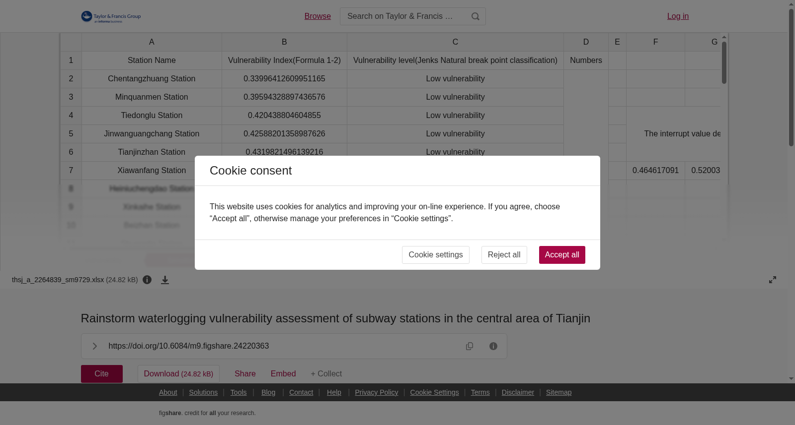
Rainstorm and waterlogging disasters of underground rail transit have recently become a vital safety problem. In this paper, a model of vulnerability assessment is established, and 14 indicators are selected to establish an indicator system for 109 stations in the central area of Tianjin. Analytic Hierarchy Process(AHP) and Entropy Weight Method (EWM) were used to determine the subjective and objective weights of indicators. A distance function was introduced to calculate the combined weights and improve the weights’ rationality. The results show that there are 34 high and medium-high vulnerability stations, and 41 low and medium-low vulnerability stations. Except for Line 2, the vulnerability level of subway stations on the rail lines decreased from the edge to the centre. Nankai District had the most high-vulnerability stations (seven of the 20 high-vulnerability stations). The main influence factors were the waterproofing capacity of the subway, the digital elevation model, the station type, the height of the exit, and the entrance steps.
近年来,地下轨道交通暴雨内涝灾害已成为至关重要的安全问题。本文构建了脆弱性评估(Vulnerability Assessment)模型,选取14项指标,针对天津中心城区的109座地铁站建立了指标体系。采用层次分析法(Analytic Hierarchy Process,AHP)与熵权法(Entropy Weight Method,EWM)分别确定指标的主观权重与客观权重,并引入距离函数计算组合权重,以提升权重的合理性。研究结果显示,脆弱性等级为高及中高的地铁站共计34座,低及中低脆弱性等级的地铁站共计41座。除2号线外,其余轨道交通线路的地铁站脆弱性等级均从线路边缘向中心区域逐步降低。南开区的高脆弱性地铁站数量最多,20座高脆弱性地铁站中有7座位于该区域。主要影响因素包括地铁防水能力、数字高程模型(Digital Elevation Model)、车站类型、出口高度以及入口台阶。
提供机构:
Taylor & Francis
创建时间:
2023-09-29
搜集汇总
数据集介绍
以上内容由遇见数据集搜集并总结生成


