南师大仙林北区多光谱正射影像数据集(20231102、20231113)
收藏国家地球系统科学数据中心2025-10-29 更新2024-04-21 收录
下载链接:
https://www.geodata.cn/data/datadetails.html?dataguid=56677512405188&docId=723
下载链接
链接失效反馈官方服务:
资源简介:
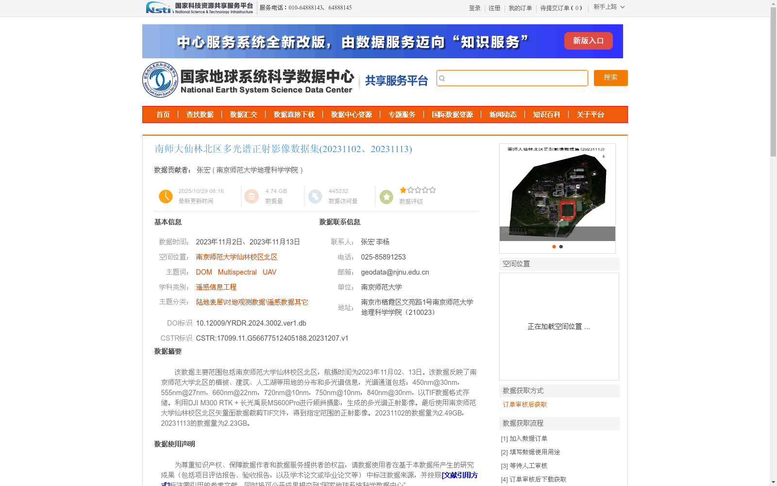
该数据主要范围包括南京师范大学仙林校区北区,航摄时间为2023年11月02、13日。该数据反映了南京师范大学北区的植被、建筑、人工湖等用地的分布和多光谱信息,光谱通道包括:450nm@30nm,555nm@27nm,660nm@22nm,720nm@10nm,750nm@10nm,840nm@30nm,以TIF数据格式存储。利用DJI M300 RTK + 长光禹辰MS600Pro进行倾斜摄影,生成的多光谱正射影像。最后使用南京师范大学仙林校区北区矢量面数据裁剪TIF文件,得到指定范围的正射影像。20231102的数据量为2.49GB,20231113的数据量为2.23GB。
The primary coverage of this dataset is the Northern District of Xianlin Campus, Nanjing Normal University. Aerial photography was carried out on November 2 and 13, 2023. This dataset documents the land use distribution (including vegetation, buildings, artificial lakes, etc.) and multispectral information of this area. The spectral bands include: 450nm@30nm, 555nm@27nm, 660nm@22nm, 720nm@10nm, 750nm@10nm, and 840nm@30nm. All data are stored in TIF format. Multispectral orthophotos were generated via oblique photography using DJI M300 RTK and Changguang Yuchen MS600Pro. Finally, the TIF files were cropped with the vector polygon data of the Northern District of Xianlin Campus, Nanjing Normal University, to produce orthophotos limited to the specified coverage. The data size on November 2, 2023, is 2.49 GB, while the data size on November 13, 2023, is 2.23 GB.
提供机构:
南京师范大学地理科学学院
创建时间:
2023-12-07
搜集汇总
数据集介绍
背景与挑战
背景概述
该数据集包含南京师范大学仙林校区北区的多光谱正射影像,覆盖植被、建筑、人工湖等地物,光谱信息丰富,适用于遥感信息工程等领域的研究。数据通过倾斜摄影获取,经过裁剪处理,具有高精度和高分辨率的特点。
以上内容由遇见数据集搜集并总结生成


