中国十年度及361个城市平均NDVI值统计数据集(250 m,1990-2020)
收藏资源简介:
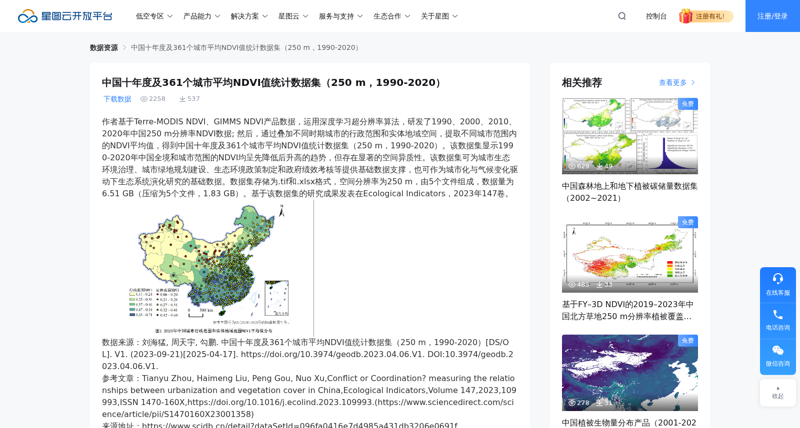
作者基于Terre-MODIS NDVI、GIMMS NDVI产品数据,运用深度学习超分辨率算法,研发了1990、2000、2010、2020年中国250 m分辨率NDVI数据; 然后,通过叠加不同时期城市的行政范围和实体地域空间,提取不同城市范围内的NDVI平均值,得到中国十年度及361个城市平均NDVI值统计数据集(250 m,1990-2020)。该数据集显示1990-2020年中国全境和城市范围的NDVI均呈先降低后升高的趋势,但存在显著的空间异质性。该数据集可为城市生态环境治理、城市绿地规划建设、生态环境政策制定和政府绩效考核等提供基础数据支撑,也可作为城市化与气候变化驱动下生态系统演化研究的基础数据。数据集存储为.tif和.xlsx格式,空间分辨率为250 m,由5个文件组成,数据量为6.51 GB(压缩为5个文件,1.83 GB)。基于该数据集的研究成果发表在Ecological Indicators,2023年147卷。数据来源:刘海猛, 周天宇, 勾鹏. 中国十年度及361个城市平均NDVI值统计数据集(250 m,1990-2020)[DS/OL]. V1. (2023-09-21)[2025-04-17]. https://doi.org/10.3974/geodb.2023.04.06.V1. DOI:10.3974/geodb.2023.04.06.V1.参考文章:Tianyu Zhou, Haimeng Liu, Peng Gou, Nuo Xu,Conflict or Coordination? measuring the relationships between urbanization and vegetation cover in China,Ecological Indicators,Volume 147,2023,109993,ISSN 1470-160X,https://doi.org/10.1016/j.ecolind.2023.109993.(https://www.sciencedirect.com/science/article/pii/S1470160X23001358)来源地址:https://www.scidb.cn/detail?dataSetId=096fa0416e7d4985a431db3206e0691f如有侵权,联系客服删除
The authors developed 250 m resolution NDVI datasets of China for the years 1990, 2000, 2010, and 2020 based on Terre-MODIS NDVI and GIMMS NDVI product data, using deep learning super-resolution algorithms. Subsequently, by overlaying the administrative boundaries and built-up urban areas of cities across different periods, and extracting the average NDVI values within the scope of each city, a statistical dataset of average NDVI values for 10 decadal periods and 361 cities in China (250 m, 1990-2020) was constructed. This dataset reveals that the NDVI values across China and within urban areas both exhibited a trend of first decreasing and then increasing from 1990 to 2020, but displayed significant spatial heterogeneity. This dataset can provide fundamental data support for urban ecological environment governance, urban green space planning and construction, ecological environment policy formulation, government performance assessment, and other relevant work, and can also serve as basic data for studies on ecosystem evolution driven by urbanization and climate change. The dataset is stored in .tif and .xlsx formats, with a spatial resolution of 250 m, consisting of 5 files, with a total size of 6.51 GB (compressed to 5 files, 1.83 GB). Research findings based on this dataset were published in *Ecological Indicators*, Volume 147, 2023. Data source: Liu Haimeng, Zhou Tianyu, Gou Peng. Statistical Dataset of Average NDVI Values for 10 Decadal Periods and 361 Cities in China (250 m, 1990-2020) [DS/OL]. V1. (2023-09-21)[2025-04-17]. https://doi.org/10.3974/geodb.2023.04.06.V1. DOI:10.3974/geodb.2023.04.06.V1. Reference article: Tianyu Zhou, Haimeng Liu, Peng Gou, Nuo Xu. Conflict or Coordination? Measuring the Relationships between Urbanization and Vegetation Cover in China. *Ecological Indicators*, Volume 147, 2023, 109993. ISSN 1470-160X. https://doi.org/10.1016/j.ecolind.2023.109993. (https://www.sciencedirect.com/science/article/pii/S1470160X23001358) Source address: https://www.scidb.cn/detail?dataSetId=096fa0416e7d4985a431db3206e0691f If there is any infringement, please contact customer service for removal.