高分辨率数值模式模拟的中国东部沿海海平面年代际变化数据集(1950-2016年)
收藏国家地球系统科学数据中心2022-06-10 更新2024-03-04 收录
下载链接:
https://www.geodata.cn/data/datadetails.html?dataguid=64851755550240&docId=8686
下载链接
链接失效反馈官方服务:
资源简介:
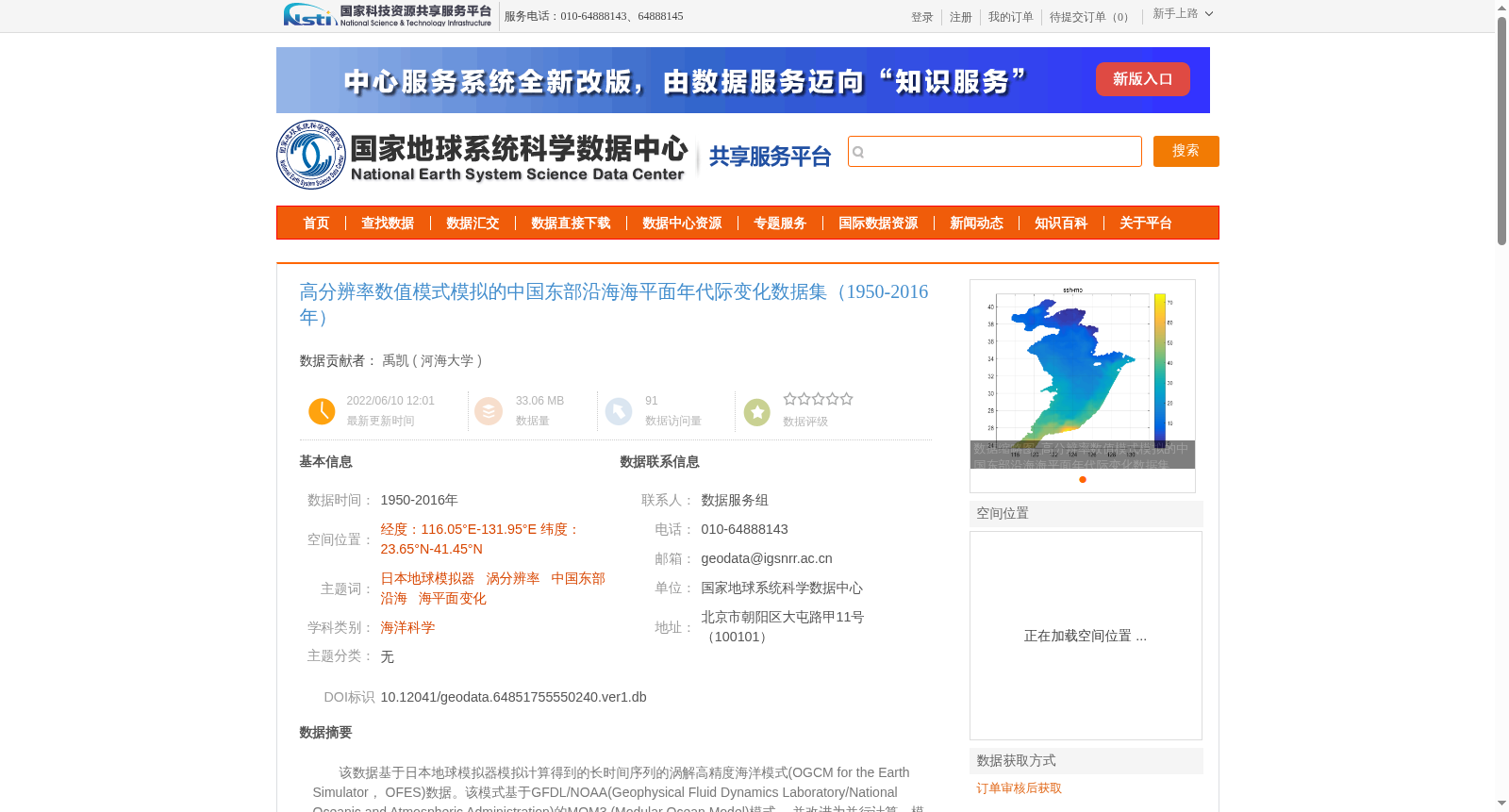
该数据基于日本地球模拟器模拟计算得到的长时间序列的涡解高精度海洋模式(OGCM for
the Earth Simulator, OFES)数据。该模式基于GFDL/NOAA(Geophysical Fluid Dynamics Laboratory/National Oceanic and Atmospheric Administration)的MOM3 (Modular Ocean Model)模式, 并改进为并行计算。模式的计算区域为75°S—75°N, 几乎覆盖除北极海域外的全球区域。模式的水平空间分辨率为0.1°, 垂直方向上分为54 层, 每层的厚度参考真实海洋的温跃层厚度, 随深度增加而逐渐变大, 从表层的5m 水深厚度到最底层的330m水深厚度, 最大水深为6065m。本数据集利用模式得到的中国东部沿海区域海平面输出结果,进行了7年低通滤波得到的年代际变化产品
This dataset is derived from long-time series eddy-resolving high-precision Ocean General Circulation Model for the Earth Simulator (OFES) data simulated using Japan’s Earth Simulator. The model is based on the MOM3 (Modular Ocean Model) developed by GFDL/NOAA (Geophysical Fluid Dynamics Laboratory/National Oceanic and Atmospheric Administration), and has been modified to support parallel computing. The model's computational domain spans 75°S to 75°N, covering nearly the entire global ocean except the Arctic region. The model has a horizontal spatial resolution of 0.1°, and is divided into 54 vertical layers. The thickness of each layer, based on the thermocline thickness of the real ocean, increases gradually with depth, ranging from 5 m at the surface to 330 m at the deepest layer, with a maximum model depth of 6065 m. This dataset is an interdecadal variation product generated by applying a 7-year low-pass filter to the sea level output of the model over the coastal waters of eastern China.
提供机构:
河海大学
创建时间:
2022-06-10
搜集汇总
数据集介绍
背景与挑战
背景概述
该数据集是基于日本地球模拟器的高分辨率海洋数值模式(OFES)模拟的中国东部沿海海平面年代际变化数据,覆盖1950-2016年,空间范围为经度116.05°E-131.95°E、纬度23.65°N-41.45°N。数据集通过7年低通滤波处理,提供了海平面变化的年代际产品,并经过与验潮站数据比对验证,相关系数较高,适用于全球变暖停滞等相关海洋科学研究。
以上内容由遇见数据集搜集并总结生成


