青藏高原土地覆被数据(2015)
收藏国家青藏高原科学数据中心2021-04-18 更新2024-03-07 收录
下载链接:
https://data.tpdc.ac.cn/zh-hans/data/3cdc6d05-e8c1-41e2-94fe-00d679c89f89
下载链接
链接失效反馈官方服务:
资源简介:
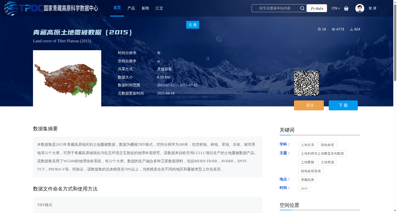
本数据集是2015年青藏高原地区的土地覆被数据,数据为栅格TIFF格式,空间分辨率为300米,包含耕地、林地、草地、水体、城市用地等22个大类,可用于青藏高原城镇化与生态环境交互胁迫的地理本底研究。该数据来自欧空局CCI-LC项目生产的土地覆被数据产品。该数据集采用了WGS84的地理坐标系统,有22个大类。数据的生产融合多种卫星数据资料,包括MERIS FR/RR,AVHRR,SPOT-VGT,PROBA-V等。经验证,该数据集的总体精度在70%以上,当然精度会在不同的地区和覆被类型上存在差异。
This dataset is a 2015 land cover dataset for the Qinghai-Tibet Plateau, stored in raster TIFF format with a spatial resolution of 300 meters. It encompasses 22 major land cover categories including cropland, forest land, grassland, water bodies, urban land, and others, and can be utilized for geographical background research on the interactive stress between urbanization and the ecological environment on the Qinghai-Tibet Plateau. This dataset is derived from the land cover data product produced by the ESA CCI-LC project. It adopts the WGS84 geographic coordinate system. The production of this dataset integrated multiple satellite datasets, including MERIS FR/RR, AVHRR, SPOT-VGT, PROBA-V, and others. Validated results show that the overall accuracy of this dataset exceeds 70%, although the accuracy varies across different regions and land cover types.
提供机构:
杜云艳
创建时间:
2019-09-16
搜集汇总
数据集介绍
背景与挑战
背景概述
该数据集是2015年青藏高原地区的土地覆被栅格数据,空间分辨率为300米,包含22个土地覆被大类(如耕地、林地、草地等),数据来源于欧空局CCI-LC项目,融合了多种卫星数据,总体精度在70%以上,适用于城镇化与生态环境交互胁迫的地理本底研究。
以上内容由遇见数据集搜集并总结生成


