青藏高原多年冻土年平均地温(MAGT)1 km逐年模拟数据产品(1981–2018)
收藏国家青藏高原科学数据中心2026-01-05 更新2025-06-14 收录
下载链接:
https://data.tpdc.ac.cn/zh-hans/data/5b6c37fc-ad3d-4710-84f0-b6439bd81a9c
下载链接
链接失效反馈官方服务:
资源简介:
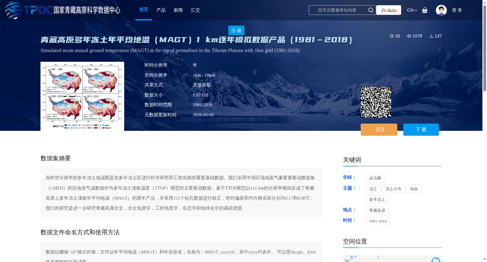
高时空分辨率的多年冻土地温图是在多年冻土区进行科学研究和工程实践的重要基础数据。我们采用中国区域地面气象要素驱动数据集(CMFD)的近地表气温数据作为多年冻土顶板温度(TTOP)模型的主要驱动数据,基于TTOP模型以1x1 km的分辨率模拟生成了青藏高原上多年冻土顶板年平均地温(MAGT)的逐年产品,并采用155个钻孔数据进行校正,绝对偏差和均方根误差分别为0.17和0.98℃。我们的研究是进一步研究青藏高原水文,水文地质学,工程地质学,生态学和地球化学的基础资源。
High spatiotemporal-resolution permafrost ground temperature datasets are critical foundational data for scientific research and engineering practices in permafrost regions. We adopted near-surface air temperature data from the China Meteorological Forcing Dataset (CMFD) as the primary driving input for the Permafrost Table Temperature (TTOP) model. Using the TTOP model, we produced annual products of mean annual ground temperature (MAGT) at the permafrost table across the Qinghai-Tibet Plateau at a spatial resolution of 1×1 km. Calibration against 155 borehole datasets resulted in an absolute bias of 0.17 ℃ and a root mean square error (RMSE) of 0.98 ℃. This study provides fundamental resources for further research on the hydrology, hydrogeology, engineering geology, ecology and geochemistry of the Qinghai-Tibet Plateau.
提供机构:
赵煜峰,姚莹莹,李新,郑春苗
创建时间:
2023-07-04
搜集汇总
数据集介绍
背景与挑战
背景概述
该数据集是青藏高原多年冻土顶板年平均地温(MAGT)的1 km分辨率逐年模拟产品(1981-2018),基于TTOP模型生成并经过钻孔数据校正,精度较高。数据以栅格格式存储,适用于遥感软件分析,为青藏高原冻土研究提供了重要基础资源。
以上内容由遇见数据集搜集并总结生成


