康西瓦断裂带赛图拉-康西瓦段10米遥感影像图(2016-2022)
收藏国家青藏高原科学数据中心2025-01-07 更新2025-01-18 收录
下载链接:
https://data.tpdc.ac.cn/zh-hans/data/ee83cf01-ac34-46d6-b457-3d7018c7fd86
下载链接
链接失效反馈官方服务:
资源简介:
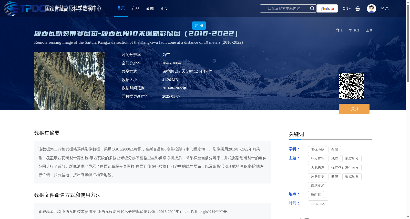
该数据为TIFF格式栅格遥感影像数据,采用CGCG2000坐标系,高斯克吕格3度带投影(中心经度78)。影像采用2016年-2022年间采集,覆盖康西瓦断裂带赛图拉-康西瓦段的多幅亚米级分辨率栅格卫星影像镶嵌拼接后,降采样至当前分辨率,并根据活动断裂带的延伸范围进行了裁剪。影像清晰地显示了康西瓦断裂带赛图拉-康西瓦段在咯拉喀什河谷中的线性展布,以及断裂活动形成的冲积扇/阶地左行位错、拉分盆地、挤压脊等特征构造地貌。
This dataset consists of TIFF-format raster remote sensing imagery using the CGCG2000 geodetic coordinate system and Gauss-Krüger 3-degree zone projection with a central longitude of 78°. The imagery was collected between 2016 and 2022, and is compiled by mosaicking multiple sub-meter resolution satellite raster images covering the Saitula-Kangxiwar segment of the Kangxiwar Fault Zone, then downsampling to the current resolution and cropping according to the extent of the active fault zone. The images clearly show the linear distribution of the Saitula-Kangxiwar segment of the Kangxiwar Fault Zone within the Karakash River Valley, as well as characteristic tectonic landforms such as left-lateral dislocations of alluvial fans/terraces, pull-apart basins, and compressive ridges formed by fault activity.
提供机构:
李海兵,潘家伟
创建时间:
2025-01-03
搜集汇总
数据集介绍
背景与挑战
背景概述
该数据集是2016年至2022年康西瓦断裂带赛图拉-康西瓦段的10米分辨率遥感影像图,采用TIFF格式和CGCG2000坐标系,通过多幅亚米级卫星影像拼接、降采样和裁剪生成,清晰地展示了断裂带的线性展布及冲积扇左行位错、拉分盆地等构造地貌特征,适用于地质灾害和大地构造研究。
以上内容由遇见数据集搜集并总结生成


