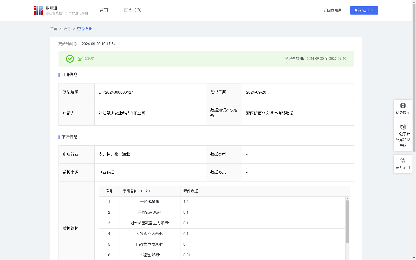
灌区断面水文运动模型数据
收藏浙江省数据知识产权登记平台2024-09-20 更新2024-09-21 收录
下载链接:
https://www.zjip.org.cn/home/announce/trends/63173
下载链接
链接失效反馈官方服务:
资源简介:
基于管理系统输入平均水深、平均流速、过水断面流量、入流量、出流量、入流速等模拟数据值,模拟在灌区排水一段时间后,计算某断面的水位高度,计算结果可提供给圩区闸站启停调度模型作为变量参数支撑闸站启停结果预测。帮助农民提前应对可能的洪涝或干旱等极端天气事件,从而减少损失。同时优化水资源的使用,减少水体污染,降低农业对周边生态环境的负面影响。1、数据采集:管理员基于管理系统输入平均水深、平均流速、过水断面流量、入流量、出流量、入流速等模拟数据值。
2、数据处理:基于一维扩散波方程(DWE-1D)计算各断面的预测水深(m),其中B为水面宽[L]。其中t表示时间[T],x表示纵轴方向[L],A为过流面积[L2],q为单位长度上的旁侧流量(入流为正,出流为负)[L2T-1],Z为水位[L],n为糙率[L-1/3T],R为水力半径[L],D为扩散系数[L3T-1]。
3、数据应用:该模型可以模拟在灌区排水一段时间后,计算某断面的水位高度,计算结果可提供给圩区闸站启停调度模型作为变量参数,支撑闸站启停预测。帮助农民提前应对可能的洪涝或干旱等极端天气事件,从而减少损失。同时优化水资源的使用,减少水体污染,降低农业对周边生态环境的负面影响。
This dataset is constructed using simulated input values such as average water depth, average flow velocity, cross-section discharge, inflow, outflow and inflow velocity entered via the management system. It simulates the water level height of a specified cross-section after a period of drainage in the irrigation district, and the calculation results can be provided as variable parameters for the start-stop scheduling model of sluices and pumping stations in polder areas to support the prediction of sluice and pumping station start-stop outcomes. This helps farmers respond to extreme weather events such as floods or droughts in advance to reduce losses, optimize water resource utilization, reduce water pollution, and mitigate the negative impacts of agriculture on the surrounding ecological environment.
1. Data Collection: Administrators enter simulated input values including average water depth, average flow velocity, cross-section discharge, inflow, outflow and inflow velocity via the management system.
2. Data Processing: The predicted water depth (m) of each cross-section is calculated based on the One-dimensional Diffusion Wave Equation (DWE-1D), where B represents the water surface width [L]. The variables are defined as follows: t denotes time [T], x represents the longitudinal axis [L], A is the flow cross-sectional area [L²], q is the lateral flow per unit length (positive for inflow, negative for outflow) [L²T⁻¹], Z is the water level [L], n is the roughness coefficient [L^(-1/3)T], R is the hydraulic radius [L], and D is the diffusion coefficient [L³T⁻¹].
3. Data Application: The model can simulate the water level height of a specified cross-section after a period of drainage in the irrigation district. The calculation results can be used as variable parameters for the start-stop scheduling model of sluices and pumping stations in polder areas to support the prediction of sluice and pumping station start-stop operations. This assists farmers in preparing for extreme weather events such as floods or droughts ahead of time to reduce losses, optimize water resource utilization, reduce water pollution, and lower the negative ecological impacts of agriculture on the surrounding environment.
提供机构:
浙江绿迹农业科技有限公司
创建时间:
2024-08-19
搜集汇总
数据集介绍
以上内容由遇见数据集搜集并总结生成


