2015/2018年中国30m“三生用地”空间分布数据集
收藏地球大数据科学工程2024-04-21 收录
下载链接:
https://data.casearth.cn/sdo/detail/653a4783819aec42f0f368d7
下载链接
链接失效反馈官方服务:
资源简介:
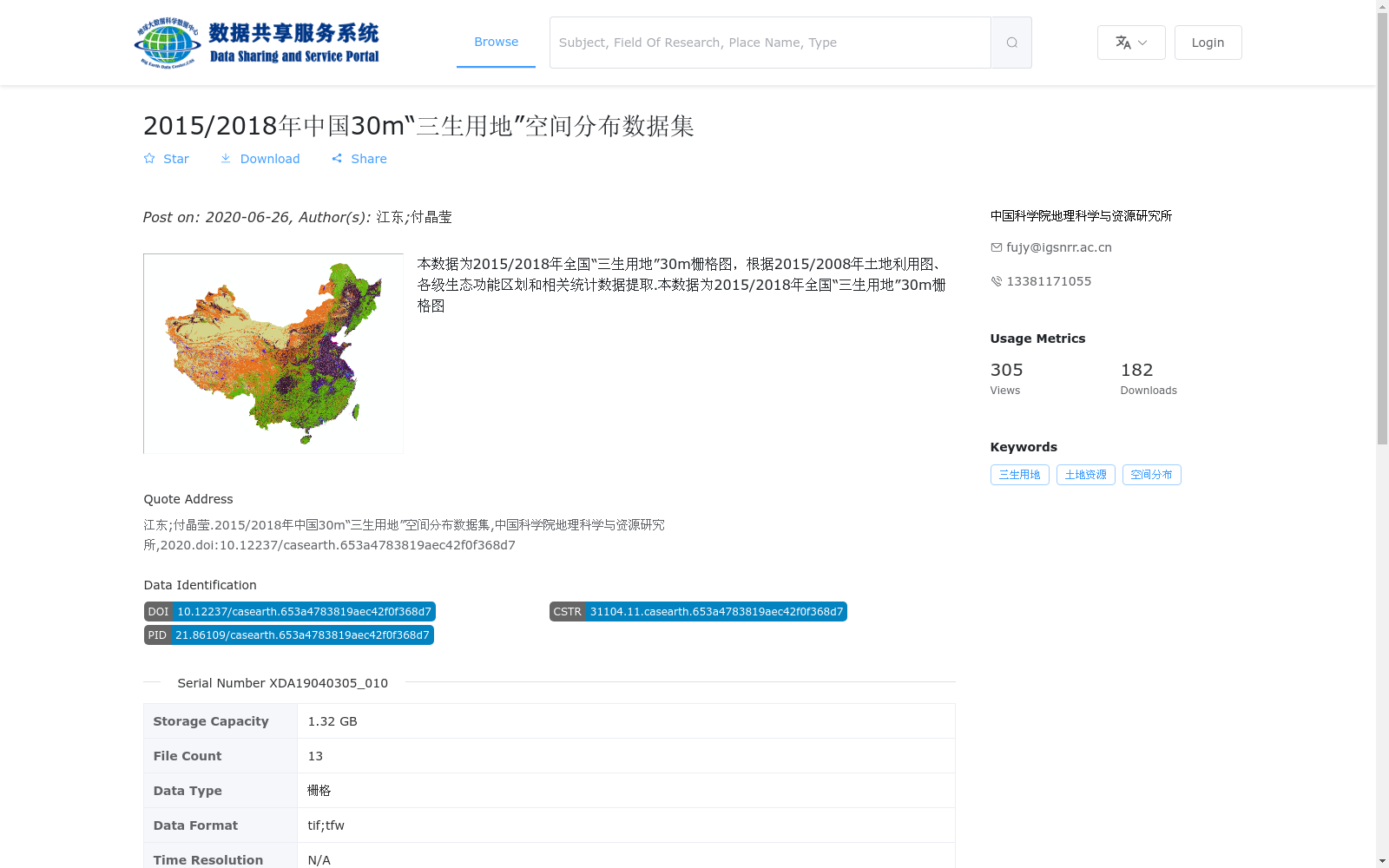
本数据为2015/2018年全国“三生用地”30m栅格图,根据2015/2008年土地利用图、各级生态功能区划和相关统计数据提取.本数据为2015/2018年全国“三生用地”30m栅格图
This dataset is a 30m raster map of national production-living-ecological land for the years 2015 and 2018, derived from the 2015 and 2008 land use maps, ecological function zoning at all levels, and relevant statistical data. This dataset is a 30m raster map of national production-living-ecological land for the years 2015 and 2018.
提供机构:
中国科学院地理科学与资源研究所
搜集汇总
数据集介绍
背景与挑战
背景概述
该数据集是2015年和2018年中国30米分辨率的'三生用地'空间分布栅格图,基于历史土地利用图、生态功能区划和统计数据提取,用于分析生产、生活、生态空间的分布情况。数据细分为八种空间类型,包括农业生产、林业生产、草地生产、水域生态、城镇生活、农村生活、工业生产和其他生态空间,覆盖全国范围,总存储容量为1.32 GB,包含13个文件,格式为tif和tfw。
以上内容由遇见数据集搜集并总结生成


