AMSR-E全球陆表被动微波遥感发射率数据集(2002-2012)
收藏国家青藏高原科学数据中心2021-04-19 更新2024-03-06 收录
下载链接:
https://data.tpdc.ac.cn/zh-hans/data/e0d47dfa-0c44-4fff-bab9-4efb59855094
下载链接
链接失效反馈官方服务:
资源简介:
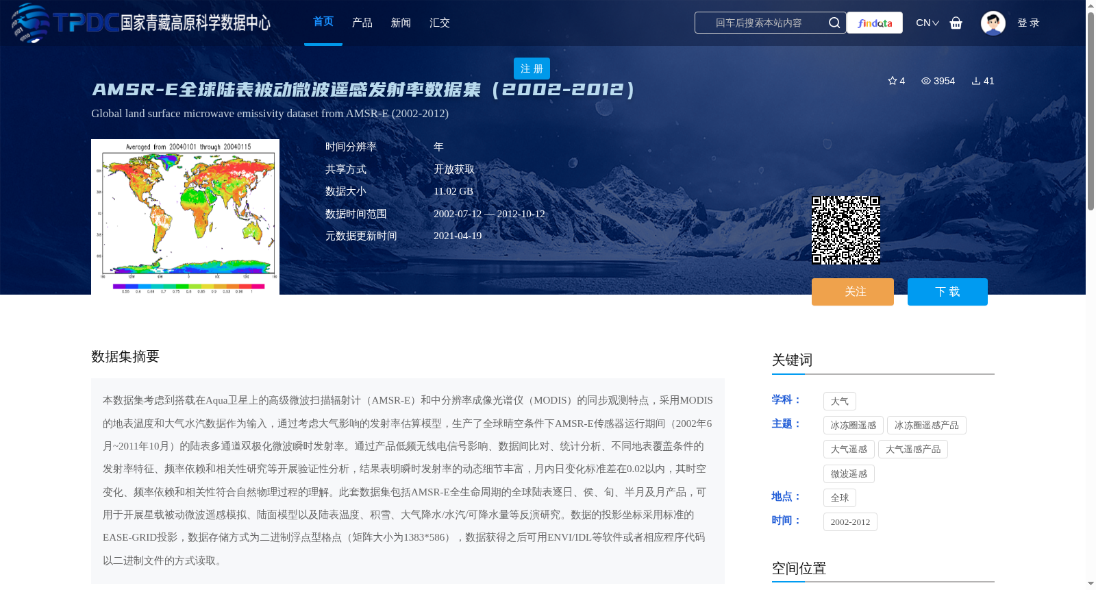
本数据集考虑到搭载在Aqua卫星上的高级微波扫描辐射计(AMSR-E)和中分辨率成像光谱仪(MODIS)的同步观测特点,采用MODIS的地表温度和大气水汽数据作为输入,通过考虑大气影响的发射率估算模型,生产了全球晴空条件下AMSR-E传感器运行期间(2002年6月~2011年10月)的陆表多通道双极化微波瞬时发射率。通过产品低频无线电信号影响、数据间比对、统计分析、不同地表覆盖条件的发射率特征、频率依赖和相关性研究等开展验证性分析,结果表明瞬时发射率的动态细节丰富,月内日变化标准差在0.02以内,其时空变化、频率依赖和相关性符合自然物理过程的理解。此套数据集包括AMSR-E全生命周期的全球陆表逐日、侯、旬、半月及月产品,可用于开展星载被动微波遥感模拟、陆面模型以及陆表温度、积雪、大气降水/水汽/可降水量等反演研究。数据的投影坐标采用标准的EASE-GRID投影,数据存储方式为二进制浮点型格点(矩阵大小为1383*586),数据获得之后可用ENVI/IDL等软件或者相应程序代码以二进制文件的方式读取。
This dataset leverages the synchronous observation characteristics of the Advanced Microwave Scanning Radiometer-Earth Observing System (AMSR-E) and the Moderate Resolution Imaging Spectroradiometer (MODIS) onboard the Aqua satellite. Using MODIS land surface temperature and atmospheric water vapor data as inputs and adopting an emissivity estimation model that accounts for atmospheric effects, it generates global land surface multi-channel dual-polarization microwave instantaneous emissivity under clear-sky conditions during the operational period of AMSR-E (June 2002 to October 2011). Validation analyses were conducted via investigations into low-frequency radio interference impacts on the product, inter-data comparison, statistical analysis, emissivity characteristics under different land cover conditions, frequency dependence, and correlation. The results show that the instantaneous emissivity has rich dynamic details, with the standard deviation of daily variations within a month being less than 0.02, and its spatiotemporal variations, frequency dependence, and correlation conform to the established understanding of natural physical processes. This dataset covers global land surface products at daily, pentad, dekad, half-month, and monthly temporal resolutions throughout the entire operational lifecycle of AMSR-E, and can be used for research such as spaceborne passive microwave remote sensing simulation, land surface modeling, and inversion of land surface temperature, snow cover, atmospheric precipitation, water vapor, and precipitable water. The data adopts the standard EASE-GRID projection coordinate system, and is stored as binary floating-point grid points with a matrix size of 1383 × 586. The data can be read as binary files using software such as ENVI/IDL or corresponding program codes after acquisition.
提供机构:
邱玉宝
创建时间:
2018-02-16
搜集汇总
数据集介绍
背景与挑战
背景概述
AMSR-E全球陆表被动微波遥感发射率数据集(2002-2012)是一个包含全球陆表多通道双极化微波瞬时发射率的数据集,时间跨度为2002年7月至2012年10月,数据大小为11.02 GB。该数据集采用MODIS的地表温度和大气水汽数据作为输入,通过大气影响的发射率估算模型生成,适用于多种遥感模拟和反演研究。
以上内容由遇见数据集搜集并总结生成


