2020-2022年极地边缘区250m冰面融水数据集
收藏地球大数据科学工程2024-03-04 收录
下载链接:
https://data.casearth.cn/sdo/detail/6538a3ad819aec0f261276fa
下载链接
链接失效反馈官方服务:
资源简介:
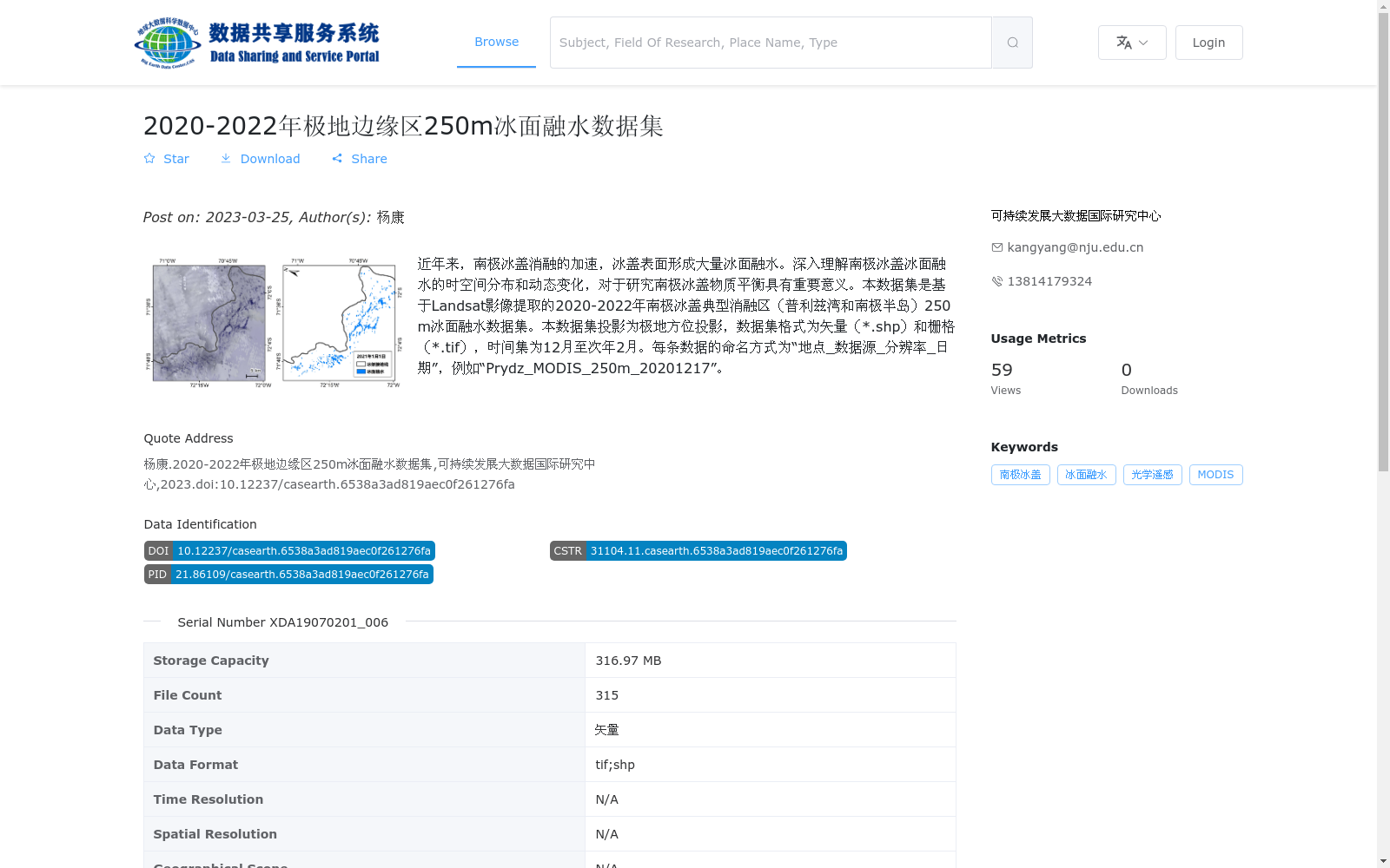
近年来,南极冰盖消融的加速,冰盖表面形成大量冰面融水。深入理解南极冰盖冰面融水的时空间分布和动态变化,对于研究南极冰盖物质平衡具有重要意义。本数据集是基于Landsat影像提取的2020-2022年南极冰盖典型消融区(普利兹湾和南极半岛)250 m冰面融水数据集。本数据集投影为极地方位投影,数据集格式为矢量(*.shp)和栅格(*.tif),时间集为12月至次年2月。每条数据的命名方式为“地点_数据源_分辨率_日期”,例如“Prydz_MODIS_250m_20201217”。
In recent years, accelerated ablation of the Antarctic Ice Sheet has led to extensive surface meltwater accumulating on the ice sheet’s surface. Gaining in-depth insights into the spatiotemporal distribution and dynamic changes of this surface meltwater is of critical importance for research on the mass balance of the Antarctic Ice Sheet. This dataset is a 250-meter surface meltwater product covering the typical ablation zones (Prydz Bay and Antarctic Peninsula) of the Antarctic Ice Sheet from 2020 to 2022, extracted using Landsat imagery. The dataset employs polar azimuthal projection, and is provided in both vector (*.shp) and raster (*.tif) formats. The temporal coverage spans from December to February of the following year. The naming convention for individual data files follows the pattern "Location_Data Source_Resolution_Date", with a sample entry being "Prydz_MODIS_250m_20201217".
提供机构:
可持续发展大数据国际研究中心
搜集汇总
数据集介绍
背景与挑战
背景概述
该数据集提供了2020-2022年南极冰盖典型消融区的250m冰面融水数据,基于Landsat影像提取,包含矢量和栅格格式,时间覆盖12月至次年2月,适用于研究南极冰盖物质平衡。
以上内容由遇见数据集搜集并总结生成


