考虑冻融期差异的黄河源区1km表层土壤湿度数据集(2015-2021)
收藏国家青藏高原科学数据中心2024-11-12 更新2024-12-07 收录
下载链接:
https://data.tpdc.ac.cn/zh-hans/data/2f529228-2f60-473e-a983-b6aa7494235f
下载链接
链接失效反馈官方服务:
资源简介:
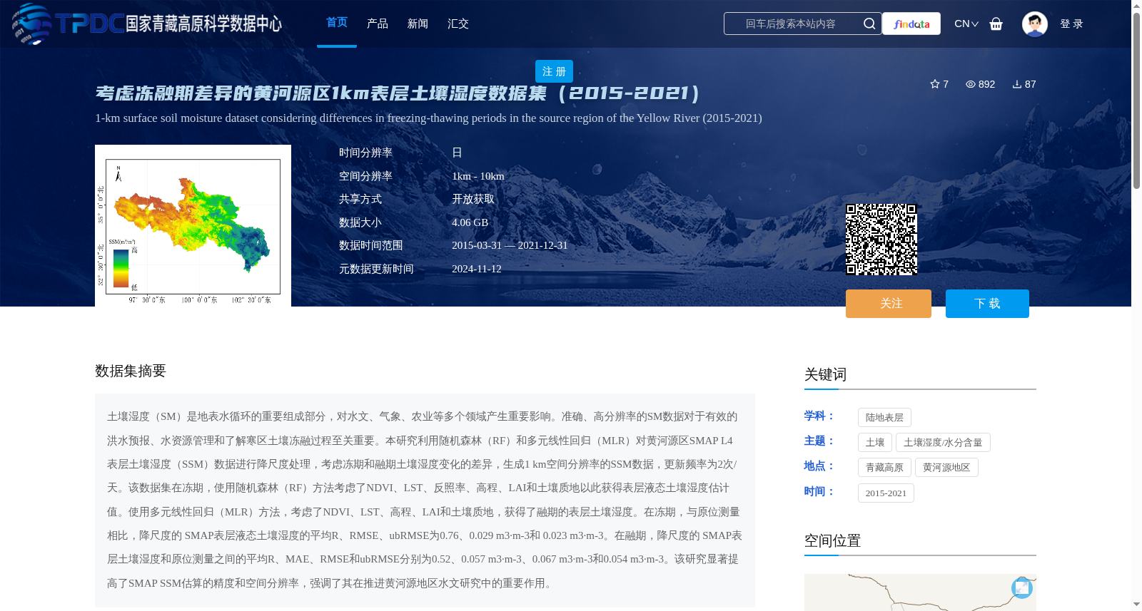
土壤湿度(SM)是地表水循环的重要组成部分,对水文、气象、农业等多个领域产生重要影响。准确、高分辨率的SM数据对于有效的洪水预报、水资源管理和了解寒区土壤冻融过程至关重要。本研究利用随机森林(RF)和多元线性回归(MLR)对黄河源区SMAP L4 表层土壤湿度(SSM)数据进行降尺度处理,考虑冻期和融期土壤湿度变化的差异,生成1 km空间分辨率的SSM数据,更新频率为2次/天。该数据集在冻期,使用随机森林(RF)方法考虑了NDVI、LST、反照率、高程、LAI和土壤质地以此获得表层液态土壤湿度估计值。使用多元线性回归(MLR)方法,考虑了NDVI、LST、高程、LAI和土壤质地,获得了融期的表层土壤湿度。在冻期,与原位测量相比,降尺度的 SMAP表层液态土壤湿度的平均R、RMSE、ubRMSE为0.76、0.029 m3·m-3和 0.023 m3·m-3。在融期,降尺度的 SMAP表层土壤湿度和原位测量之间的平均R、MAE、RMSE和ubRMSE分别为0.52、0.057 m3·m-3、0.067 m3·m-3和0.054 m3·m-3。该研究显著提高了SMAP SSM估算的精度和空间分辨率,强调了其在推进黄河源地区水文研究中的重要作用。
Soil Moisture (SM) is a critical component of the surface water cycle, exerting substantial impacts on diverse fields including hydrology, meteorology, agriculture and other related disciplines. Accurate, high-resolution SM data is crucial for effective flood forecasting, water resource management and understanding soil freeze-thaw processes in cold regions.
In this study, Random Forest (RF) and Multiple Linear Regression (MLR) were employed to downscale SMAP L4 Surface Soil Moisture (SSM) data in the source region of the Yellow River. By accounting for the differences in soil moisture variations between freeze and thaw periods, we generated SSM data with a spatial resolution of 1 km and an update frequency of twice per day.
For the freeze period, the RF method was adopted, taking into account NDVI, LST, albedo, elevation, LAI and soil texture to estimate surface liquid soil moisture. For the thaw period, the MLR method was utilized with the inclusion of NDVI, LST, elevation, LAI and soil texture to retrieve surface soil moisture.
Compared with in-situ measurements, the downscaled SMAP surface liquid soil moisture during the freeze period achieved mean Pearson correlation coefficient (R), Root Mean Square Error (RMSE) and Unbiased Root Mean Square Error (ubRMSE) of 0.76, 0.029 m³·m⁻³ and 0.023 m³·m⁻³, respectively. During the thaw period, the mean R, Mean Absolute Error (MAE), RMSE and ubRMSE between the downscaled SMAP surface soil moisture and in-situ measurements were 0.52, 0.057 m³·m⁻³, 0.067 m³·m⁻³ and 0.054 m³·m⁻³, respectively.
This study significantly improved the estimation accuracy and spatial resolution of SMAP SSM, highlighting its important role in advancing hydrological research in the source region of the Yellow River.
提供机构:
付晓雷,章雨晨,郭洛夫杰,蒋晓蕾
创建时间:
2024-11-06
搜集汇总
数据集介绍
背景与挑战
背景概述
该数据集是一个高分辨率表层土壤湿度数据集,覆盖黄河源区(青藏高原),时间跨度为2015年至2021年,空间分辨率为1公里,日时间分辨率(每天2次)。它采用随机森林和多元线性回归方法对SMAP L4数据进行降尺度处理,特别考虑了冻期和融期土壤湿度变化的差异,以提高精度和空间分辨率,适用于水文、气象和农业等领域的研究。
以上内容由遇见数据集搜集并总结生成


