2020年松嫩平原生态功能区1km分辨率产水量遥感监测与模拟空间数据集
收藏国家地球系统科学数据中心2023-07-07 更新2024-03-04 收录
下载链接:
https://www.geodata.cn/data/datadetails.html?dataguid=214993987949551&docId=4671
下载链接
链接失效反馈官方服务:
资源简介:
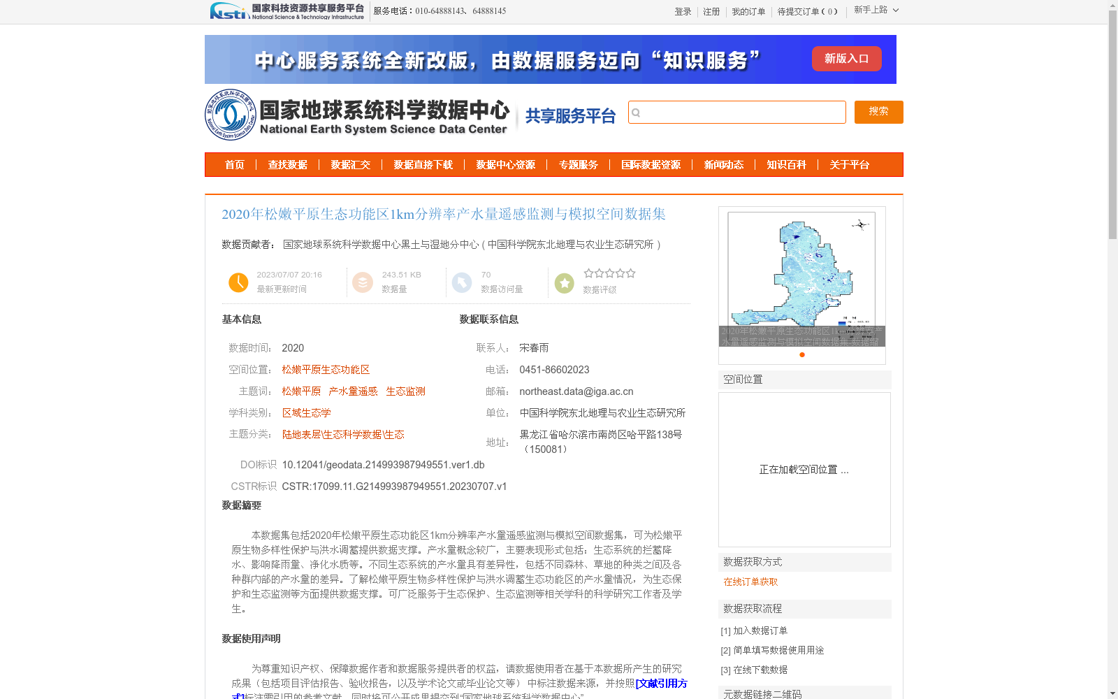
本数据集包括2020年松嫩平原生态功能区1km分辨率产水量遥感监测与模拟空间数据集,可为松嫩平原生物多样性保护与洪水调蓄提供数据支撑。产水量概念较广,主要表现形式包括:生态系统的拦蓄降水、影响降雨量、净化水质等。不同生态系统的产水量具有差异性,包括不同森林、草地的种类之间及各种群内部的产水量的差异。了解松嫩平原生物多样性保护与洪水调蓄生态功能区的产水量情况,为生态保护和生态监测等方面提供数据支撑。可广泛服务于生态保护、生态监测等相关学科的科学研究工作者及学生。
This dataset is a 1 km spatial resolution remote sensing monitoring and simulation dataset of water yield for the ecological function zones of the Songnen Plain in 2020, providing data support for biodiversity conservation and flood regulation and storage in the region. Water yield has a broad connotation, and its main manifestations include ecosystem precipitation retention, modulation of precipitation amounts, water purification, and other related ecological functions. Water yield varies across different ecosystems, including disparities between various forest and grassland types as well as within their respective populations. Understanding the water yield conditions of the ecological function zones focused on biodiversity conservation and flood regulation and storage in the Songnen Plain provides data support for ecological protection, ecological monitoring, and related work. This dataset can widely serve researchers and students conducting scientific research in relevant disciplines such as ecological protection and ecological monitoring.
提供机构:
中国科学院东北地理与农业生态研究所
创建时间:
2023-07-07
搜集汇总
数据集介绍
背景与挑战
背景概述
该数据集是2020年松嫩平原生态功能区的1公里分辨率产水量遥感监测与模拟空间数据,基于InVEST模型的水量平衡原理计算,旨在为生物多样性保护和洪水调蓄提供数据支撑。数据来源于可靠的遥感资料,经过严格质量审核,适用于生态科学研究和监测应用。
以上内容由遇见数据集搜集并总结生成


