中巴经济走廊(全区1:25 万、重点区段1:10 万)崩塌滑坡、泥石流、冰崩、冰湖溃决灾害分布图(1990年-2022年)
收藏国家地球系统科学数据中心2024-04-12 更新2024-04-21 收录
下载链接:
https://www.geodata.cn/data/datadetails.html?dataguid=31141198851486&docId=3638
下载链接
链接失效反馈官方服务:
资源简介:
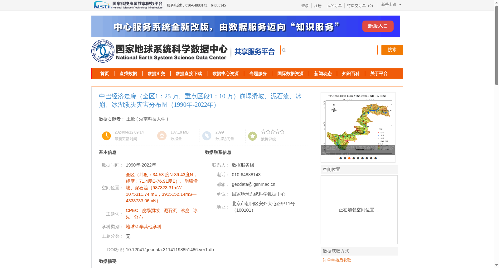
该数据集源于野外采集、Google Earth遥感影像解译、数字化加工整理得到19990-2022年中巴经济走廊北部山区(全区1:25 万、重点区段1:10 万)崩塌滑坡、泥石流、冰崩、冰湖溃决灾害分布图灾害分布图,数据集为矢量数据,有序号、经度、纬度、类型等数据。
This dataset is compiled from field surveys, Google Earth remote sensing image interpretation, and digital processing and organization, covering the period from 1999 to 2022. It contains the distribution maps of collapse landslides, debris flows, ice avalanches and glacial lake outburst disasters in the northern mountainous area of the China-Pakistan Economic Corridor, with a scale of 1:250,000 for the entire region and 1:100,000 for key sections. The dataset is in vector format, with fields including serial number, longitude, latitude, disaster type and other related attributes.
提供机构:
湖南科技大学
创建时间:
2024-04-12
搜集汇总
数据集介绍
背景与挑战
背景概述
该数据集提供了1990年至2022年中巴经济走廊区域(全区1:25万、重点区段1:10万)的崩塌滑坡、泥石流、冰崩和冰湖溃决灾害分布图,基于野外采集和遥感解译生成矢量数据,包含灾害类型、位置等信息,并遵循相关技术规范确保数据质量,适用于地球科学研究和灾害防治。
以上内容由遇见数据集搜集并总结生成


