中国30m分辨率的降雨侵蚀力图(1981-2010年)
收藏国家地球系统科学数据中心2024-05-07 更新2024-04-21 收录
下载链接:
https://www.geodata.cn/data/datadetails.html?dataguid=10201049275608&docId=3284
下载链接
链接失效反馈官方服务:
资源简介:
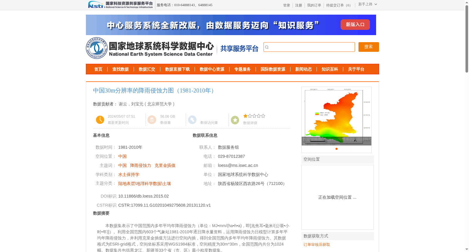
本数据集表示了中国范围内多年平均年降雨侵蚀力(单位:MJ•mm/(ha•h•a),即[兆焦耳•毫米/(公顷•小时•年)])。利用全国范围内603个气象站1981-2010年逐日降水量资料,运用降雨侵蚀力日模型计算多年平均年降雨侵蚀力,并利用克里金插值方法进行空间内插,得到全国范围内多年平均年降雨侵蚀力。其数据格式为ESRI-grid格式,空间坐标系采用WGS1984标准,空间精度为30m*30m,全国范围内共分为1024幅。数据集共包括黑龙江、新疆等33个省(市、区)最小粒度数据集。
This dataset presents the multi-year average annual rainfall erosivity across China, with the unit of MJ·mm/(ha·h·a) (i.e., Megajoule·millimeter/(hectare·hour·year)). It was developed using daily precipitation data from 603 meteorological stations nationwide during 1981–2010. The daily rainfall erosivity model was employed to calculate the multi-year average annual rainfall erosivity, followed by spatial interpolation via the Kriging method to generate the nationwide multi-year average annual rainfall erosivity grid data. The data is stored in ESRI-Grid format, adopts the WGS1984 spatial coordinate system, has a spatial resolution of 30m × 30m, and is divided into 1024 tiles across the entire country. The dataset covers the finest-grained data for 33 provinces, municipalities and autonomous regions including Heilongjiang, Xinjiang and others.
提供机构:
北京师范大学
创建时间:
2013-11-20
搜集汇总
数据集介绍
背景与挑战
背景概述
该数据集提供了中国1981-2010年间30米分辨率的降雨侵蚀力空间分布图,基于全国603个气象站数据通过克里金插值方法生成,适用于水土保持等地理科学研究。数据采用ESRI-grid格式存储,空间参考为WGS1984坐标系,具有较高的空间精度和质量可靠性。
以上内容由遇见数据集搜集并总结生成


