祁连山地区活动层厚度及冻结深度变化时空分布图
收藏国家青藏高原科学数据中心2022-04-18 更新2024-03-06 收录
下载链接:
https://data.tpdc.ac.cn/zh-hans/data/4747158b-1df3-47ad-8537-a230ed4cb020
下载链接
链接失效反馈官方服务:
资源简介:
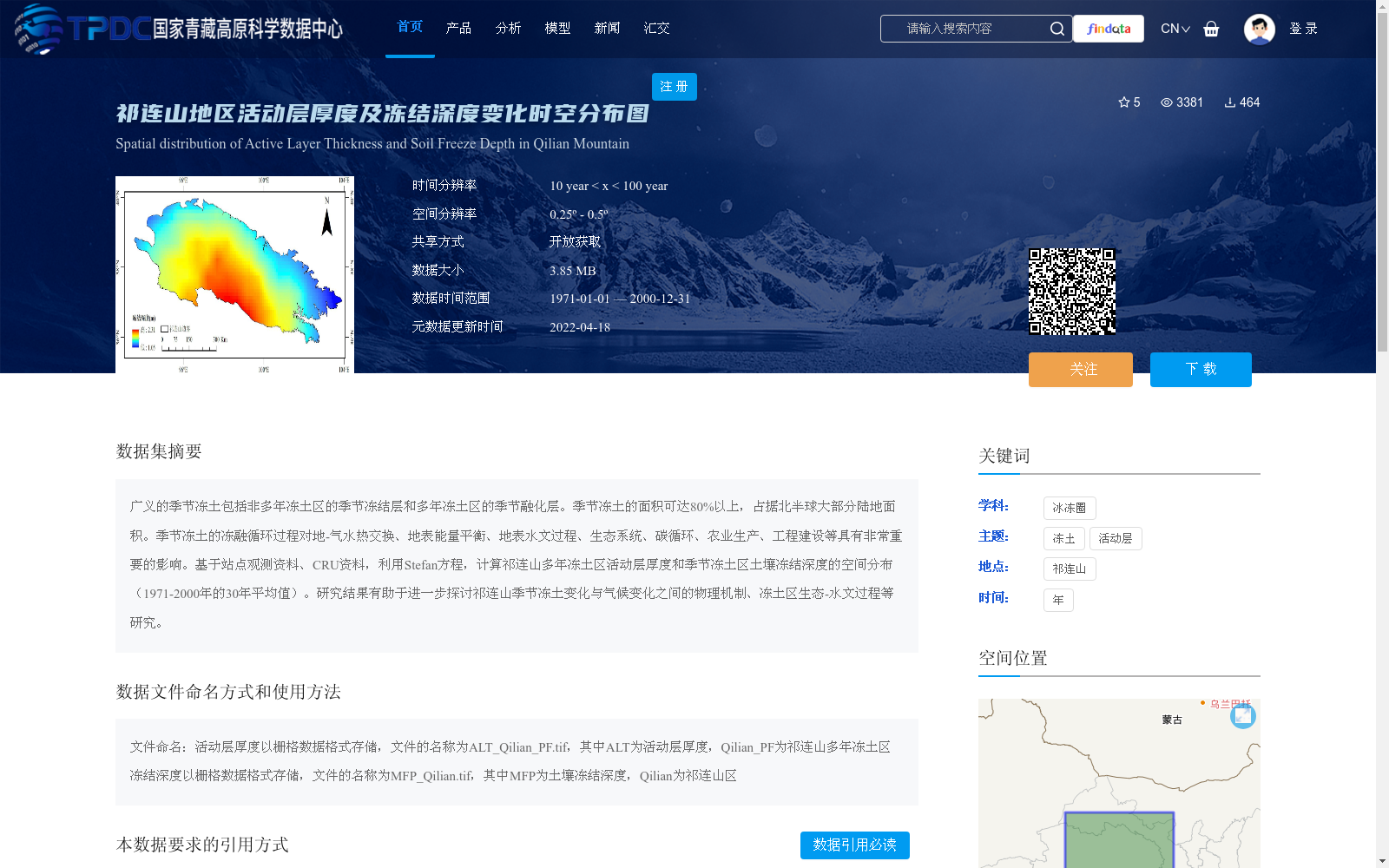
广义的季节冻土包括非多年冻土区的季节冻结层和多年冻土区的季节融化层。季节冻土的面积可达80%以上,占据北半球大部分陆地面积。季节冻土的冻融循环过程对地-气水热交换、地表能量平衡、地表水文过程、生态系统、碳循环、农业生产、工程建设等具有非常重要的影响。基于站点观测资料、CRU资料,利用Stefan方程,计算祁连山多年冻土区活动层厚度和季节冻土区土壤冻结深度的空间分布(1971-2000年的30年平均值)。研究结果有助于进一步探讨祁连山季节冻土变化与气候变化之间的物理机制、冻土区生态-水文过程等研究。
Broadly defined seasonally frozen soil includes seasonal frozen layers in non-permafrost regions and seasonally thawed layers in permafrost regions. Seasonally frozen soil covers more than 80% of the total land area across the Northern Hemisphere, occupying most of its terrestrial landmass. The freeze-thaw cycles of seasonally frozen soil exert a critical influence on soil-atmosphere water and heat exchange, surface energy balance, surface hydrological processes, ecosystems, carbon cycles, agricultural production, engineering construction, and other relevant domains. Based on in-situ observational data and CRU datasets, the spatial distribution of active layer thickness in permafrost regions and soil freezing depth in seasonally frozen soil regions of the Qilian Mountains (30-year average over the period 1971–2000) was calculated using Stefan's equation. The research findings will facilitate further investigations into the physical mechanisms linking seasonal frozen soil changes in the Qilian Mountains to climate change, as well as eco-hydrological processes in permafrost regions and other related research topics.
提供机构:
彭小清,张廷军
创建时间:
2020-12-15
搜集汇总
数据集介绍
背景与挑战
背景概述
该数据集提供了祁连山地区1971-2000年30年平均的活动层厚度和土壤冻结深度空间分布图,基于站点观测和CRU资料,采用Stefan方程计算生成。数据以栅格格式存储,时间分辨率在10-100年之间,空间分辨率为0.25º - 0.5º,旨在支持研究季节冻土变化与气候、生态-水文过程的物理机制。
以上内容由遇见数据集搜集并总结生成


