青藏高原冻土变化数据集(1961-2020)
收藏国家青藏高原科学数据中心2024-01-09 更新2024-03-07 收录
下载链接:
https://data.tpdc.ac.cn/zh-hans/data/e03ae441-0af2-4f57-b5b0-0a4f368f4015
下载链接
链接失效反馈官方服务:
资源简介:
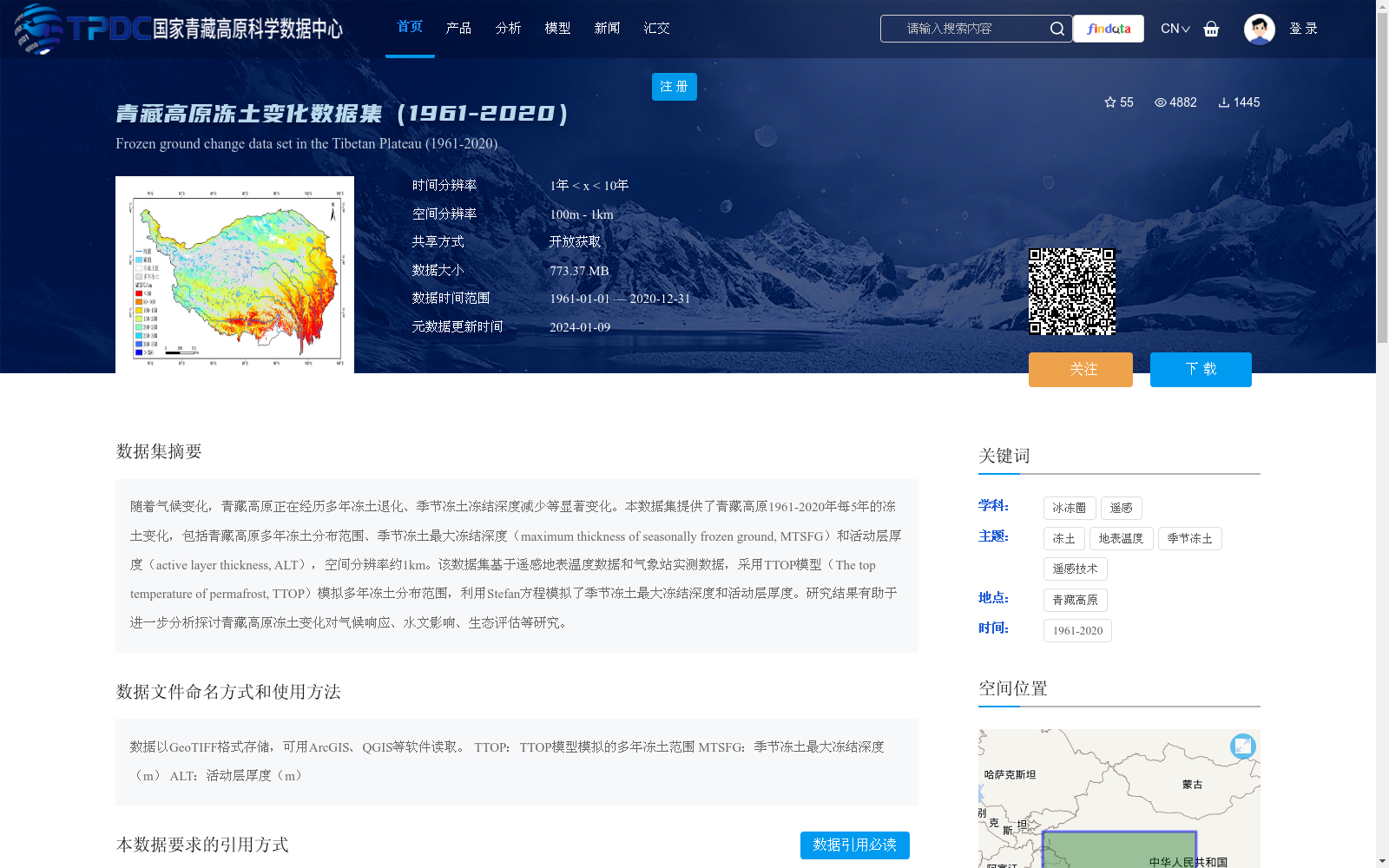
随着气候变化,青藏高原正在经历多年冻土退化、季节冻土冻结深度减少等显著变化。本数据集提供了青藏高原1961-2020年每5年的冻土变化,包括青藏高原多年冻土分布范围、季节冻土最大冻结深度(maximum thickness of seasonally frozen ground, MTSFG)和活动层厚度(active layer thickness, ALT),空间分辨率约1km。该数据集基于遥感地表温度数据和气象站实测数据,采用TTOP模型(The top temperature of permafrost, TTOP)模拟多年冻土分布范围,利用Stefan方程模拟了季节冻土最大冻结深度和活动层厚度。研究结果有助于进一步分析探讨青藏高原冻土变化对气候响应、水文影响、生态评估等研究。
Against the backdrop of climate change, the Qinghai-Tibet Plateau is undergoing significant alterations including permafrost degradation and a reduction in the freezing depth of seasonally frozen ground. This dataset presents permafrost changes at 5-year intervals from 1961 to 2020 across the Qinghai-Tibet Plateau, covering the distribution extent of permafrost, maximum thickness of seasonally frozen ground (MTSFG), and active layer thickness (ALT), with a spatial resolution of approximately 1 km. Developed based on remote sensing land surface temperature data and in-situ meteorological station measurements, the dataset utilizes the TTOP model (The Top Temperature of Permafrost, TTOP) to simulate the permafrost distribution extent, and adopts the Stefan equation to estimate the maximum thickness of seasonally frozen ground and active layer thickness. The findings of this dataset support further analyses and discussions on the climate response, hydrological impacts, ecological assessment and other relevant studies associated with permafrost changes on the Qinghai-Tibet Plateau.
提供机构:
闫德昭,郑先坤,冯敏,梁四海,胡仲毅,匡星星,冯雨晴
创建时间:
2023-12-12
搜集汇总
数据集介绍
背景与挑战
背景概述
该数据集提供了青藏高原1961-2020年每5年的冻土变化信息,包括多年冻土分布范围、季节冻土最大冻结深度和活动层厚度,空间分辨率约1公里。数据基于遥感地表温度数据和气象站实测数据,采用TTOP模型和Stefan方程模拟生成,旨在支持冻土变化对气候响应、水文影响和生态评估等研究。数据集以GeoTIFF格式存储,大小为773.37 MB,可通过开放获取方式使用。
以上内容由遇见数据集搜集并总结生成


