2022 年 SDGSAT-1 卫星中国 大陆海岸 带近海10m 多光 谱-总悬浮 颗粒物浓 度数据集
收藏地球大数据科学工程2024-03-04 收录
下载链接:
https://data.casearth.cn/sdo/detail/653628e6819aec33de894680
下载链接
链接失效反馈官方服务:
资源简介:
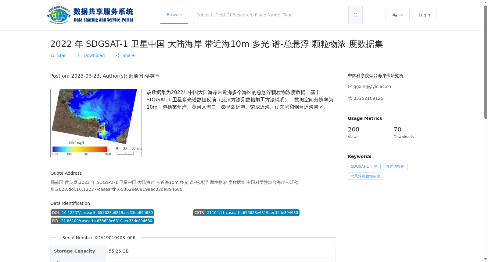
该数据集为2022年中国大陆海岸带近海多个海区的总悬浮颗粒物浓度数据,基于SDGSAT-1 卫星多光谱数据反演(反演方法见数据加工方法说明),数据空间分辨率为10m,包括莱州湾、黄河入海口、秦皇岛近海、荣成近海、辽东湾和烟台近海海区。
This dataset provides total suspended particulate (TSP) concentration data across multiple offshore coastal regions of mainland China in 2022. The data were retrieved using multi-spectral imagery acquired by the SDGSAT-1 satellite, with the detailed retrieval procedures outlined in the data processing method description. The dataset has a spatial resolution of 10 meters and covers the following offshore areas: Laizhou Bay, the Yellow River Estuary, coastal waters near Qinhuangdao, coastal waters near Rongcheng, Liaodong Bay, and coastal waters near Yantai.
提供机构:
中国科学院烟台海岸带研究所
搜集汇总
数据集介绍
背景与挑战
背景概述
该数据集基于2022年SDGSAT-1卫星多光谱数据反演,提供了中国大陆海岸带近海多个海区的总悬浮颗粒物浓度数据,空间分辨率为10m,覆盖莱州湾、黄河入海口、秦皇岛近海、荣成近海、辽东湾和烟台近海等区域,数据格式为GeoTiff。
以上内容由遇见数据集搜集并总结生成


