
Antarctic drainage basins delineation
收藏Mendeley Data2024-01-31 更新2024-06-30 收录
下载链接:
https://www.scidb.cn/en/detail?dataSetId=0e9b8c27499a4f179b8b43843839ce4a
下载链接
链接失效反馈官方服务:
资源简介:
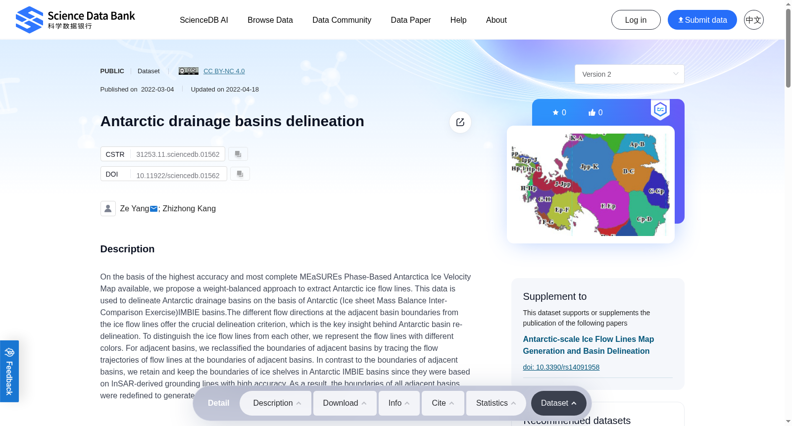
On the basis of the highest accuracy and most complete MEaSUREs Phase-Based Antarctica Ice Velocity Map available, we propose a weight-balanced approach to extract Antarctic ice flow lines. This data is used to delineate Antarctic drainage basins on the basis of Antarctic (Ice sheet Mass Balance Inter-Comparison Exercise)IMBIE basins.The different flow directions at the adjacent basin boundaries from the ice flow lines offer the crucial delineation criterion, which is the key insight behind Antarctic basin re-delineation. To distinguish the ice flow lines from each other, we represent the flow lines with different colors. For adjacent basins, we reclassified the boundaries of adjacent basins by tracing the flow trajectories of flow lines at the boundaries of adjacent basins. In contrast to the boundaries of adjacent basins, we retain and keep the boundaries of ice shelves in Antarctic IMBIE basins since they were based on InSAR-derived grounding lines with high accuracy. As a result, the boundaries of all adjacent basins were redefined to generate the re-delineated Antarctic basin systems.
本研究基于现有精度最高、完整性最优的MEaSUREs相位基南极冰速度图(MEaSUREs Phase-Based Antarctica Ice Velocity Map),提出一种权重平衡方法以提取南极冰流流线。本数据集以南极IMBIE(冰盖质量平衡互比较试验,Ice sheet Mass Balance Inter-Comparison Exercise)流域为基础,用于划定南极流域盆地。冰流流线在相邻流域边界处呈现的不同流向,构成了关键的划分准则,这也是南极流域重新划界的核心思路。为区分各条冰流流线,我们采用不同颜色对其进行可视化呈现。针对相邻流域,我们通过追踪其边界处冰流流线的运动轨迹,对流域边界进行了重新分类。与相邻流域边界不同,我们保留了南极IMBIE流域中冰架的边界,因其基于高精度合成孔径雷达干涉测量(InSAR)得到的接地线。最终,所有相邻流域的边界均被重新定义,由此生成了重新划界后的南极流域系统。
创建时间:
2024-01-31
搜集汇总
数据集介绍
背景与挑战
背景概述
该数据集基于高精度的南极冰流速图,采用权重平衡方法提取冰流线,用于重新划分南极流域。数据集包含10个文件,总大小为1.02 MB,由中国国家重点研发计划资助。
以上内容由遇见数据集搜集并总结生成



